
Last Updated August 5, 2026
Land-system change is one of the central boundaries within the planetary boundaries framework because the transformation of forests, grasslands, wetlands, savannas, peatlands, agricultural frontiers, and other terrestrial systems alters the ecological and biophysical processes that help regulate the Earth system. Land is not simply surface area available for economic use. It is part of the living and material infrastructure of planetary stability. When land is extensively converted through deforestation, agricultural expansion, extraction, urbanization, infrastructure growth, drainage, fire-regime disruption, and landscape simplification, the effects do not remain local. They reshape habitat, carbon storage, evapotranspiration, hydrological patterns, soil function, regional climate, and biosphere integrity across scales.
This is why land-system change is treated in the planetary boundaries literature as more than a land-use question in the ordinary policy sense. The boundary is concerned with the extent to which human transformation of terrestrial systems weakens the resilience of the Earth system itself. The framework’s logic is not that every land conversion is equally dangerous, nor that human societies can avoid using land. The point is that large-scale ecological transformation can push key biomes, water cycles, carbon flows, and biosphere interactions beyond safer ranges, increasing the risk of destabilization.
Main Library
Publications
Article Map
Planetary Boundaries
Related Article
Biosphere Integrity
Related Article
Freshwater Change
Related Topic
Environmental Science
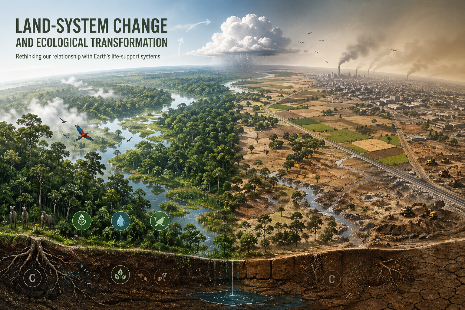
The land boundary is especially important because terrestrial systems sit at the intersection of several planetary processes. Forests store carbon, recycle moisture, cool landscapes, regulate runoff, support biodiversity, sustain Indigenous and local livelihoods, stabilize soils, and shape regional atmospheric circulation. Grasslands and rangelands support pastoral systems, soil carbon, biodiversity, and food production. Wetlands store carbon, buffer floods, filter water, support species, and regulate hydrological extremes. When these systems are simplified or replaced, societies lose more than vegetation cover. They lose regulatory capacity.
This article examines land-system change as a planetary boundary by explaining why terrestrial transformation matters at planetary scale, how the boundary is conceptualized and measured, why forests and major biomes are especially important, how land-system change interacts with climate, biosphere integrity, freshwater change, biogeochemical flows, atmospheric aerosols, food systems, and supply chains, and why the issue has become central to sustainability, governance, justice, and long-term civilizational resilience.
Why Land-System Change Matters
Land-system change matters because terrestrial ecosystems help regulate the climate system, the hydrological cycle, carbon storage, biodiversity, soil function, nutrient cycling, and regional ecological resilience. The conversion of land is not only a matter of replacing one visible landscape with another. It changes the way energy, water, carbon, nutrients, organisms, and fire move through the Earth system. Forest clearing, cropland expansion, pasture conversion, wetland drainage, mining, road building, and large-scale landscape simplification can reduce carbon uptake, alter rainfall regimes, fragment habitats, weaken ecosystem function, and undermine the resilience of terrestrial biomes.
Within the planetary boundaries framework, land-system change is significant because it can contribute to broad Earth-system destabilization even when decisions are made locally, sector by sector, or parcel by parcel. A landscape may be altered for timber, food production, settlement, mining, transport, or energy infrastructure, yet the cumulative result can be a reduction in the capacity of major land systems to regulate the conditions on which societies depend. That is why the issue must be understood not only economically or administratively, but biophysically and systemically.
The deeper conceptual shift is from land as a passive development platform to land as a regulating component of Earth-system stability. Once this shift is made, terrestrial transformation becomes a question of systemic resilience rather than merely one of local planning efficiency. Land is not just where human activity occurs. It is one of the foundations that determines whether climate, water, biodiversity, and food systems remain within more stable operating conditions.
This is also why the boundary cannot be understood only through land quantity. Two regions with the same number of converted hectares can have different Earth-system implications depending on biome type, fragmentation, carbon density, hydrological role, biodiversity importance, fire sensitivity, soil condition, and social-ecological context. A hectare of intact tropical forest, boreal forest, peatland, savanna, wetland, urban land, pasture, or industrial monoculture does not perform the same ecological work. Land-system change therefore concerns function, structure, location, and cumulative transformation, not only area.
Land-system change also matters because terrestrial systems are difficult to repair once they are simplified. A forest can be cleared quickly, but mature forest structure, soil complexity, hydrological function, fungal networks, seed banks, animal dispersal systems, and Indigenous stewardship relationships may take generations to recover. A wetland can be drained in months, while its carbon storage, flood-buffering capacity, and ecological complexity may require decades of restoration. A degraded soil can lose organic matter faster than it can be rebuilt. The boundary therefore identifies not only land conversion, but the loss of slow-building ecological capacity.
In planetary-boundary terms, the danger is not simply that land is changing. Land has always changed. The danger is that human systems are transforming land at scales, rates, and intensities that reduce the regulatory functions of major terrestrial systems. When enough land loses its capacity to store carbon, move water, support biodiversity, sustain soils, and buffer disturbance, land-system change becomes an Earth-system risk.
How the Boundary Is Defined
In the earlier formulation of the planetary boundaries framework, land-system change was associated with the percentage of global land cover converted to cropland. The underlying concern was that excessive conversion could trigger widespread and potentially irreversible transformation of biomes into less desirable states. That original formulation was useful because it linked land conversion to Earth-system risk rather than treating it as an ordinary land-use statistic. But later work refined the boundary by placing greater emphasis on forest biomes and their role in biophysical climate regulation.
This development matters because the land boundary is not simply about the total amount of land under human use. It is about the transformation of ecologically important systems whose structure and function shape planetary resilience. The framework therefore links land-system change to the integrity of forests and other major terrestrial biomes rather than treating all hectares as interchangeable. In current planetary-boundary assessments, remaining forest area in tropical, boreal, and temperate biomes is central to the boundary’s measurement and interpretation.
The Planetary Health Check describes the land-system-change boundary as a forest-cover boundary, with a global threshold expressed in relation to original forest cover and differentiated safe levels across major forest biomes. Tropical and boreal forests receive especially stringent thresholds because of their strong influence on regional and remote climatic conditions, while temperate forests are assessed with a different threshold. This biome-sensitive approach makes the boundary more ecologically meaningful than a single undifferentiated land-cover number.
That emphasis on forests is especially important because it clarifies that the land boundary is not reducible to a generic development metric. It is a question about whether the remaining composition and function of terrestrial systems are still compatible with a safe operating space. Forest cover becomes a control variable not because forests are the only terrestrial systems that matter, but because forest biomes are among the most important land-system regulators of climate, moisture, biodiversity, and carbon dynamics.
At the same time, the forest-centered metric should not be misunderstood. It does not imply that grasslands, savannas, wetlands, peatlands, drylands, shrublands, rangelands, or agroecological mosaics are secondary or expendable. It reflects the need for a measurable global control variable while recognizing that forest biomes play an especially strong role in climate and hydrological regulation. A mature land-system framework should therefore treat forest cover as a central indicator while also monitoring wider land degradation, habitat quality, soil function, wetland condition, fragmentation, fire regimes, and ecological connectivity.
| Boundary element | Measurement logic | Why it matters |
|---|---|---|
| Original cropland-conversion framing | Tracked the share of global ice-free land converted to cropland. | Connected land conversion to Earth-system risk rather than ordinary land-use accounting. |
| Forest-cover control variable | Tracks remaining forest cover relative to original forest cover and biome-specific thresholds. | Reflects the role of forests in carbon storage, moisture recycling, climate regulation, and biodiversity. |
| Biome sensitivity | Differentiates tropical, boreal, and temperate forest systems. | Recognizes that forest biomes are not interchangeable and perform different regulatory roles. |
| Fragmentation and ecological quality | Evaluates whether remaining land cover retains functional integrity. | Prevents false reassurance from green cover that is degraded, simplified, or disconnected. |
| Governance and restoration capacity | Assesses whether land systems can be protected, restored, monitored, and governed. | Connects boundary status to institutional response and long-term resilience. |
The land-system boundary is therefore both quantitative and interpretive. It uses measurable indicators, but those indicators are meaningful only when connected to the ecological functions of land: climate regulation, hydrological cycling, habitat maintenance, soil resilience, carbon storage, and the ability of landscapes to recover from disturbance.
From Land Use to Earth-System Process
A central contribution of the planetary-boundary perspective is that it shifts the discussion from land use in a narrow economic sense to land-system change as an Earth-system process. Land is often managed through categories such as agriculture, forestry, development, conservation, mining, infrastructure, and urban planning. The planetary-boundary framework cuts across those categories by asking what happens to the Earth system when landscapes are transformed at scale.
This is a deeper question than whether land is being used efficiently or productively. A high-yield agricultural frontier can still degrade climate regulation, biodiversity, soils, and water systems if it depends on extensive forest loss, drained wetlands, degraded peatlands, eroded soils, or simplified ecological mosaics. Land-system change therefore concerns the ecological reorganization of terrestrial systems, not merely the reassignment of land to new purposes. What appears locally as development may appear globally as destabilization when enough of the biosphere is transformed.
This Earth-system framing also reveals why cumulative local decisions matter. Land conversion can seem justified when assessed parcel by parcel, project by project, or commodity by commodity, but its aggregate consequences may still breach planetary thresholds. That is precisely the type of scale mismatch the planetary boundaries framework is designed to illuminate. The boundary makes visible a pattern that conventional land-use planning often misses: decisions that appear rational in isolation can become destabilizing in aggregate.
Land-system change also reveals a conflict between short-term productivity and long-term Earth-system viability. A landscape may produce more commodities after conversion while losing carbon storage, moisture recycling, habitat complexity, soil resilience, and adaptive capacity. The boundary asks whether those losses are becoming large enough to undermine the larger planetary conditions that make productivity possible.
That distinction is especially important for food systems. Agriculture is necessary, but agricultural expansion into high-integrity ecosystems can create hidden costs: carbon emissions from land clearing, reduced rainfall recycling, soil erosion, biodiversity loss, nutrient pollution, and exposure to future drought and heat. The planetary-boundary view does not reject food production. It asks whether food systems can meet human needs without destroying the terrestrial systems that make food production possible over the long run.
The same logic applies to infrastructure and extraction. Roads, mines, pipelines, ports, energy corridors, and urban expansion can produce economic value while opening intact ecosystems to fragmentation, settlement pressure, illegal clearing, fire, invasive species, and accelerated commodity expansion. The Earth-system effect of infrastructure is often larger than the immediate footprint. Land-system governance must therefore evaluate not only the area directly converted, but the secondary transformations that infrastructure makes possible.
To understand land use as land-system change is to see land as process rather than property alone. It is a living system of carbon, water, soil, organisms, fire, climate feedback, culture, livelihood, and governance. That is why land transformation belongs inside the planetary-boundaries framework.
Forests, Biomes, and Planetary Regulation
Forests and major biomes are especially important because they influence climate, carbon storage, evapotranspiration, rainfall patterns, habitat continuity, soil stability, fire regimes, and ecological resilience. The 2015 planetary boundaries update emphasized that the role of land-system change in biophysical climate regulation is primarily related to changes in forest biomes. This makes clear that land transformation is not only a biodiversity issue. It is also a climate-regulation issue, hydrological issue, and Earth-system issue.
When forest systems are cleared or fragmented, societies lose more than biomass. They alter the capacity of landscapes to recycle moisture, stabilize temperatures, support species interactions, maintain soil structure, buffer fire, and regulate the exchange of energy and water between land and atmosphere. These changes can accumulate into wider regional and global effects, particularly when large contiguous systems are pushed toward thresholds of degradation. Forest biomes matter because they are structural components of planetary stability.
Tropical forests are especially important for carbon storage, evapotranspiration, rainfall recycling, biodiversity, and regional climate dynamics. Boreal forests store large quantities of carbon in biomass and soils and interact with albedo, snow cover, fire regimes, and permafrost systems. Temperate forests regulate regional hydrology, carbon storage, biodiversity, and landscape connectivity. These forests are not interchangeable. They perform different regulatory roles, and the loss of each biome carries different implications for Earth-system resilience.
Other terrestrial systems also matter. Grasslands, savannas, rangelands, peatlands, wetlands, drylands, shrublands, and agroecological mosaics can store carbon, regulate water, support biodiversity, sustain livelihoods, and buffer climatic extremes. The forest-centered control variable does not mean these systems are unimportant. It means forest integrity is one of the clearest measurable indicators of land-system regulation at planetary scale. A serious land-system strategy must therefore protect forests while also preventing degradation and simplification across the wider terrestrial biosphere.
Peatlands and wetlands deserve special emphasis because they combine carbon, water, biodiversity, and climate functions. Draining peatlands can release carbon accumulated over centuries or millennia, while also increasing fire risk and weakening hydrological regulation. Wetlands buffer floods, filter pollutants, store carbon, and sustain species. Their loss can create cascading effects across water quality, flood exposure, fisheries, agriculture, and carbon emissions.
Savannas and grasslands also require careful treatment. They are sometimes wrongly classified as degraded forest or empty land available for tree planting. Many are biodiverse, fire-adapted, culturally significant, and ecologically functional systems in their own right. Poorly designed afforestation or land-conversion schemes can damage them. A land-system approach must therefore avoid simplistic tree-cover maximization. The goal is biome integrity, not one-size-fits-all greening.
Major biomes regulate the planet in different ways. The governance task is to protect the integrity of each system according to its ecological character, not to treat all land as interchangeable space.
The Boundary and Its Current Status
Land-system change is currently transgressed in the planetary boundaries framework. Stockholm Resilience Centre’s overview identifies land-system change as beyond safe levels, noting that remaining forest areas in tropical, boreal, and temperate biomes have fallen below safe levels. The 2023 global assessment confirmed that land-system change remains transgressed within a broader pattern of Earth-system overshoot. The 2025 Planetary Health Check lists land-system change among the seven breached planetary boundaries.
The 2025 Planetary Health Check reports that approximately 59 percent of potential global forest cover remains, below the 75 percent planetary-boundary reference, and that all major continuous forest biomes have transgressed their biome-specific boundaries to varying degrees. FAO’s Global Forest Resources Assessment 2025 reports 4.14 billion hectares of forest worldwide, with deforestation slowing to 10.9 million hectares per year during 2015–2025 but continuing at a scale that places forests, naturally regenerating systems, and primary forests under substantial pressure.
The significance of this status is not merely classificatory. It indicates that terrestrial transformation has already moved beyond the range the framework considers compatible with safer Earth-system functioning. The issue is therefore not only hypothetical future risk, but an already active condition of ecological overshoot. The land boundary has not been crossed because humans use land. It has been crossed because the scale and structure of land transformation have weakened major terrestrial regulatory systems.
Recent research also suggests that climate change and land-system change are tightly coupled. A 2024 study summarized by Stockholm Resilience Centre examined how climate change affects the land-system-change boundary, showing that the stability of forest biomes cannot be evaluated independently of climate trajectories. This is an important refinement because it shows that land-system change is not driven only by direct conversion. It is also affected by the broader destabilization of the climate system itself.
That coupling matters for governance. Protecting forests and restoring landscapes will be harder under severe climate change because heat stress, drought, fire, pests, biome shifts, and hydrological instability can weaken ecosystems even where direct deforestation is reduced. Conversely, climate mitigation is harder when land systems lose carbon storage and ecological resilience. Land and climate are therefore mutually reinforcing boundaries. Stabilizing one helps stabilize the other.
The boundary’s transgressed status should not be read as fatalism. It is a diagnostic warning that terrestrial systems have already been pushed outside safer operating conditions. It means that avoiding further conversion, restoring degraded systems, strengthening rights-based stewardship, improving soil and water resilience, and aligning food and commodity systems with ecological limits are not optional environmental improvements. They are part of Earth-system risk reduction.
| Land-system indicator | Current interpretation | Governance implication |
|---|---|---|
| Remaining forest cover | Below safe levels in major forest biomes. | Protect remaining forests and prevent further conversion, degradation, and fragmentation. |
| Biome integrity | Threatened by direct conversion, climate stress, fire, pests, and hydrological shifts. | Manage land and climate together rather than treating forest protection as separate from climate stabilization. |
| Land-system boundary status | Transgressed / breached. | Reduce land-conversion pressure and restore regulatory functions. |
| Cross-boundary interaction | Strongly linked to climate, freshwater, biosphere integrity, and biogeochemical flows. | Use integrated Earth-system governance rather than narrow land-use planning alone. |
Current-status language should therefore remain precise: the land-system boundary is breached, but outcomes are still shaped by decisions. The difference between continued conversion and serious restoration is enormous. The boundary warns that land-system change has become dangerous; it does not say that terrestrial resilience can no longer be rebuilt.
Deforestation, Fragmentation, and Ecological Simplification
Deforestation is one of the most visible forms of land-system change, but it is not the only one. Fragmentation can degrade ecosystems even where some forest cover remains. Roads, farms, settlements, pipelines, mines, transmission corridors, and plantations can divide habitats into smaller pieces, exposing interior ecosystems to edge effects, fire risk, invasive species, hunting pressure, microclimate shifts, and biodiversity decline. A landscape may retain green cover on a satellite image while losing ecological continuity.
Ecological simplification is another major concern. Replacing diverse forests, wetlands, savannas, or mosaic landscapes with monocultures, simplified pasture, industrial plantations, or urban surfaces reduces the complexity that helps ecosystems adapt and recover. Simplified systems may produce a commodity efficiently in the short term, but they often support fewer species, store less carbon, retain less water, and provide weaker resilience under climatic stress.
This distinction matters because land-system change is not only a binary question of forest versus non-forest. The quality, connectivity, composition, age structure, management regime, and ecological function of landscapes all matter. A degraded forest, a primary forest, a restored forest, a monoculture plantation, a mixed agroforestry system, and a fragmented forest patch do not perform the same ecological work.
For Earth-system analysis, the key question is whether land systems retain enough integrity to regulate climate, water, biodiversity, carbon, soil, and ecological feedbacks. Deforestation removes ecological capacity directly. Fragmentation and simplification erode it more gradually. All three processes can push terrestrial systems toward lower resilience.
Ecological simplification is particularly dangerous because it can be hidden behind production metrics. A landscape may produce more soy, palm oil, beef, timber, fiber, or bioenergy after conversion while losing ecological redundancy, moisture cycling, wildlife corridors, pollination, pest regulation, soil structure, and cultural meaning. The apparent efficiency of commodity production may depend on the unpriced destruction of regulatory functions.
Fragmentation also creates a temporal trap. A fragmented landscape may not collapse immediately. Species may persist for a time in isolated patches. Carbon may remain stored temporarily. Streams may continue flowing. But the system becomes more vulnerable to fire, drought, invasive species, hunting, local extinction, and edge effects. Fragmentation is therefore often a slow destabilizer: it weakens resilience before collapse becomes visible.
The land boundary pushes governance beyond simple deforestation accounting. It asks whether landscapes remain connected, diverse, mature, functional, and resilient enough to perform their Earth-system roles.
Land Degradation, Soils, and Productive Resilience
Land-system change is also inseparable from soil degradation. Soil is not merely a growth medium. It is a living biogeochemical system that stores carbon, regulates water, cycles nutrients, supports microbial life, anchors vegetation, and helps buffer droughts and floods. When soils are eroded, compacted, salinized, depleted of organic matter, contaminated, or biologically simplified, the productive and ecological resilience of the land declines.
This matters because some forms of land transformation do not begin with dramatic forest clearing. They unfold through gradual degradation: overgrazing, repeated tillage, poorly managed irrigation, nutrient imbalance, erosion, dryland degradation, wetland drainage, peat oxidation, and loss of soil structure. These processes may not always appear as abrupt land-cover change, but they can still weaken Earth-system resilience by reducing carbon storage, infiltration, soil moisture, vegetation recovery, and agricultural stability.
The land-degradation literature also highlights the social dimension of terrestrial transformation. Degraded land affects food security, livelihoods, migration pressure, ecosystem services, rural poverty, and vulnerability to drought and flood. The planetary-boundary framing does not replace these development concerns. It deepens them by showing that land degradation also contributes to the systemic weakening of the biosphere.
Productive resilience therefore requires more than maximizing short-term output. It requires maintaining soil carbon, biological activity, water retention, landscape heterogeneity, tree cover, perennial systems, ecological buffers, and the capacity of land to recover after disturbance. A land system that produces today while losing its regenerative foundations is not truly productive in Earth-system terms.
Soils are especially important because they connect land-system change to climate, water, and food. Soil organic matter supports fertility and carbon storage. Soil structure influences infiltration and runoff. Soil biology affects decomposition, nutrient cycling, and plant health. When soils are degraded, landscapes become more vulnerable to drought, flood, erosion, heat, and input dependence. Degraded soils can also reduce the capacity of agriculture to adapt to climate stress.
Peat soils represent one of the clearest examples of hidden risk. Peatlands may appear as marginal land in narrow economic terms, but they store immense quantities of carbon and regulate water. When drained for agriculture, forestry, or development, peat oxidizes and can become a persistent source of emissions. Fire in drained peatlands can release large amounts of carbon and create severe haze and health impacts. Treating such landscapes as ordinary land-conversion opportunities is a planetary-risk error.
A mature land-system strategy must therefore treat soil health, peat protection, wetland restoration, regenerative agriculture, agroforestry, erosion control, and water retention as part of boundary governance. Land resilience is not only above ground. It is built in the living structure beneath the surface.
Interactions with Other Boundaries
Land-system change interacts strongly with several other planetary boundaries. It is closely linked to biosphere integrity because habitat destruction, fragmentation, simplification, and degradation weaken both genetic diversity and ecosystem function. It interacts with climate change through carbon release, altered albedo, evapotranspiration, fire regimes, and changes in regional rainfall. It affects freshwater systems through runoff, infiltration, groundwater recharge, soil moisture, wetland loss, and watershed dynamics. It also interacts with biogeochemical flows because many land transformations are tied to fertilizer-intensive agriculture, livestock expansion, erosion, manure concentration, and nutrient loading.
These interactions mean land-system change cannot be understood as an isolated terrestrial issue. A transformed landscape can intensify multiple forms of Earth-system pressure at once. Conversely, climate disruption, freshwater instability, nutrient overload, and biosphere degradation can reduce the resilience of land systems and make them more vulnerable to further transformation. The result is an interconnected pattern of ecological destabilization rather than a single-policy problem.
Atmospheric aerosol loading can also be affected by land-system change through dust, biomass burning, wildfire smoke, and land-surface change. Ocean systems are connected through riverine sediment and nutrient flows, coastal habitat loss, and carbon cycling. Novel entities enter the picture through pesticides, plastics, mining residues, industrial contaminants, and chemical inputs that accumulate in transformed landscapes. Land systems are therefore both sources and receivers of planetary pressures.
Food systems are one of the clearest pathways of interaction. Agriculture links land-system change to nitrogen and phosphorus flows, freshwater withdrawals, pesticide use, methane and nitrous oxide emissions, biodiversity decline, soil degradation, and commodity-driven deforestation. A food system can appear efficient when measured only by yield, but boundary thinking asks whether that yield depends on transgressing land, nutrient, water, climate, and biosphere limits at the same time.
Climate-land interaction is especially important because it creates feedback risk. Forest loss can intensify regional drying and warming, while climate change can push forests toward drought stress, dieback, fire, and biome shifts. Wetland drainage can release carbon and reduce flood resilience, while climate extremes can further damage wetlands. Soil degradation can reduce carbon storage and water retention, while drought and heat accelerate soil stress. These feedbacks make land-system change both a driver and a consequence of wider Earth-system destabilization.
For companion essays, see Climate Change as a Planetary Boundary, Biosphere Integrity and the Stability of Life Systems, Freshwater Change and Earth System Risk, Biogeochemical Flows: Nitrogen, Phosphorus, and Planetary Destabilization, and Atmospheric Aerosol Loading and Regional Planetary Risk.
Ecological Transformation and Systemic Risk
The planetary-boundary framing changes how land conversion is understood. It is not enough to ask whether a particular landscape has become more productive in the short term. The deeper question is whether large-scale ecological transformation is weakening the terrestrial systems that help stabilize the planet. Once land-system change is seen through that lens, deforestation, biome conversion, wetland loss, peatland degradation, and landscape simplification become matters of systemic risk rather than only local planning or agricultural expansion.
This broader framing is important because the effects of land transformation are often delayed, cumulative, and spatially distributed. A region may gain cropland, roads, mines, settlements, or infrastructure while losing resilience, moisture recycling, habitat structure, carbon storage, fire buffering, and soil integrity. The danger lies not only in immediate visible damage, but in the gradual erosion of the ecological capacities that support long-term planetary stability.
Ecological transformation is therefore both a material and a strategic problem. It affects what land can do: store carbon, support life, cycle water, sustain food production, buffer extremes, and recover after disturbance. If enough terrestrial systems lose those functions, the consequences become systemic. A planet with simplified, fragmented, degraded land systems is less able to maintain stable climate, water, biodiversity, and food-system conditions.
What the boundary highlights, in other words, is the difference between short-term productivity and long-term Earth-system viability. A landscape can be economically intensified while becoming ecologically less able to support the wider conditions on which economies ultimately depend. The boundary makes that contradiction visible.
Systemic risk also arises because land transformation can create path dependence. Once forests are cleared, roads built, tenure systems changed, commodity infrastructure installed, and markets organized around expansion, reversal becomes difficult. Land conversion often creates institutions, incentives, and dependencies that continue driving transformation even after the ecological costs become obvious. This is why governance must intervene early rather than treating restoration as a simple later correction.
Land-system change also produces systemic risk through supply chains. A consumer product, investment portfolio, infrastructure project, or national food strategy may depend on land transformation far away. The ecological consequences are displaced through trade. Planetary-boundary thinking makes these distant connections visible: the land boundary can be transgressed by patterns of consumption and finance that never appear in the local landscape of the consumer.
Ecological transformation therefore becomes a test of whether societies can distinguish development from depletion. Land can support prosperity, food security, shelter, culture, and livelihoods. But land systems cannot be treated as indefinitely substitutable surfaces. When their regulatory functions are degraded, human systems lose the ecological foundations that sustain them.
Justice, Indigenous Stewardship, and Land Governance
Land-system change is also a justice issue. The benefits of land conversion and commodity extraction are often captured by states, firms, investors, and distant consumers, while the costs are borne by Indigenous peoples, local communities, smallholders, pastoralists, forest-dependent populations, downstream communities, and future generations. Land transformation is therefore not only an ecological process. It is also a political and historical process shaped by power, property, dispossession, extraction, and uneven vulnerability.
Indigenous peoples and local communities are central to land governance because many of the world’s remaining high-integrity ecosystems overlap with territories shaped by long-term stewardship, customary governance, and place-based ecological knowledge. Protecting terrestrial systems cannot be reduced to fortress conservation that removes people from land. In many contexts, justice-based stewardship, land rights, community governance, and Indigenous sovereignty are part of ecological resilience rather than obstacles to it.
This matters for the planetary-boundary framework because Earth-system governance must not treat land only as a technical surface to optimize. Land is lived, governed, contested, inherited, and culturally meaningful. Strategies that ignore land rights and historical injustice may produce resistance, displacement, and ineffective conservation. Strategies that protect ecosystems while strengthening local and Indigenous governance can support both justice and resilience.
The land boundary therefore forces a difficult but necessary synthesis. It asks how societies can protect planetary-scale ecological functions while respecting the people and communities most closely connected to those landscapes. A credible land-system strategy must be scientifically grounded, politically legitimate, and socially just.
Justice also requires confronting the colonial history of land transformation. Many landscapes were converted through conquest, plantation economies, forced labor, enclosure, displacement, extractive concession systems, and racialized property regimes. Modern land-use patterns often inherit these histories. A planetary-boundary approach that ignores this history risks treating land degradation as a purely technical problem while leaving intact the power relations that produced it.
Land governance must also avoid using climate or biodiversity goals as justification for new dispossession. Carbon markets, protected areas, offset schemes, bioenergy plantations, mining for energy transition minerals, and large-scale restoration projects can create ecological benefits in some contexts, but they can also reproduce land grabs if rights, consent, and local governance are weak. Boundary governance must therefore protect both ecological function and human dignity.
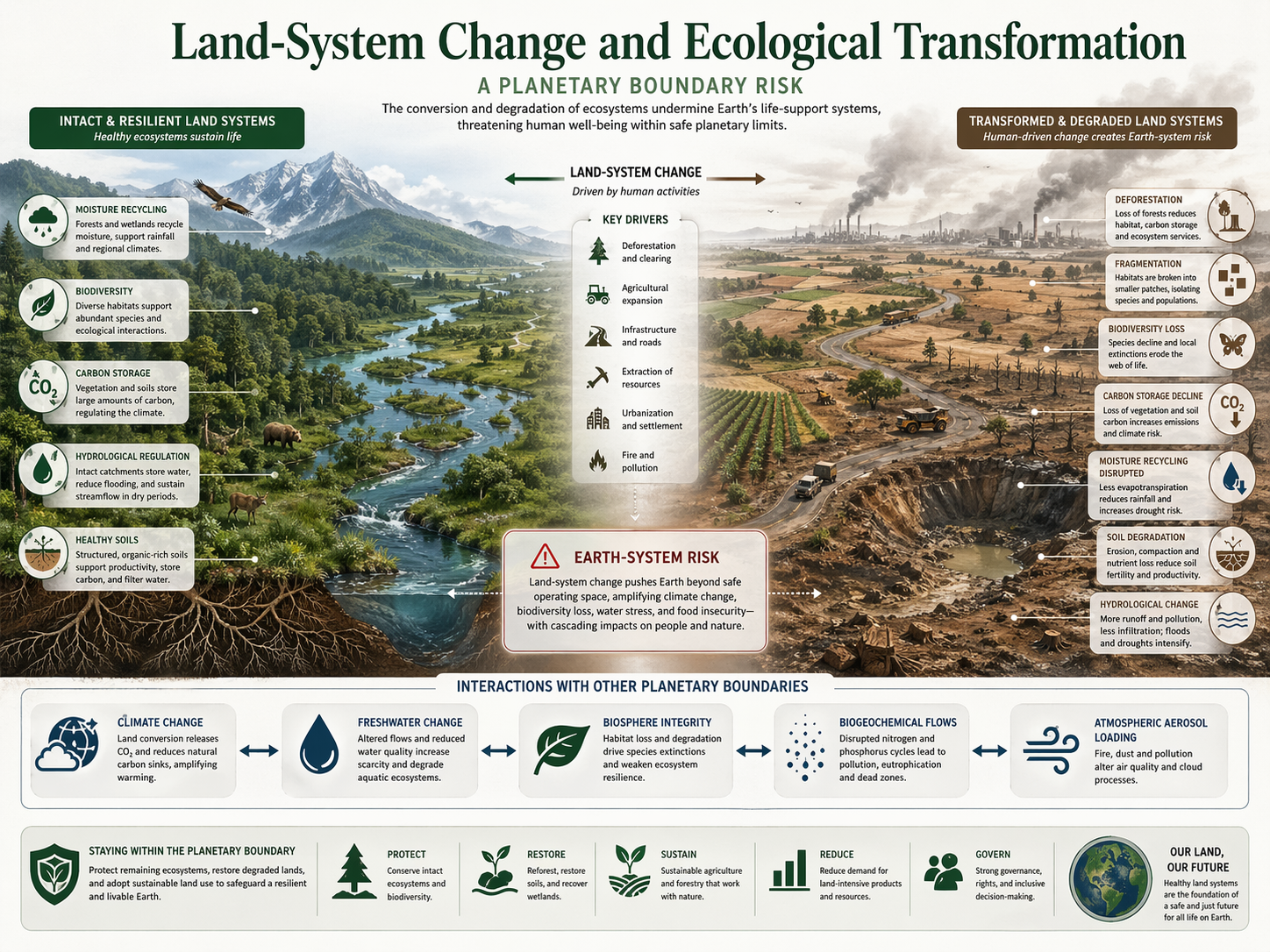
The justice dimension is not separate from ecological effectiveness. Communities with secure rights and strong stewardship institutions are often better positioned to protect ecosystems than distant authorities or firms with short-term extraction incentives. A land-system strategy that marginalizes local knowledge and rights may be unjust and ineffective at the same time. A strategy that supports rights-based stewardship can strengthen both resilience and legitimacy.
Governance Implications
If land-system change is a planetary boundary, governance cannot treat land merely as a passive development platform. Land policy becomes inseparable from climate policy, biodiversity governance, water management, food systems, Indigenous rights, rural development, supply-chain accountability, and long-horizon resilience planning. Protecting major forest biomes, limiting destructive conversion, restoring degraded landscapes, reducing fragmentation, improving soil health, and coordinating land use across sectors all become part of maintaining Earth-system stability.
The governance difficulty is that land decisions are often made locally while their consequences accumulate systemically. This creates a mismatch between decision scale and Earth-system effect. The planetary-boundary perspective therefore implies a need for institutions that can connect local land management to wider ecological thresholds and planetary risk. Without that connection, land transformation is likely to proceed as fragmented short-term decision-making with long-term systemic consequences.
Governance should therefore combine several strategies: protecting remaining intact ecosystems, reducing deforestation and conversion, restoring degraded forests and wetlands, improving agricultural productivity without expansion into critical biomes, strengthening land tenure and Indigenous rights, reducing commodity-driven deforestation, building ecological corridors, improving soil carbon and water retention, managing fire regimes, and integrating land-use planning with climate and biodiversity targets.
Supply-chain governance is especially important. Land conversion is often driven by demand for beef, soy, palm oil, timber, pulp, minerals, infrastructure, biofuels, and urban land. If buyers, investors, governments, and consumers treat land impacts as external to their decisions, land-system degradation continues invisibly. Traceability, deforestation-free procurement, land-rights due diligence, ecological-risk disclosure, and credible monitoring can help connect distant consumption to land-system pressure.
Finance is another governance lever. Capital flows shape agricultural expansion, mining, infrastructure, forestry, real estate, and restoration. A financial system that funds land conversion while treating forest loss, water disruption, soil degradation, and rights violations as externalities will deepen boundary pressure. A more responsible system would price and govern exposure to land-system risk while supporting restoration, agroecology, Indigenous stewardship, ecological corridors, and soil-water resilience.
Governance must also distinguish restoration from offset logic. Restoration is essential, but it should not be used to justify ongoing destruction of high-integrity ecosystems. Mature forests, peatlands, wetlands, old soils, and complex social-ecological landscapes cannot be replaced quickly or fully by newly planted trees or future restoration pledges. A credible governance strategy must prioritize avoided loss first, then restoration of degraded systems, then long-term stewardship.
This is why land-system change increasingly appears in discussions of integrated land policy, food-system transition, climate mitigation, resilience planning, ecological restoration, and Earth-system governance. For adjacent essays, see Earth System Governance in an Age of Limits, Business Strategy Within Planetary Boundaries, and Finance, Disclosure, and Systemic Environmental Risk.
Why This Matters for Planetary Boundaries
Land-system change matters for planetary boundaries because it reveals that planetary stability depends not only on atmospheric chemistry or global averages, but on the integrity of living landscapes. Forests, wetlands, soils, grasslands, savannas, and agroecological mosaics help regulate carbon, water, biodiversity, fire, and regional climate. When these systems are extensively transformed, the Earth system loses regulatory capacity.
The boundary also matters because land change is where many planetary pressures become physically visible. Climate stress, freshwater disruption, nutrient overload, biodiversity loss, novel-entity pollution, and food-system expansion all meet in landscapes. Land systems absorb pressures generated by energy systems, commodity systems, finance, infrastructure, and consumption. They also feed pressure back into climate, water, biodiversity, and human vulnerability.
This matters for strategy because land-system governance cannot be reduced to isolated protected areas or tree-planting campaigns. Protection is necessary, but so are food-system reform, soil restoration, wetland protection, Indigenous land rights, deforestation-free supply chains, ecological corridors, responsible finance, and climate mitigation. The boundary is crossed through the structure of the real economy, and it must be repaired through governance that reaches the real economy.
Finally, land-system change matters because land is never merely land. It is habitat, memory, livelihood, culture, watershed, carbon store, soil system, food system, spiritual relation, and political terrain. A planetary-boundary framework that treats land seriously must therefore be both scientifically rigorous and morally awake.
To understand land-system change as a planetary boundary is to understand that the stability of civilization depends on the integrity of landscapes. Land is not outside the human story. It is the living ground beneath it.
Land Cover Versus Land Condition
Land-cover classification describes what appears to occupy the surface: forest, cropland, grassland, wetland, settlement, bare ground, or another category. Land condition asks whether that system retains its structure, composition, hydrology, soils, connectivity, and ecological function. The distinction is essential because the same cover class can contain very different land systems.
A forest map can combine primary forest, logged forest, secondary regrowth, plantation, fire-damaged woodland, and fragmented remnants. A grassland class can include intact native prairie, heavily grazed pasture, invasive-dominated land, or afforested savanna. Wetland area can remain mapped while hydrological function is lost through drainage, pollution, channelization, or groundwater decline.
Condition indicators can include canopy structure, native composition, soil organic carbon, erosion, hydrological connectivity, habitat intactness, fire regime, invasive pressure, biomass, productivity, and recovery capacity. These indicators should be interpreted in relation to the ecological character of the biome rather than through a universal greenness score.
The land boundary uses forest area as a global control variable because forests have major climatic and hydrological roles. Applied land-system analysis must add condition, function, and biome identity so that nominal cover does not create false reassurance.
Biome Thresholds and Spatial Allocation
The planetary-boundary control variable distinguishes tropical, boreal, and temperate forest biomes because their climatic roles and safer retention thresholds differ. This avoids treating all forest hectares as interchangeable. It also creates a scale-translation challenge: global and continental biome thresholds do not automatically prescribe what may be converted in a particular watershed, municipality, concession, or project area.
Local allocation requires information about ecological condition, rarity, connectivity, carbon density, hydrological role, biodiversity, fire sensitivity, social dependence, and cumulative pressure. A project cannot claim entitlement to convert intact land merely because another part of the biome remains above a numerical share.
Spatial allocation also raises justice questions. Historical conversion and consumption have been highly unequal. A rule based only on remaining cover can place conservation burdens on regions that retained ecosystems while allowing high-consuming actors to avoid responsibility for imported land pressure.
A credible translation should therefore document the planetary indicator, biome threshold, local ecological evidence, territorial and consumption drivers, historical responsibility, rights, and precautionary safeguards. The result is a decision framework, not a parcel-level conversion allowance.
Moisture Recycling and Atmospheric Connectivity
Land systems influence water far beyond their boundaries. Vegetation returns water to the atmosphere through evapotranspiration, contributing to cloud formation, rainfall, humidity, and regional cooling. Repeated recycling of moisture across large forest systems can support rainfall downwind, linking distant landscapes through atmospheric transport.
P = E_{\mathrm{local}} + M_{\mathrm{in}} – M_{\mathrm{out}}
\]
Interpretation: Regional precipitation \(P\) is influenced by local evapotranspiration and atmospheric moisture transported into and out of the region.
Deforestation can reduce evapotranspiration, increase sensible heat, alter cloud formation, and change runoff. The effect depends on biome, season, scale, wind, soil moisture, and replacement land cover. Irrigated agriculture may increase local evaporation while changing timing, groundwater, energy use, and water availability elsewhere.
Atmospheric connectivity means that land-system governance cannot stop at watersheds or political borders. Forest and soil change in one region can affect drought, heat, agriculture, hydropower, and ecosystems downwind. Monitoring should therefore connect land cover with evapotranspiration, soil moisture, vapor transport, rainfall, temperature, and streamflow.
Soils, Peatlands, and Belowground Carbon
Land-system change is often evaluated through aboveground cover while substantial ecological capacity lies below ground. Soil structure, organic matter, roots, fungi, microbes, invertebrates, and groundwater interactions regulate carbon, nutrients, infiltration, fertility, erosion, and plant resilience.
Peatlands are especially consequential because they accumulate carbon slowly under waterlogged conditions. Drainage exposes peat to oxidation, subsidence, fire, and continuing emissions. Rewetting can reduce these losses, but hydrology, land tenure, infrastructure, methane, fire, and livelihood transitions require careful management.
Soil carbon can increase under improved management, but sequestration is finite, reversible, and difficult to measure precisely across heterogeneous land. Claims should state depth, bulk density, baseline, sampling design, permanence, leakage, and uncertainty. Soil-carbon gains should not be used to justify conversion of high-integrity ecosystems.
Belowground integrity also includes salinity, compaction, contamination, erosion, nutrient balance, and biological function. A productive field can remain commercially viable through high inputs while its regenerative capacity declines.
Grasslands, Savannas, Drylands, and Rangelands
Forest-centered metrics can unintentionally obscure non-forest biomes. Grasslands, savannas, shrublands, drylands, and rangelands support distinctive biodiversity, soil carbon, fire regimes, pastoral livelihoods, migration, water regulation, and cultural systems. Many are naturally open and should not be classified as degraded forests.
Tree planting in open ecosystems can reduce native diversity, alter water balance, change fire behavior, restrict grazing, and displace land users. Conversely, woody encroachment can arise from changed grazing, fire suppression, carbon dioxide, or climate. More tree cover is not universally a sign of improved land-system integrity.
Dryland degradation is shaped by rainfall variability, grazing pressure, land tenure, cultivation, groundwater use, invasive species, and infrastructure. Simple narratives of desertification can misrepresent dynamic pastoral systems and marginalize mobile knowledge and governance.
Biome-appropriate stewardship protects ecological processes rather than imposing one visual ideal. Monitoring should distinguish native vegetation, functional heterogeneity, soil condition, water, mobility, and livelihood resilience.
Fire Regimes, Drought, and Biome Shift
Fire is both an ecological process and a growing source of land-system risk. Some ecosystems depend on periodic fire, while others are damaged by frequent, intense, or novel fire. Land conversion, fragmentation, fuel accumulation, invasive grasses, drainage, ignition, suppression, drought, and warming can all change fire regimes.
Repeated burning can create feedbacks. Forest loss and drying increase flammability; fire damages canopy and soils; invasive vegetation can add fine fuel; and subsequent fires become more likely. Boreal fire can alter carbon storage, permafrost, albedo, and regeneration. Drained peat fires can persist below ground and produce severe smoke.
Drought interacts with heat, pests, disease, logging, and fragmentation. Tree mortality and failed regeneration can signal movement toward a different biome state even without direct clearing. Climate change therefore affects the land boundary through ecological transformation as well as human land use.
Fire governance should integrate Indigenous and local burning knowledge, prevention of harmful ignition, fuel and landscape management, evacuation, smoke health, ecological objectives, and post-fire recovery. Suppression alone is not a universal solution.
Roads, Mining, Energy, and Infrastructure Corridors
The direct footprint of infrastructure can be much smaller than its full land-system effect. Roads, railways, ports, pipelines, power lines, dams, mines, industrial zones, and digital infrastructure open access, fragment habitat, change drainage, increase ignition, and reorganize settlement and commodity flows.
Secondary and induced effects should be part of assessment. A road can enable logging, land speculation, hunting, agricultural expansion, invasive spread, and additional roads. A mine can require power, water, waste storage, worker settlements, transport corridors, and long-term remediation. Renewable-energy infrastructure and transition-mineral extraction can also create land and rights impacts when poorly located.
Cumulative impact is critical. Projects approved independently can create a connected network of transformation. Strategic assessment should therefore examine regional corridors, future expansion, supply infrastructure, and ecological connectivity before individual permits fix the development pathway.
Avoidance is often more effective than mitigation when infrastructure would open intact or irreplaceable systems. Where projects proceed, design should minimize width, crossings, edge, hydrological disruption, wildlife mortality, and long-term access pressure.
Food Systems, Commodity Frontiers, and Demand
Agriculture is the leading direct driver of global deforestation, but the mechanism extends beyond farms. Diets, livestock systems, feed, biofuels, subsidies, trade, finance, storage, processing, retail, waste, land tenure, and commodity prices determine where and how land expands.
Yield improvement can reduce land pressure when total demand and expansion are governed. It can also increase profitability and accelerate conversion. Sustainable intensification therefore requires land protection, supply-chain rules, rights, demand measures, nutrient and water management, and support for producers during transition.
Commodity frontiers often move. Reduced conversion in one jurisdiction can shift expansion to another region, crop, or ecosystem. Leakage assessment should examine indirect land-use change and the substitution of forests, savannas, wetlands, peatlands, and smallholder land.
Food-system change should protect nutrition and livelihoods while reducing destructive land demand. Options include dietary shifts where consumption is excessive, reduced waste, agroecology, improved grazing, perennial systems, restoration of degraded land, secure tenure, and redirecting subsidies away from conversion.
Urbanization, Settlement, and Land Footprints
Urban land occupies a relatively small share of the planet, yet cities shape land systems through settlement patterns, infrastructure, construction materials, food, energy, water, finance, and consumption. Low-density expansion can convert agricultural and ecological land while increasing roads, vehicle dependence, and utility networks.
Urban land policy affects regional heat, flooding, habitat, soil sealing, water infiltration, and access to green space. Compact development can reduce expansion pressure, but density without housing affordability, public space, trees, water management, and transit can worsen social and environmental conditions.
The consumption footprint of cities extends far beyond municipal boundaries. Timber, food, minerals, concrete, energy, and goods embody distant land transformation. Procurement and investment can therefore be major land-governance tools.
Urban strategy should connect infill, housing, transit, brownfield reuse, watershed protection, biodiversity networks, circular construction, material demand, and regional planning rather than treating land consumption as a zoning issue alone.
Monitoring, Remote Sensing, and Data Uncertainty
Satellite systems make land change visible at unprecedented scale, but mapped products differ in resolution, classification, baseline, sensor, algorithm, cloud treatment, and definition. Forest cover, tree cover, canopy height, biomass, land use, land cover, primary forest, degradation, and disturbance are not interchangeable measures.
Remote sensing can identify clearing, fire, moisture, vegetation structure, and some forms of degradation. Field plots, soil sampling, ecological surveys, hydrological monitoring, tenure data, and community observation remain necessary for condition, species, rights, causation, and validation.
Change alerts can support enforcement when institutions can investigate and act. Without authority, finance, safety, and legal clarity, real-time detection may document destruction rather than prevent it. Monitoring can also expose environmental defenders or communities if sensitive locations are published without consent.
Data systems should preserve source, date, uncertainty, classification rules, spatial resolution, version, quality control, and the distinction between observation and model inference. A land dashboard is only as trustworthy as its measurement contract.
Land Tenure, Rights, and Knowledge Sovereignty
Land-system change is inseparable from tenure and power. Formal title, customary rights, communal governance, concessions, leases, public land, overlapping claims, and informal occupation shape who can decide, benefit, resist, restore, and remain.
Secure Indigenous and community tenure can support ecological integrity, but recognition should not instrumentalize rights only because conservation outcomes are favorable. Sovereignty, culture, livelihood, law, and self-determination have standing beyond ecosystem services.
Free, prior, and informed consent is essential where decisions affect Indigenous peoples. Meaningful participation also requires access to evidence, time, language, legal support, safety, and the ability to refuse. Compensation does not automatically legitimize irreversible loss or coerced displacement.
Knowledge sovereignty applies to maps, ecological observations, cultural sites, land-use histories, and genetic or traditional knowledge. Data governance should define ownership, access, attribution, storage, commercial use, and protection from extraction or harmful disclosure.
Restoration Hierarchy, Additionality, and Permanence
Restoration belongs within a hierarchy: avoid new degradation, reduce ongoing pressure, and reverse damage where feasible. UNCCD’s Land Degradation Neutrality framework expresses this logic as Avoid, Reduce, Reverse. Avoidance generally preserves more ecological value and costs less than attempting to rebuild complex systems later.
Restoration claims require a reference condition, causal diagnosis, baseline, additionality, permanence, leakage, rights, climate suitability, and long-term monitoring. Hectares treated or seedlings planted are activity measures, not proof of restored function.
Ecological recovery may involve natural regeneration, assisted regeneration, hydrological repair, soil recovery, invasive control, fire management, reintroduction, connectivity, and changes in production. The appropriate intervention depends on the biome and degradation process.
Offsets are especially problematic where mature forests, peatlands, wetlands, rare habitats, cultural landscapes, or threatened populations would be destroyed. An uncertain future gain should not be treated as equivalent to a known and irreversible loss.
Land Degradation Neutrality and Policy Architecture
Land Degradation Neutrality seeks to maintain or increase the amount and quality of land resources needed to support ecosystem functions, services, and food security within defined spatial and temporal scales. It provides a practical governance architecture for baseline setting, monitoring, integrated land-use planning, safeguards, and the response hierarchy.
Neutrality should not be interpreted as permission to degrade one place because another is restored. Like-for-like ecological context, rights, ecosystem function, and spatial effects matter. National balance can hide severe local loss, displacement, or the destruction of irreplaceable systems.
Land policy also connects to the Global Biodiversity Framework, climate commitments, food and water policy, disaster risk, Indigenous rights, and development planning. These instruments use different indicators and legal structures, so alignment requires explicit crosswalks rather than assuming that one target satisfies another.
Implementation depends on land institutions, finance, extension, monitoring, enforcement, cadastral systems, conflict resolution, and local governance. A target without operational capacity remains aspirational.
Finance, Traceability, and Deforestation-Free Supply Chains
Land conversion is financed through lending, investment, insurance, trade credit, public subsidy, infrastructure finance, and commodity purchasing. Financial institutions can be exposed to land risk while also contributing to it.
Traceability can connect products to farms, concessions, processors, traders, and jurisdictions, but coverage, data quality, indirect suppliers, leakage, smallholder inclusion, legality, ecosystem scope, and cut-off dates determine credibility. Deforestation-free does not necessarily mean conversion-free, degradation-free, rights-respecting, or compatible with all biomes.
Due diligence should address native ecosystems beyond forests, labor and land rights, pollution, water, fire, and cumulative impacts. Exclusion can also harm small producers who lack documentation or technical capacity, so transition support and fair purchasing are necessary.
Portfolio and supply-chain claims should report absolute exposure and outcomes, not only the share covered by policies. A policy can appear comprehensive while high-risk finance, noncompliant suppliers, or indirect sourcing continue.
Land-Based Climate Mitigation and Maladaptation
Protecting and restoring land can support climate mitigation, but land-based carbon strategies are constrained by area, permanence, fire, climate change, food, water, biodiversity, and rights. Biological carbon should complement rapid fossil-fuel reduction rather than delay it.
Afforestation is beneficial in appropriate degraded forest landscapes, but planting trees in native grasslands, savannas, peatlands, or water-limited systems can damage biodiversity and hydrology. Bioenergy and large carbon-removal pathways can create major land competition, fertilizer use, water demand, and displacement.
Carbon metrics can undervalue ecological condition. A plantation and an intact forest may store carbon while differing in permanence, species, soil, water, fire resilience, and cultural significance. Avoided loss of mature ecosystems often provides benefits that cannot be recreated by new planting on policy timescales.
Integrated assessment should include carbon, biome integrity, water, food, materials, livelihoods, tenure, and future climate. A land action is not sustainable merely because it appears in a carbon inventory.
Adaptive Pathways, Thresholds, and Uncertainty
Land systems change under uncertain climate, markets, technology, migration, policy, fire, pests, and ecological feedbacks. Fixed plans based on one forecast can lock landscapes into fragile development pathways.
Adaptive pathways identify actions that perform across several futures and define triggers for stronger protection or redesign. Indicators can include forest retention, habitat condition, soil carbon, peat subsidence, fragmentation, streamflow, evapotranspiration, fire recurrence, regeneration failure, rights violations, and conversion pressure.
Thresholds should be connected to authority and response. A warning without a funded institution, enforcement mechanism, or alternative livelihood pathway does not change land use. Review should also consider whether the indicator remains valid as climate and ecosystems shift.
Precaution is warranted for intact, irreplaceable, high-carbon, high-biodiversity, hydrologically critical, and culturally significant systems. Uncertain restoration potential cannot justify known destruction.
Worked Diagnostic: A Forest–Peat–Agriculture Development Corridor
Consider a regional corridor containing tropical forest, peatlands, rivers, Indigenous territories, smallholder farms, plantations, towns, roads, and proposed mining and energy infrastructure. Forest area remains substantial, but fragmentation, drainage, fire, and land conflict are increasing.
Step 1: Define the landscape and decision boundary
The assessment includes direct project footprints, induced access, watersheds, atmospheric moisture links, commodity chains, tenure, settlements, and future corridor expansion.
Step 2: Establish biome and condition baselines
Potential natural cover, historical change, primary forest, peat depth, hydrology, soil, connectivity, fire, and community land-use knowledge are documented.
Step 3: Diagnose conversion and fragmentation
Clearing, roads, edges, concessions, drainage canals, settlement, and indirect expansion are mapped as a cumulative network rather than isolated projects.
Step 4: Diagnose regulatory functions
Carbon, evapotranspiration, rainfall recycling, streamflow, flood buffering, biodiversity, soil integrity, and fire resilience are assessed separately.
Step 5: Examine rights and distribution
Customary tenure, consent, livelihoods, cultural sites, environmental defenders, benefit capture, and downstream burden are made decision-critical.
Step 6: Compare development pathways
A conventional corridor is compared with avoidance zones, brownfield and existing-road use, compact infrastructure, peat protection, regenerative production, and demand reduction.
Step 7: Apply restoration and no-go safeguards
Intact forest, deep peat, critical watersheds, migration routes, and rights-sensitive areas are excluded from compensatory scoring. Restoration is additional and long-term.
Step 8: Establish triggers and accountability
Forest, peat-water, fire, river, rights, and supply-chain thresholds activate permit review, suspension, restoration, enforcement, and public reporting.
| Pathway | Immediate result | Long-term systems implication |
|---|---|---|
| Build the corridor and offset later | Rapid infrastructure and commodity access. | Induced conversion, drainage, fragmentation, conflict, and uncertain ecological replacement. |
| Protect forest percentage only | Headline retention target is maintained. | Condition, peat, connectivity, rights, and fire may continue deteriorating. |
| Integrated land-system pathway | Avoidance, compact design, rights, peat and watershed protection, pressure reduction, and verified restoration. | Preserves regulatory function while directing development toward lower-risk locations and systems. |
The diagnostic shows why a land decision cannot be reduced to hectares converted or trees planted. Location, biome, condition, induced effects, hydrology, rights, and permanence determine the systems outcome.
Mathematical Lens: Forest Cover, Biome Integrity, and Land-System Boundary Pressure
Land-system change can be represented through forest-cover retention, biome thresholds, fragmentation, ecological function, and governance capacity. Let \(F_{b,t}\) represent remaining forest cover in biome \(b\) at time \(t\), and let \(F_{b,0}\) represent original or baseline forest cover. A simple forest-retention ratio can be written as:
C_{b,t} = \frac{F_{b,t}}{F_{b,0}}
\]
Interpretation: The forest-retention ratio compares remaining forest cover with original or baseline forest cover for a given biome.
Let \(B_b\) represent the biome-specific boundary threshold. A boundary-pressure ratio can be written as:
P_{b,t} = \frac{B_b}{C_{b,t}}
\]
Interpretation: Boundary pressure exceeds 1 when remaining forest cover falls below the biome-specific boundary threshold.
Because land-system change also depends on fragmentation and ecological function, a biome-integrity score can be represented as:
I_b = C_b \times (1 – R_b) \times Q_b
\]
Interpretation: Biome integrity rises when forest retention and ecological quality are high, and falls when fragmentation risk is high.
A land-system risk score can then include climate stress, hydrological disruption, biodiversity sensitivity, and governance capacity:
L_b = \alpha P_b + \beta H_b + \gamma K_b + \delta S_b – \lambda G_b
\]
Interpretation: Land-system risk rises with boundary pressure, hydrological disruption, climate stress, and biodiversity sensitivity, and falls when governance capacity is stronger.
A restoration-adjusted land-system score can include credible recovery potential:
L^{*}_b = L_b – \rho R_b^{st}
\]
Interpretation: Restoration potential can reduce long-term land-system risk, but it should not be treated as a substitute for protecting intact high-integrity ecosystems.
| Term | Meaning | Interpretive role |
|---|---|---|
| \(F_{b,t}\) | Remaining forest cover in biome \(b\) | Represents observed forest-cover status at time \(t\). |
| \(F_{b,0}\) | Original or baseline forest cover | Provides the reference condition for forest-cover retention. |
| \(C_{b,t}\) | Forest-retention ratio | Shows how much original or baseline forest cover remains. |
| \(B_b\) | Biome-specific boundary threshold | Represents the safer reference threshold for a given biome. |
| \(P_{b,t}\) | Boundary-pressure ratio | Shows whether forest cover is below the biome boundary threshold. |
| \(R_b\) | Fragmentation risk | Represents loss of landscape connectivity and exposure to edge effects. |
| \(Q_b\) | Ecological quality | Represents functional condition of the remaining land system. |
| \(I_b\) | Biome-integrity score | Combines retention, fragmentation, and ecological quality. |
| \(G_b\) | Governance capacity | Represents monitoring, enforcement, land rights, restoration, and adaptive governance. |
| \(R_b^{st}\) | Restoration potential | Represents credible capacity for ecological recovery. |
This simplified formulation captures the boundary’s central logic: land-system risk rises when forest cover falls below biome-specific thresholds, landscapes become fragmented, ecological quality declines, climate and hydrological stress intensify, and governance capacity is weak. It is not a substitute for land-system science. It is a transparent way to connect boundary thinking with reproducible diagnostics.
Advanced Python Workflow: Land-System Change and Biome-Risk Diagnostics
The following Python workflow models land-system change as a biome-specific forest-cover, fragmentation, ecological-quality, climate-stress, hydrological-risk, and governance problem. It separates remaining forest cover, boundary thresholds, fragmentation, ecological quality, carbon-storage importance, moisture-recycling importance, biodiversity sensitivity, restoration potential, governance capacity, and land-conversion pressure. The values are illustrative, but the structure can be adapted for land-system dashboards, forest-risk analytics, landscape planning, remote-sensing pipelines, restoration prioritization, and reproducible reporting.
from __future__ import annotations

import csv
from collections import defaultdict
from pathlib import Path
from statistics import mean

ARTICLE_ROOT = Path(__file__).resolve().parents[1]
DATA_FILE = ARTICLE_ROOT / "data" / "land_system_profiles.csv"
TABLES = ARTICLE_ROOT / "outputs" / "tables"

PRESSURE_COLUMNS = [
    "conversion_pressure",
    "fragmentation_pressure",
    "climate_fire_pressure",
    "hydrological_disruption",
    "soil_peat_degradation",
    "pollution_extraction_pressure",
]

CONDITION_COLUMNS = [
    "forest_biome_retention",
    "ecological_condition",
    "connectivity_index",
    "soil_integrity",
    "peat_wetland_integrity",
    "moisture_recycling_function",
    "biodiversity_integrity",
]

CAPACITY_COLUMNS = [
    "monitoring_capacity",
    "governance_capacity",
    "rights_stewardship_capacity",
    "restoration_capacity",
    "fiscal_implementation_capacity",
]

def clamp(value: float, low: float = 0.0, high: float = 1.0) -> float:
    return max(low, min(high, value))

def load_profiles(path: Path = DATA_FILE) -> list[dict[str, object]]:
    with path.open(newline="", encoding="utf-8") as handle:
        rows = list(csv.DictReader(handle))

    numeric = [
        "biome_boundary_threshold",
        "regulatory_importance",
        "livelihood_cultural_dependence",
        "irreversibility_index",
        "data_completeness",
        "imported_demand_pressure",
        *PRESSURE_COLUMNS,
        *CONDITION_COLUMNS,
        *CAPACITY_COLUMNS,
    ]
    for row in rows:
        for column in numeric:
            value = float(row[column])
            if not 0.0 <= value <= 1.0:
                raise ValueError(f"{column} outside [0, 1]: {value}")
            row[column] = value
    return rows

def weighted_average(row: dict[str, object], weights: dict[str, float]) -> float:
    total = sum(weights.values())
    return sum(float(row[key]) * weight for key, weight in weights.items()) / total

def score_profile(row: dict[str, object]) -> dict[str, object]:
    direct_pressure = weighted_average(
        row,
        {
            "conversion_pressure": 0.22,
            "fragmentation_pressure": 0.18,
            "climate_fire_pressure": 0.17,
            "hydrological_disruption": 0.17,
            "soil_peat_degradation": 0.14,
            "pollution_extraction_pressure": 0.12,
        },
    )
    land_condition = weighted_average(
        row,
        {
            "forest_biome_retention": 0.18,
            "ecological_condition": 0.18,
            "connectivity_index": 0.13,
            "soil_integrity": 0.13,
            "peat_wetland_integrity": 0.10,
            "moisture_recycling_function": 0.14,
            "biodiversity_integrity": 0.14,
        },
    )
    condition_deficit = 1.0 - land_condition
    implementation_capacity = weighted_average(
        row,
        {
            "monitoring_capacity": 0.17,
            "governance_capacity": 0.24,
            "rights_stewardship_capacity": 0.22,
            "restoration_capacity": 0.18,
            "fiscal_implementation_capacity": 0.19,
        },
    )

    retention = float(row["forest_biome_retention"])
    threshold = float(row["biome_boundary_threshold"])
    boundary_pressure = threshold / max(retention, 0.01)
    boundary_deficit = max(0.0, threshold - retention)

    externalization = clamp(
        0.58 * float(row["imported_demand_pressure"])
        + 0.42 * float(row["conversion_pressure"])
    )
    rights_burden = clamp(
        0.48 * float(row["livelihood_cultural_dependence"])
        + 0.30 * (1.0 - float(row["rights_stewardship_capacity"]))
        + 0.22 * float(row["irreversibility_index"])
    )
    restoration_credibility = clamp(
        float(row["restoration_capacity"])
        * float(row["governance_capacity"])
        * float(row["rights_stewardship_capacity"])
        * float(row["data_completeness"])
    )
    delayed_loss_risk = clamp(
        0.38 * condition_deficit
        + 0.34 * float(row["fragmentation_pressure"])
        + 0.28 * float(row["irreversibility_index"])
    )

    land_system_risk = clamp(
        (
            0.20 * clamp(boundary_pressure / 1.5)
            + 0.24 * condition_deficit
            + 0.20 * direct_pressure
            + 0.10 * delayed_loss_risk
            + 0.09 * externalization
            + 0.09 * rights_burden
            + 0.08 * (1.0 - implementation_capacity)
        )
        * (0.82 + 0.28 * float(row["regulatory_importance"]))
        * (1.08 - 0.16 * restoration_credibility)
    )

    if land_system_risk >= 0.72:
        risk_band = "Severe synthetic risk"
    elif land_system_risk >= 0.56:
        risk_band = "High synthetic risk"
    elif land_system_risk >= 0.38:
        risk_band = "Moderate synthetic risk"
    else:
        risk_band = "Lower synthetic risk"

    priorities = {
        "avoid conversion": float(row["conversion_pressure"])
        + 0.35 * float(row["irreversibility_index"]),
        "restore condition": condition_deficit,
        "reconnect landscape": float(row["fragmentation_pressure"])
        + (1.0 - float(row["connectivity_index"])),
        "repair water soil and peat": (
            float(row["hydrological_disruption"])
            + float(row["soil_peat_degradation"])
            + (1.0 - float(row["peat_wetland_integrity"]))
        ) / 3.0,
        "rights and governance": 1.0 - (
            0.5 * float(row["rights_stewardship_capacity"])
            + 0.5 * float(row["governance_capacity"])
        ),
    }
    priority = max(priorities, key=priorities.get)

    return {
        **row,
        "forest_boundary_pressure": round(boundary_pressure, 4),
        "forest_boundary_deficit": round(boundary_deficit, 4),
        "direct_pressure_score": round(direct_pressure, 4),
        "land_condition_score": round(land_condition, 4),
        "condition_deficit": round(condition_deficit, 4),
        "implementation_capacity": round(implementation_capacity, 4),
        "externalization_pressure": round(externalization, 4),
        "rights_burden": round(rights_burden, 4),
        "restoration_credibility": round(restoration_credibility, 4),
        "delayed_loss_risk": round(delayed_loss_risk, 4),
        "land_system_risk": round(land_system_risk, 4),
        "risk_band": risk_band,
        "priority": priority,
    }

def system_summary(scored: list[dict[str, object]]) -> list[dict[str, object]]:
    groups: dict[str, list[dict[str, object]]] = defaultdict(list)
    for row in scored:
        groups[str(row["system_type"])].append(row)

    output = []
    for system_type, rows in sorted(groups.items()):
        output.append({
            "system_type": system_type,
            "landscapes": len(rows),
            "mean_land_system_risk": round(mean(float(r["land_system_risk"]) for r in rows), 4),
            "mean_condition_deficit": round(mean(float(r["condition_deficit"]) for r in rows), 4),
            "mean_direct_pressure": round(mean(float(r["direct_pressure_score"]) for r in rows), 4),
            "mean_implementation_capacity": round(mean(float(r["implementation_capacity"]) for r in rows), 4),
            "mean_restoration_credibility": round(mean(float(r["restoration_credibility"]) for r in rows), 4),
        })
    return output

def dimension_summary(rows: list[dict[str, object]]) -> list[dict[str, object]]:
    output = []
    for column in PRESSURE_COLUMNS + CONDITION_COLUMNS + CAPACITY_COLUMNS:
        values = [float(row[column]) for row in rows]
        output.append({
            "dimension": column,
            "mean": round(mean(values), 4),
            "minimum": round(min(values), 4),
            "maximum": round(max(values), 4),
            "range": round(max(values) - min(values), 4),
        })
    return output

def policy_scenarios(profiles: list[dict[str, object]]) -> list[dict[str, object]]:
    scenarios = {
        "Baseline trajectory": {
            "pressure_reduction": 0.00,
            "condition_gain": 0.00,
            "capacity_gain": 0.00,
            "retention_gain": 0.00,
        },
        "Monitoring and traceability": {
            "pressure_reduction": 0.02,
            "condition_gain": 0.01,
            "capacity_gain": 0.12,
            "retention_gain": 0.01,
        },
        "Forest percentage protection": {
            "pressure_reduction": 0.06,
            "condition_gain": 0.03,
            "capacity_gain": 0.05,
            "retention_gain": 0.05,
        },
        "Restoration without demand reform": {
            "pressure_reduction": 0.04,
            "condition_gain": 0.11,
            "capacity_gain": 0.08,
            "retention_gain": 0.06,
        },
        "Integrated rights-based land pathway": {
            "pressure_reduction": 0.16,
            "condition_gain": 0.14,
            "capacity_gain": 0.15,
            "retention_gain": 0.10,
        },
    }

    records = []
    for scenario_name, settings in scenarios.items():
        for base in profiles:
            row = dict(base)
            for column in PRESSURE_COLUMNS:
                row[column] = clamp(
                    float(row[column]) - settings["pressure_reduction"]
                )
            for column in CONDITION_COLUMNS:
                row[column] = clamp(
                    float(row[column]) + settings["condition_gain"]
                )
            for column in CAPACITY_COLUMNS:
                row[column] = clamp(
                    float(row[column]) + settings["capacity_gain"]
                )
            row["forest_biome_retention"] = clamp(
                float(row["forest_biome_retention"]) + settings["retention_gain"]
            )
            scored = score_profile(row)
            records.append({
                "scenario": scenario_name,
                "landscape": scored["landscape"],
                "forest_boundary_pressure": scored["forest_boundary_pressure"],
                "land_system_risk": scored["land_system_risk"],
                "condition_deficit": scored["condition_deficit"],
                "direct_pressure_score": scored["direct_pressure_score"],
                "implementation_capacity": scored["implementation_capacity"],
                "restoration_credibility": scored["restoration_credibility"],
                "risk_band": scored["risk_band"],
                "priority": scored["priority"],
            })
    return records

def write_csv(path: Path, rows: list[dict[str, object]]) -> None:
    path.parent.mkdir(parents=True, exist_ok=True)
    if not rows:
        raise ValueError(f"No rows generated for {path}")
    with path.open("w", newline="", encoding="utf-8") as handle:
        writer = csv.DictWriter(handle, fieldnames=list(rows[0].keys()))
        writer.writeheader()
        writer.writerows(rows)

def main() -> None:
    profiles = load_profiles()
    scored = [score_profile(row) for row in profiles]
    scored.sort(key=lambda row: float(row["land_system_risk"]), reverse=True)

    write_csv(TABLES / "land_system_landscape_diagnostics.csv", scored)
    write_csv(TABLES / "land_system_type_summary.csv", system_summary(scored))
    write_csv(TABLES / "land_system_dimension_summary.csv", dimension_summary(profiles))
    write_csv(TABLES / "land_system_policy_scenarios.csv", policy_scenarios(profiles))

    print("Land-system workflow complete.")
    print(TABLES / "land_system_landscape_diagnostics.csv")

if __name__ == "__main__":
    main()
This workflow is useful because it separates the land boundary into interpretable components: forest-cover retention, biome thresholds, fragmentation, ecological quality, land-conversion pressure, climate stress, hydrological disruption, regulatory importance, restoration potential, monitoring capacity, and governance capacity. That distinction matters because land-system governance is not one intervention everywhere. A tropical forest frontier, boreal fire transition zone, temperate agricultural mosaic, peatland conversion zone, savanna expansion region, and restored corridor landscape require different forms of protection, restoration, monitoring, and institutional response.
The scenario section also makes the strategic logic visible. Improved monitoring helps, but monitoring alone does not protect biomes. Conversion reduction addresses land-use pressure directly. Restoration and corridors improve connectivity and ecological quality. Integrated land-system resilience combines reduced conversion, restoration, improved forest retention, ecological quality, monitoring, and governance capacity because land-system change is ecological, social, and institutional at the same time.
Advanced R Workflow: Land-System Boundary Dashboarding
The following R workflow prepares dashboard-ready outputs for land-system-change analysis. It is designed for researchers, engineers, sustainability analysts, land-use planners, conservation scientists, remote-sensing teams, restoration practitioners, and governance analysts who need to compare forest-cover pressure, biome integrity, fragmentation, regulatory importance, and policy scenarios across regions.
# Base R land-system diagnostic cross-check.
args <- commandArgs(trailingOnly = FALSE)
file_arg <- grep("^--file=", args, value = TRUE)

if (length(file_arg) > 0) {
  script_path <- normalizePath(sub("^--file=", "", file_arg[1]), mustWork = TRUE)
  article_root <- normalizePath(file.path(dirname(script_path), ".."), mustWork = TRUE)
} else {
  article_root <- getwd()
}

input_file <- file.path(article_root, "data", "land_system_profiles.csv")
output_file <- file.path(article_root, "outputs", "tables", "land_system_diagnostics_r.csv")

land <- read.csv(input_file, stringsAsFactors = FALSE)

land$direct_pressure_score <- rowMeans(
  land[, c(
    "conversion_pressure",
    "fragmentation_pressure",
    "climate_fire_pressure",
    "hydrological_disruption",
    "soil_peat_degradation",
    "pollution_extraction_pressure"
  )]
)

land$land_condition_score <- rowMeans(
  land[, c(
    "forest_biome_retention",
    "ecological_condition",
    "connectivity_index",
    "soil_integrity",
    "peat_wetland_integrity",
    "moisture_recycling_function",
    "biodiversity_integrity"
  )]
)

land$condition_deficit <- 1 - land$land_condition_score

land$implementation_capacity <- rowMeans(
  land[, c(
    "monitoring_capacity",
    "governance_capacity",
    "rights_stewardship_capacity",
    "restoration_capacity",
    "fiscal_implementation_capacity"
  )]
)

land$forest_boundary_pressure <- (
  land$biome_boundary_threshold /
  pmax(land$forest_biome_retention, 0.01)
)

land$land_system_risk <- pmin(
  1,
  pmax(
    0,
    0.24 * pmin(1, land$forest_boundary_pressure / 1.5) +
    0.28 * land$condition_deficit +
    0.24 * land$direct_pressure_score +
    0.12 * land$regulatory_importance +
    0.12 * (1 - land$implementation_capacity)
  )
)

dir.create(dirname(output_file), recursive = TRUE, showWarnings = FALSE)
write.csv(land, output_file, row.names = FALSE)

cat("Base R land-system diagnostics complete.\n")
cat(output_file, "\n")
This R workflow is designed for transparent interpretation rather than false precision. It separates biome-specific forest-cover pressure, ecological integrity, fragmentation, carbon importance, moisture recycling, biodiversity sensitivity, climate stress, hydrological disruption, restoration potential, and governance capacity. That distinction matters because land-system governance is not one strategy everywhere. A tropical forest frontier, boreal fire zone, temperate agricultural mosaic, peatland conversion zone, savanna expansion region, and restored corridor landscape require different interventions.
The scenario outputs are especially useful for governance because they show how different interventions affect different dimensions of risk. Conversion reduction lowers land-use pressure. Restoration and corridors improve ecological quality and connectivity. Integrated land-system resilience combines avoided conversion, restoration, reduced fragmentation, better monitoring, and stronger governance. The land boundary cannot be managed through one lever alone.
Advanced Go Workflow: Lightweight Land-System Scoring Service
The following Go workflow translates land-system-boundary analysis into a lightweight scoring service. Go is useful for command-line tools, APIs, monitoring systems, and operational scoring engines. This example reads biome profiles from a CSV file and reports forest-boundary pressure, biome integrity, regulatory importance, land-system pressure, land-system risk score, risk class, and priority.
package main

import (
	"encoding/csv"
	"fmt"
	"math"
	"os"
	"path/filepath"
	"strconv"
)

func parse(record map[string]string, key string) float64 {
	value, err := strconv.ParseFloat(record[key], 64)
	if err != nil {
		panic(fmt.Errorf("%s: %w", key, err))
	}
	return value
}

func clamp(value float64) float64 {
	return math.Max(0, math.Min(1, value))
}

func average(values ...float64) float64 {
	total := 0.0
	for _, value := range values {
		total += value
	}
	return total / float64(len(values))
}

func main() {
	input := filepath.Join("..", "data", "land_system_profiles.csv")
	output := filepath.Join("..", "outputs", "tables", "land_system_scores_go.csv")

	file, err := os.Open(input)
	if err != nil {
		panic(err)
	}
	defer file.Close()

	reader := csv.NewReader(file)
	rows, err := reader.ReadAll()
	if err != nil {
		panic(err)
	}
	headers := rows[0]

	out, err := os.Create(output)
	if err != nil {
		panic(err)
	}
	defer out.Close()

	writer := csv.NewWriter(out)
	defer writer.Flush()
	writer.Write([]string{
		"landscape",
		"boundary_pressure",
		"direct_pressure",
		"condition_deficit",
		"implementation_capacity",
		"land_system_risk",
	})

	for _, row := range rows[1:] {
		record := map[string]string{}
		for index, header := range headers {
			record[header] = row[index]
		}

		directPressure := average(
			parse(record, "conversion_pressure"),
			parse(record, "fragmentation_pressure"),
			parse(record, "climate_fire_pressure"),
			parse(record, "hydrological_disruption"),
			parse(record, "soil_peat_degradation"),
			parse(record, "pollution_extraction_pressure"),
		)
		condition := average(
			parse(record, "forest_biome_retention"),
			parse(record, "ecological_condition"),
			parse(record, "connectivity_index"),
			parse(record, "soil_integrity"),
			parse(record, "peat_wetland_integrity"),
			parse(record, "moisture_recycling_function"),
			parse(record, "biodiversity_integrity"),
		)
		deficit := 1 - condition
		capacity := average(
			parse(record, "monitoring_capacity"),
			parse(record, "governance_capacity"),
			parse(record, "rights_stewardship_capacity"),
			parse(record, "restoration_capacity"),
			parse(record, "fiscal_implementation_capacity"),
		)
		boundaryPressure := parse(record, "biome_boundary_threshold") /
			math.Max(parse(record, "forest_biome_retention"), 0.01)
		risk := clamp(
			0.24*clamp(boundaryPressure/1.5) +
				0.28*deficit +
				0.24*directPressure +
				0.12*parse(record, "regulatory_importance") +
				0.12*(1-capacity),
		)

		writer.Write([]string{
			record["landscape"],
			fmt.Sprintf("%.4f", boundaryPressure),
			fmt.Sprintf("%.4f", directPressure),
			fmt.Sprintf("%.4f", deficit),
			fmt.Sprintf("%.4f", capacity),
			fmt.Sprintf("%.4f", risk),
		})
	}

	fmt.Println("Go land-system scoring complete.")
	fmt.Println(output)
}
The Go workflow shows how land-system diagnostics can move from article-level explanation into operational systems. A lightweight scoring service could support internal dashboards, land-risk registers, remote-sensing pipelines, restoration prioritization, supply-chain monitoring, or policy-support APIs.
A production implementation should include schema validation, unit checking, source metadata, uncertainty intervals, versioned boundary definitions, structured logging, test coverage, land-rights fields, biome-specific metadata, and audit trails. Land-system scoring should not hide ecological complexity behind a single score. It should make forest retention, fragmentation, ecological quality, regulatory function, restoration potential, and governance capacity visible enough to support better decisions.
Engineering Extensions in the GitHub Repository
The accompanying GitHub repository extends the article workflow beyond Python, R, and Go into a broader engineering scaffold. The article body keeps Python and R visible because they are accessible tools for analytics, dashboard preparation, scenario testing, and reproducible reporting. Go provides a compact service layer. The repository, however, is structured for readers who want to translate land-system-boundary analysis into more technical systems: auditable databases, scoring engines, APIs, embedded monitoring, scenario simulation, edge anomaly detection, remote-sensing pipelines, and accelerator-aware environmental data workflows.
The SQL scaffold is intended for biome records, forest-cover observations, boundary thresholds, fragmentation indicators, ecological quality, land-conversion pressure, climate stress, hydrological disruption, regulatory importance, restoration potential, governance capacity, scenario runs, source provenance, and audit trails. Rust can support reliable scoring engines or command-line tools where type safety and reproducibility matter. Go can support lightweight diagnostic APIs. C and C++ can support embedded threshold monitoring, local sensor processing, or scenario simulation. TinyML can support low-power edge detection of land-cover anomalies, while PYNQ-oriented scaffolding can support accelerated preprocessing of remote-sensing tiles or land-cover classification streams.
This engineering layer matters because land-system change is fundamentally a measurement and integration problem as well as a governance problem. Forest cover, fragmentation, ecological quality, soil condition, carbon storage, fire risk, hydrological function, land tenure, and restoration progress all need to be made visible. A serious technical architecture should make land-system change inspectable across that whole chain rather than hiding it behind a single aggregate score.
A mature implementation should also include documentation for indicator selection, unit conventions, uncertainty handling, spatial resolution, remote-sensing limitations, biome definitions, land-tenure data, rights and stewardship fields, restoration assumptions, and review workflows. Without that layer, land-system analytics can become decorative. With it, the technical system becomes accountable ecological knowledge infrastructure.
GitHub Repository
The full code distribution for this article, including Python, R, and Go workflows plus extended engineering scaffolding for SQL, Rust, C, C++, TinyML, and PYNQ-oriented land-system-change and biome-risk diagnostics, is available on GitHub.
Common Misunderstandings
A common misunderstanding is that land-system change is simply another name for deforestation. Forest loss is central, but the boundary is broader than that. It concerns the transformation of terrestrial systems in ways that weaken Earth-system regulation. Forest cover, fragmentation, ecological quality, carbon storage, moisture recycling, soil resilience, and biodiversity all matter.
Another misunderstanding is that land transformation is mainly a local development issue. In the planetary-boundary framework, the concern is precisely that cumulative local changes can destabilize planetary processes. Land decisions may be made locally, but their consequences accumulate through climate, water, carbon, biodiversity, food systems, and supply chains.
A third misunderstanding is that land-system change can be evaluated independently of climate, biodiversity, water, and nutrient cycles. The framework argues the opposite. Land-system change matters because it is entangled with those other processes and can amplify wider ecological disruption. Its significance lies not in land conversion alone, but in how land transformation interacts with the stability of the Earth system as a whole.
A further misunderstanding is that the boundary is about preserving all land from human use. The framework makes a subtler claim: human societies necessarily use land, but some forms and scales of transformation are more compatible with Earth-system resilience than others. The question is not whether land should be used. The question is whether land systems retain enough integrity to regulate the conditions that make human life and ecological flourishing possible.
Another misunderstanding is that more trees always mean better land-system governance. In reality, biome-appropriate restoration matters. Replacing grasslands, savannas, wetlands, or Indigenous-managed landscapes with poorly designed plantations can harm biodiversity, water systems, fire regimes, and local livelihoods. The goal is ecological integrity, not simplistic tree-counting.
A final misunderstanding is that restoration can simply offset continued conversion. Restoration is essential, but it is not a license for ongoing destruction of high-integrity ecosystems. Mature forests, peatlands, wetlands, Indigenous-managed landscapes, and biodiverse biomes often contain functions that cannot be quickly recreated. Avoiding further loss and restoring degraded systems must be pursued together.
A Practical Method for Assessing Land-System Change
1. Define the decision and cumulative system boundary
Include the project, landscape, watershed, biome, infrastructure network, supply chain, communities, and long-term development pathway.
2. Establish biome-appropriate baselines
Document potential and historical cover, ecological condition, soil, peat, hydrology, connectivity, fire, tenure, and uncertainty.
3. Separate cover, use, condition, and function
Do not treat forest cover, tree cover, land use, ecological quality, and regulatory function as interchangeable.
4. Map direct, indirect, and induced change
Trace clearing, degradation, roads, settlement, drainage, fire, commodity expansion, leakage, and imported demand.
5. Assess carbon, water, soil, and biome regulation
Evaluate storage, evapotranspiration, rainfall recycling, runoff, groundwater, erosion, nutrient cycling, and resilience.
6. Assess biodiversity, connectivity, and ecological memory
Protect intact systems, corridors, source populations, refugia, mature structure, seed banks, and recovery capacity.
7. Examine tenure, rights, and distribution
Identify decision authority, consent, cultural values, livelihoods, benefit capture, displacement, and unequal exposure.
8. Apply Avoid, Reduce, Reverse
Prioritize avoidance, reduce ongoing pressure, and restore degraded systems without assuming ecological equivalence.
9. Compare complete development pathways
Test location, scale, demand, infrastructure, production, finance, procurement, and restoration portfolios rather than isolated mitigations.
10. Test climate, fire, market, and leakage scenarios
Include biome shift, drought, pests, fire, price change, indirect land use, and institutional failure.
11. Define safeguards, thresholds, and accountable owners
Connect no-go areas and leading indicators to permits, finance, enforcement, public reporting, and response rules.
12. Monitor long-term outcomes and revise
Compare expected with observed condition, preserve decision history, update data, and redirect action when the pathway fails.
Common Pitfalls in Land-System Assessment
- Treating all hectares as interchangeable: biome, condition, location, carbon, hydrology, biodiversity, and cultural meaning change the consequence of conversion.
- Using tree cover as forest integrity: plantations, agroforestry, secondary growth, degraded forest, and primary forest are not equivalent.
- Ignoring non-forest biomes: grasslands, savannas, shrublands, peatlands, wetlands, and drylands can be harmed by simplistic greening.
- Assessing only the direct footprint: roads, mines, ports, and energy corridors can induce much larger secondary transformation.
- Counting carbon while ignoring water and biodiversity: a carbon-positive intervention can still be ecologically and socially damaging.
- Assuming higher yield prevents expansion: profitability and rebound can increase conversion unless demand and land protection change.
- Using national net balance to hide local loss: restoration elsewhere cannot automatically compensate for destruction of an irreplaceable system.
- Counting seedlings or hectares as restoration success: condition, function, permanence, rights, leakage, and recovery debt remain essential.
- Publishing maps without measurement contracts: definitions, resolution, uncertainty, version, and validation determine what a land product means.
- Reducing participation to consultation: tenure, consent, decision power, safety, and knowledge sovereignty affect legitimacy and outcome.
- Treating deforestation-free as impact-free: degradation, conversion of other ecosystems, water, pollution, labor, and rights may remain.
- Ending at disclosure or project approval: land systems require long-term monitoring, enforcement, learning, and adaptive management.
The central error is to treat land as a passive surface rather than a living system of biome identity, water, carbon, soils, organisms, rights, infrastructure, finance, and delayed ecological change.
Related Articles
- What Are Planetary Boundaries?
- The Origins of the Planetary Boundaries Framework
- Safe Operating Space and the Logic of Thresholds
- How Planetary Boundaries Are Measured
- Uncertainty, Precaution, and Scientific Debate in Boundary Setting
- Climate Change as a Planetary Boundary
- Biosphere Integrity and the Stability of Life Systems
- Freshwater Change and Earth System Risk
- Biogeochemical Flows: Nitrogen, Phosphorus, and Planetary Destabilization
- Ocean Acidification and the Chemistry of Planetary Change
- Stratospheric Ozone Depletion and Global Environmental Governance
- Atmospheric Aerosol Loading and Regional Planetary Risk
- Novel Entities and the Problem of Synthetic Overload
- Planetary Boundaries and Earth System Resilience
- Tipping Points, Feedback Loops, and Cascading Ecological Change
- Sustainable Development Goals Within Planetary Boundaries
- Planetary Boundaries, Justice, and Global Inequality
- Earth System Governance in an Age of Limits
- Business Strategy Within Planetary Boundaries
- Finance, Disclosure, and Systemic Environmental Risk
- Critiques of the Planetary Boundaries Framework
- Planetary Boundaries and Doughnut Economics
- The Future of Planetary Stewardship
Further Reading
- United Nations Convention to Combat Desertification (2026) Land Degradation Neutrality Principles. Available at: https://www.unccd.int/land-and-life/land-degradation-neutrality/ldn-principles
- United Nations Convention to Combat Desertification (2026) Land Degradation Neutrality Conceptual Framework. Available at: https://www.unccd.int/land-and-life/land-degradation-neutrality/ldn-conceptual-framework
- Stockholm Resilience Centre (2024) Climate Change Critically Affects the Status of the Land-System Change Planetary Boundary. Available at: https://www.stockholmresilience.org/publications/publications/2024-09-30-climate-change-critically-affects-the-status-of-the-land-system-change-planetary-boundary.html
- Food and Agriculture Organization of the United Nations (2025) Watching Over Our Forests. Available at: https://www.fao.org/interactive/2025/forest-resources-assessment/en/
- Food and Agriculture Organization of the United Nations (2025) Global Forest Resources Assessment 2025. Available at: https://www.fao.org/forest-resources-assessment/past-assessments/fra-2025/en
- Planetary Health Check (2025) A Scientific Assessment of the State of the Planet. Available at: https://www.planetaryhealthcheck.org/wp-content/uploads/PlanetaryHealthCheck2025.pdf
- Planetary Health Check (2025) Land System Change. Available at: https://www.planetaryhealthcheck.org/boundary/land-system-change/
- Planetary Boundaries
- Environmental Science
- Earth Science
- Biology
- Ecology
- Restoration Ecology
- Environmental Monitoring Systems
- Risk & Resilience
References
- United Nations Convention to Combat Desertification (2026) Land Degradation Neutrality Principles. Available at: https://www.unccd.int/land-and-life/land-degradation-neutrality/ldn-principles
- United Nations Convention to Combat Desertification (2026) Land Degradation Neutrality Conceptual Framework. Available at: https://www.unccd.int/land-and-life/land-degradation-neutrality/ldn-conceptual-framework
- Stockholm Resilience Centre (2024) Climate Change Critically Affects the Status of the Land-System Change Planetary Boundary. Available at: https://www.stockholmresilience.org/publications/publications/2024-09-30-climate-change-critically-affects-the-status-of-the-land-system-change-planetary-boundary.html
- Food and Agriculture Organization of the United Nations (2025) Watching Over Our Forests. Available at: https://www.fao.org/interactive/2025/forest-resources-assessment/en/
- Planetary Health Check (2025) Land System Change. Available at: https://www.planetaryhealthcheck.org/boundary/land-system-change/
- Donges, J.F., Schleussner, C.-F., Lucht, W., Cornell, S.E., Lade, S.J., Steffen, W., Wunderling, N., Staal, A., Fetzer, I., Wang-Erlandsson, L., Rockström, J. and Heitzig, J. (2024) ‘Climate change critically affects the status of the land-system change planetary boundary’, Environmental Research Letters, 19(5). Available at: https://www.stockholmresilience.org/publications/publications/2024-09-30-climate-change-critically-affects-the-status-of-the-land-system-change-planetary-boundary.html.
- FAO (2025) Global Forest Resources Assessment 2025. Rome: Food and Agriculture Organization of the United Nations. Available at: https://www.fao.org/forestry/publications/5/en.
- IPBES (2018) The IPBES Assessment Report on Land Degradation and Restoration. Bonn: Intergovernmental Science-Policy Platform on Biodiversity and Ecosystem Services. Available at: https://www.ipbes.net/node/28328.
- IPCC (2019) Climate Change and Land. Geneva: Intergovernmental Panel on Climate Change. Available at: https://www.ipcc.ch/srccl/.
- IPCC (2022) ‘Chapter 7: Agriculture, Forestry and Other Land Uses’, in Climate Change 2022: Mitigation of Climate Change. Cambridge: Cambridge University Press. Available at: https://www.ipcc.ch/report/ar6/wg3/chapter/chapter-7/.
- Kitzmann, N. et al. (2025) Planetary Health Check 2025: A Scientific Assessment of the State of the Planet. Potsdam: Potsdam Institute for Climate Impact Research. Available at: https://www.planetaryhealthcheck.org/.
- Richardson, K., Steffen, W., Lucht, W., Bendtsen, J., Cornell, S.E., Donges, J.F., Drüke, M., Fetzer, I., Bala, G., von Bloh, W., Feulner, G., Fiedler, S., Gerten, D., Gleeson, T., Hofmann, M., Huiskamp, W., Jakobsson, C., Jürgensen, J.H., Kummu, M., Mohan, C., Nogués-Bravo, D., Petri, S., Porkka, M., Rahmstorf, S., Schaphoff, S., Schulte-Uebbing, L., Staal, A., Sun, Z., Sakschewski, B. and Wang-Erlandsson, L. (2023) ‘Earth beyond six of nine planetary boundaries’, Science Advances, 9(37), eadh2458. Available at: https://www.science.org/doi/10.1126/sciadv.adh2458.
- Rockström, J., Steffen, W., Noone, K., Persson, Å., Chapin, F.S. III, Lambin, E.F., Lenton, T.M., Scheffer, M., Folke, C., Schellnhuber, H.J., Nykvist, B., de Wit, C.A., Hughes, T., van der Leeuw, S., Rodhe, H., Sörlin, S., Snyder, P.K., Costanza, R., Svedin, U., Falkenmark, M., Karlberg, L., Corell, R.W., Fabry, V.J., Hansen, J., Walker, B., Liverman, D., Richardson, K., Crutzen, P. and Foley, J.A. (2009) ‘Planetary boundaries: Exploring the safe operating space for humanity’, Ecology and Society, 14(2), 32. Available at: https://www.ecologyandsociety.org/vol14/iss2/art32/.
- Rockström, J., Steffen, W., Noone, K., Persson, Å., Chapin, F.S. III, Lambin, E.F., Lenton, T.M., Scheffer, M., Folke, C., Schellnhuber, H.J., Nykvist, B., de Wit, C.A., Hughes, T., van der Leeuw, S., Rodhe, H., Sörlin, S., Snyder, P.K., Costanza, R., Svedin, U., Falkenmark, M., Karlberg, L., Corell, R.W., Fabry, V.J., Hansen, J., Walker, B., Liverman, D., Richardson, K., Crutzen, P. and Foley, J.A. (2009) ‘A safe operating space for humanity’, Nature, 461, pp. 472–475. Available at: https://www.nature.com/articles/461472a.
- Rockström, J. et al. (2024) ‘Planetary boundaries guide humanity’s future on Earth’, Nature Reviews Earth & Environment, 5, pp. 773–788. Available at: https://www.nature.com/articles/s43017-024-00597-z.
- Steffen, W., Richardson, K., Rockström, J., Cornell, S.E., Fetzer, I., Bennett, E.M., Biggs, R., Carpenter, S.R., de Vries, W., de Wit, C.A., Folke, C., Gerten, D., Heinke, J., Mace, G.M., Persson, L.M., Ramanathan, V., Reyers, B. and Sörlin, S. (2015) ‘Planetary boundaries: Guiding human development on a changing planet’, Science, 347(6223), 1259855. Available at: https://www.science.org/doi/10.1126/science.1259855.
- Stockholm Resilience Centre (n.d.) Planetary boundaries. Available at: https://www.stockholmresilience.org/research/planetary-boundaries.html.
- Stockholm Resilience Centre (2025) ‘Seven of nine planetary boundaries now breached’. Available at: https://www.stockholmresilience.org/news–events/general-news/2025-09-24-seven-of-nine-planetary-boundaries-now-breached.html.
- UNCCD (n.d.) Global Land Outlook. Bonn: United Nations Convention to Combat Desertification. Available at: https://www.unccd.int/resources/global-land-outlook/overview.