
Last Updated May 3, 2026
Earth Science examines the structure, history, materials, and dynamic systems of the planet. It seeks to explain how Earth formed, changed, and persisted through interacting geological, atmospheric, hydrological, oceanic, cryospheric, geochemical, biological, and climatic processes that shape landscapes, environments, hazards, resources, infrastructure, and the material conditions for life. As a foundational natural science, Earth Science provides one of the principal frameworks through which human beings understand the planet not as a static backdrop, but as a complex, changing, stratified, and historically formed system.
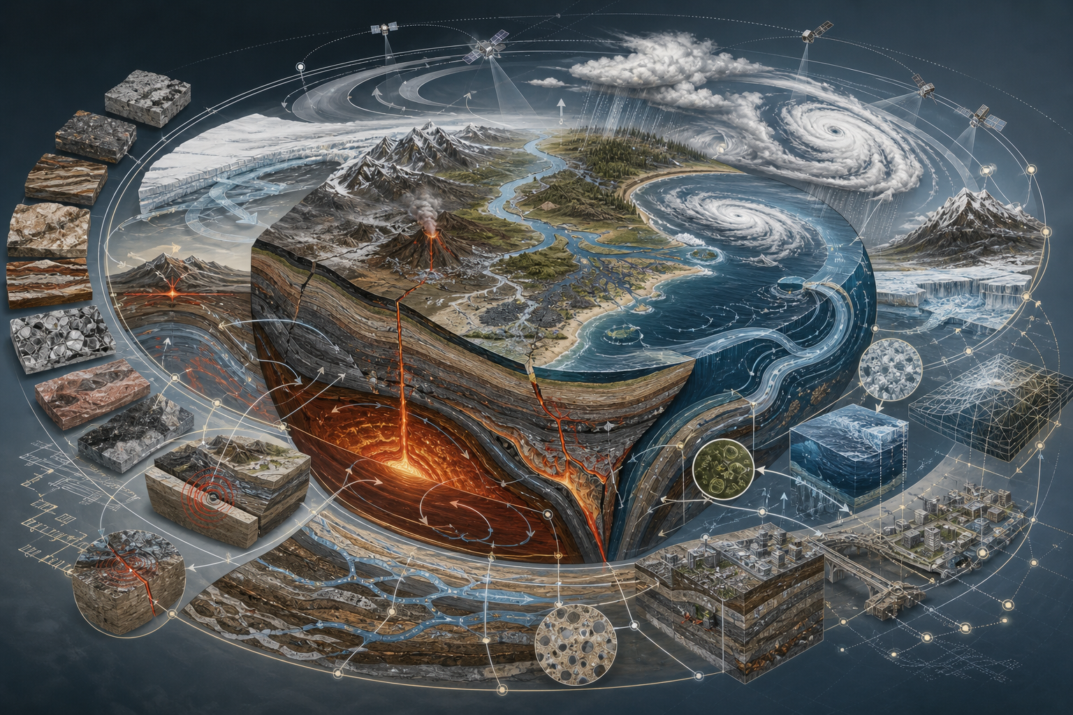
This content pillar brings together the major domains through which Earth Science interprets the planet. It treats Earth Science not merely as the study of rocks, weather, oceans, landforms, or hazards in isolation, but as a disciplined framework for understanding deep time, planetary structure, tectonic change, mineral systems, climate, oceans, water systems, surface processes, natural hazards, resource systems, and the interactions among Earth’s major spheres. Across environmental science, climate science, natural hazards, infrastructure, resource governance, agriculture, water security, public health, urban planning, and sustainability, Earth Science provides an indispensable language for explaining how planetary systems operate and how human societies exist within them.
This series also approaches Earth Science as a field that increasingly depends on quantitative reasoning, geospatial analysis, field measurement, remote sensing, statistical inference, computational modeling, Earth observation, reproducible data workflows, and open scientific code. Many of the most important Earth-system questions now require not only observation, mapping, and interpretation, but programmable environments capable of tracing change across space, time, depth, elevation, uncertainty, and scale. For that reason, this pillar integrates Earth Science with mathematics, statistics, GIS, R, Python, Julia, SQL, notebooks, reproducible data practices, geospatial workflows, remote-sensing pipelines, hydrological models, climate datasets, and open scientific code. Mathematics clarifies rates, gradients, fluxes, storage, transport, circulation, recurrence, uncertainty, feedback, and threshold behavior. R supports statistical climatology, hydrology, time-series analysis, geospatial visualization, trend detection, environmental monitoring, and reproducible reporting. Python supports geospatial processing, raster and vector analysis, climate-data workflows, hydrological modeling, terrain analysis, remote sensing, automation, scientific computing, machine learning, and simulation. Julia supports high-performance numerical modeling, differential equations, dynamical systems, and computational geophysics. C++, Fortran, C, Rust, and Go support numerical kernels, geophysical simulation, environmental instrumentation, safe scientific tooling, data services, command-line workflows, and reproducible computational infrastructure. SQL supports metadata, station records, geospatial observations, sensor logs, hazard inventories, sample catalogs, and research provenance. Together, these tools make it possible not only to describe Earth systems, but to measure, model, simulate, test, reproduce, and interrogate them with greater rigor.
Earth Science therefore appears here not only as an observational and field-based science, but also as a historical, theoretical, quantitative, computational, geographic, geophysical, chemical, biological, ecological, technological, ethical, and civilizational one. The aim of the series is to preserve the conceptual richness of geoscientific thought while showing how contemporary Earth Science increasingly relies on mathematical structure, statistical reasoning, geospatial data, modeling, simulation, remote sensing, and computation in order to understand planetary systems under real conditions of uncertainty, heterogeneity, nonlinearity, interdependence, and change. In that sense, this series treats Earth Science not simply as the study of the planet, but as one of the deepest and most demanding ways human beings have developed for thinking about time, matter, energy, water, climate, landscape, hazard, infrastructure, and habitability.
Earth Science Code Repository
The Earth Science knowledge series is supported by an open computational repository with article-level folders, reproducible examples, synthetic datasets, documentation, geospatial workflows, Earth-observation scaffolding, hydrological and climate-analysis examples, SQL metadata structures, and full-stack scientific-computing support across Python, R, Julia, SQL, Rust, Go, C, C++, Fortran, and notebooks where appropriate.
Earth Science as a Foundational Science
Earth Science occupies a central place within the natural sciences because it explains the planet as an interconnected system. Physics helps clarify energy, force, radiation, fluid motion, gravity, heat transfer, and geophysical process. Chemistry helps explain minerals, rocks, atmosphere, water composition, weathering, ocean chemistry, soil formation, and biogeochemical cycling. Biology helps interpret ecosystems, life-environment interaction, carbon cycling, soils, microbial processes, and the conditions under which habitability is sustained. Earth Science is distinctive because it brings these dimensions together in order to understand the planet’s structure, history, circulation systems, surface processes, hazards, resources, and long-term transformations across deep time.
This foundational role does not mean that Earth Science is simply an aggregate of other sciences. Rather, it is a field uniquely concerned with the organization and evolution of the Earth system itself. It investigates how rock, water, air, ice, land, life, energy, and time interact across scales, and how these interactions generate both stability and disruption. It therefore serves as one of the most important bridges between planetary history, present environmental conditions, natural hazards, resource systems, infrastructure systems, and the long-term material foundations of civilization.
Earth Science is therefore both integrative and plural. It includes field sciences, laboratory sciences, observational sciences, historical sciences, theoretical sciences, quantitative sciences, computational sciences, and applied sciences. It draws on mapping, stratigraphy, mineral analysis, geochemistry, geophysics, hydrological measurement, ocean observation, atmospheric monitoring, paleoclimate reconstruction, satellite imagery, GIS, numerical modeling, hazard assessment, statistical inference, and historical reconstruction. Across these methods, Earth Science seeks not a single level of explanation, but a layered understanding of planetary systems in which material structure, physical process, historical time, environmental change, and human vulnerability remain inseparable.
Earth Science as a Science of Planetary Systems
Earth Science may be understood as one of the great sciences of planetary systems. Earth is neither a passive platform nor a collection of isolated environments. It is a dynamic, layered, energy-driven system whose properties emerge from interaction among the geosphere, hydrosphere, atmosphere, cryosphere, biosphere, and human-built systems. Tectonic movement creates mountains, basins, earthquakes, volcanoes, and continental arrangements. Weathering and erosion reshape those structures through water, ice, wind, gravity, and chemical reaction. Oceans store and transport heat. Atmosphere circulates moisture and energy. Ice records and influences climate. Soils form at the boundary between geology, water, air, and life. Human systems increasingly alter land cover, water flows, atmospheric chemistry, sediment movement, and biogeochemical cycles.
For that reason, Earth Science has always demanded forms of thinking capable of moving between scales. It must explain how mineral-scale processes shape rocks, how rock units become landscapes, how landscapes shape watersheds, how watersheds connect to coasts and oceans, how atmospheric circulation produces local weather and global climate, how ice sheets record planetary history, and how human decisions alter Earth-system trajectories. In the contemporary world, these problems increasingly require quantitative and computational tools, but they remain Earth-scientific in the deepest sense because they concern the planet as organized material process across time.
This makes Earth Science especially important within a broader intellectual project concerned with systems, sustainability, risk, infrastructure, and long-horizon responsibility. The planet is not merely the background against which human history unfolds. It is the material system within which life, settlement, agriculture, cities, transport, energy, water, food, and civilization become possible. To study Earth Science seriously is therefore to study the conditions under which landscapes endure, hazards emerge, resources are formed, water circulates, climate changes, ecosystems persist, and human societies either adapt to or misunderstand planetary limits.
Earth Science as a Quantitative and Computational Science
Modern Earth Science is increasingly quantitative. Planetary systems are not only observed and described; they are measured, mapped, modeled, compared, visualized, simulated, and analyzed using formal methods. River discharge can be represented as flow through a watershed. Climate change can be studied through time-series anomalies, energy balance, radiative forcing, circulation, feedback, and uncertainty. Earthquake risk can be analyzed through recurrence, magnitude-frequency relationships, ground motion, exposure, and vulnerability. Coastlines can be studied through shoreline change, sea-level rise, sediment budgets, storm surge, and erosion rates. Terrain can be analyzed through elevation models, slope, curvature, flow accumulation, drainage networks, and landslide susceptibility. Earth-system knowledge therefore increasingly emerges through the combination of empirical observation, mathematical reasoning, geospatial interpretation, computational analysis, and reproducible workflows.
This does not mean that Earth Science ceases to be field-based, observational, historical, or interpretive. Rather, it means that modern Earth-system understanding often depends on moving across modes of inquiry. A researcher may collect field measurements, compare them with remote-sensing data, analyze the results in R, model a physical process in Python, store station metadata in SQL, document the workflow in a computational notebook, visualize change in GIS, and interpret the results through geologic history, climate dynamics, hydrology, geomorphology, or hazard science. Earth Science has become one of the clearest examples of a science in which conceptual understanding, measurement, mapping, formal reasoning, and computation must work together.
For that reason, this series treats mathematics, statistics, GIS, R, Python, Julia, SQL, scientific computing, remote sensing, geospatial workflows, and reproducible notebooks as increasingly important parts of Earth Science literacy. Some articles in the series remain primarily conceptual, historical, field-based, geographic, or civilizational. Others lend themselves naturally to rates of change, uncertainty, statistical inference, raster analysis, vector analysis, numerical simulation, terrain modeling, hydrological modeling, climate trend analysis, hazard modeling, geophysical inversion, geochemical mass balance, or machine learning. The aim is not to force code into every article, but to build an Earth Science pillar that reflects how the geosciences are actually practiced.
What Earth Science Studies
Earth Science studies the planet across multiple levels of organization. At the material level, it examines minerals, rocks, sediments, soils, fluids, gases, ice, and the chemical and physical transformations through which Earth materials form, move, react, and change. At the structural level, it investigates Earth’s interior, crust, mantle, lithosphere, plates, faults, basins, mountains, volcanoes, and the geophysical processes that shape planetary architecture. At the surface level, it studies weathering, erosion, rivers, glaciers, coasts, landslides, deserts, soils, watersheds, and the processes that continually remake landscapes.
At broader scales, Earth Science studies oceans, atmosphere, climate systems, cryosphere dynamics, hydrological cycles, biogeochemical cycles, ecosystems, and planetary habitability. It asks how energy and matter circulate through the Earth system, how climate has changed across deep time, how hazards emerge, how water moves across and beneath the surface, how oceans regulate heat and chemistry, how ice responds to temperature and feedback, and how life and Earth systems shape one another. It also examines earthquakes, volcanic eruptions, floods, droughts, landslides, storms, coastal change, sea-level rise, resource formation, environmental risk, and the interaction between human systems and planetary processes.
Earth Science further studies the planet as a historical phenomenon. Every landscape carries evidence of earlier conditions. Every rock formation records processes that occurred under particular physical and chemical circumstances. Every fossil-bearing layer, sedimentary sequence, glacial deposit, isotope signal, and geomorphic surface preserves traces of past Earth environments. Earth Science is therefore not only concerned with how Earth systems function now, but with how they came to be, how they have changed, and how they may respond to future pressures.
What This Pillar Covers
This pillar brings together the major domains through which Earth Science interprets the planet. It begins with the scope of Earth Science and the historical emergence of modern geoscience, then moves through planetary formation, geologic time, Earth’s internal structure, plate tectonics, minerals, rocks, geochemistry, volcanism, earthquakes, weathering, geomorphology, soils, hydrology, rivers, groundwater, oceans, coasts, atmosphere, weather, climate systems, paleoclimate, cryosphere dynamics, biogeochemical cycles, natural hazards, and the methods through which Earth processes are observed, measured, mapped, and modeled. From there, it expands into resource systems, remote sensing, Earth observation, geospatial data, computational geoscience, climate-risk analysis, infrastructure, planetary change, stewardship, and the wider scientific and civilizational significance of understanding a changing planet.
The pillar also incorporates quantitative and computational Earth Science reasoning where appropriate. Some topics naturally involve mathematical structure, including rates of erosion, streamflow, groundwater movement, heat transfer, plate motion, seismic recurrence, climate trends, sediment transport, glacial mass balance, and ocean circulation. Others lend themselves especially well to statistical inference, geospatial visualization, reproducible notebooks, remote-sensing pipelines, terrain analysis, hydrological simulation, climate-data processing, machine learning, or computational workflows. In those cases, articles may incorporate mathematical interpretation, R-based analysis, Python-based modeling, Julia-based simulation, SQL metadata, GitHub-based code examples, or full-stack computational scaffolding. This allows the series to remain conceptually rich while also becoming methodologically stronger.
Taken together, these domains form a coherent intellectual architecture. Earth Science is not simply a descriptive inventory of land, sea, sky, rock, ice, and hazard. It is a far-reaching mode of explanation that connects planetary formation to present-day systems, connects physical structure to circulation and change, connects local landscapes to global processes, and connects human vulnerability to the material dynamics of the planet. It shows that Earth is dynamic, stratified, interconnected, historically contingent, and always changing, and that planetary stability is the outcome of processes that can be studied scientifically but never reduced to a single cause.
The series also treats Earth Science as a field that links the descriptive and the applied. Earth-system knowledge informs climate adaptation, water management, hazard preparedness, infrastructure planning, agriculture, coastal resilience, mineral and energy resource decisions, environmental monitoring, land-use planning, disaster risk reduction, public health, and sustainability. For that reason, the pillar is designed not only to introduce Earth Science concepts, but to clarify why Earth-system thinking remains indispensable for understanding the contemporary world.
Mathematics, Computation, and Simulation in Earth Science
Mathematics provides part of the formal language through which Earth Science understands motion, change, storage, transfer, uncertainty, and feedback. Rates of erosion, groundwater flow, river discharge, sediment transport, heat transfer, radioactive decay, glacial mass balance, atmospheric circulation, ocean mixing, seismic recurrence, and climate trends can all be clarified through mathematical reasoning. Earth Science often relies on geometry, calculus, probability, statistics, linear algebra, differential equations, signal processing, graph theory, numerical methods, and spatial analysis. These tools help make planetary processes comparable, testable, and interpretable across scales.
Computation is especially valuable where Earth systems are too large, heterogeneous, spatially complex, data-rich, or nonlinear for direct intuition alone. R supports environmental statistics, climatology, hydrology, time-series analysis, geospatial visualization, trend detection, reproducible reports, and uncertainty analysis. Python supports geospatial processing, raster analysis, vector workflows, terrain modeling, hydrological simulation, climate-data pipelines, remote sensing, machine learning, automation, and scientific notebooks. Julia supports high-performance numerical modeling, differential equations, geophysical simulation, and dynamical systems. C++, Fortran, C, Rust, and Go support performance-critical simulation, numerical kernels, environmental sensors, command-line tools, data validation, and computational infrastructure. SQL supports station metadata, environmental observations, geospatial indexing, sensor logs, hazard catalogs, sample records, and reproducible provenance.
Used together, mathematics, computation, GIS, numerical methods, notebooks, SQL metadata, and open code repositories help make Earth Science more explicit, testable, reproducible, and scalable. They allow planetary patterns to be measured rather than merely described, uncertainty to be quantified rather than assumed away, and complex Earth systems to be explored through models as well as through observation. In this series, those tools are integrated where they deepen explanation rather than distract from it. The result is an Earth Science pillar that remains faithful to geoscience while also acknowledging that modern Earth-system literacy increasingly includes quantitative, geospatial, and computational competence.
Major Domains of Earth Science
Earth Science includes a wide range of major domains, each of which illuminates a different dimension of planetary organization. Geology examines Earth materials, structures, stratigraphy, tectonics, rocks, minerals, fossils, sedimentary environments, and the history of Earth’s crust. Geophysics studies the physical properties and processes of the planet, including gravity, magnetism, seismic waves, heat flow, plate motion, and Earth’s internal structure. Geochemistry studies the chemical composition and transformation of Earth materials, including minerals, rocks, waters, gases, isotopes, weathering, ocean chemistry, and biogeochemical cycles.
Geomorphology examines the shaping of landscapes through water, wind, ice, gravity, tectonics, weathering, and erosion. Hydrology studies water movement through atmosphere, land surface, rivers, lakes, soils, aquifers, and human water systems. Oceanography studies the global ocean as a physical, chemical, biological, and geological system. Atmospheric science examines weather, circulation, storms, radiation, atmospheric composition, and climate dynamics. Climatology and paleoclimatology study climate systems across instrumental, historical, and deep-time records. Cryospheric science studies glaciers, ice sheets, snow, permafrost, sea ice, and their relationship to climate and sea level.
Other major Earth Science domains extend and deepen this framework. Soil science studies the living and mineral interface between rock, water, air, and organisms. Volcanology studies magma, eruptions, lava, gases, volcanic landforms, and volcanic hazards. Seismology studies earthquakes, faults, seismic waves, and ground motion. Natural hazards science examines risk, exposure, vulnerability, recurrence, resilience, early warning, and disaster reduction. Remote sensing and GIS interpret Earth systems through satellite imagery, sensors, spatial data, and computational mapping. Resource geology studies minerals, energy systems, groundwater, and the material foundations of society. Earth-system science integrates geosphere, atmosphere, hydrosphere, cryosphere, biosphere, and human systems into a unified understanding of planetary change.
Many of these domains are now inseparable from quantitative and computational methods. Climate science depends heavily on modeling, time-series analysis, satellite data, and uncertainty assessment. Hydrology increasingly uses numerical models, geospatial data, and sensor networks. Geophysics relies on signal processing, inversion, simulation, and high-performance computing. Remote sensing depends on raster processing, spectral analysis, classification, and machine learning. Hazard science increasingly integrates probabilistic modeling, exposure data, vulnerability analysis, and decision support. Earth Science therefore continues to broaden not only in subject matter but also in formal and technical depth.
Why Earth Science Matters
Earth Science matters because it explains the planetary conditions under which human and ecological life become possible. It clarifies how continents move, how mountains rise and erode, how rivers and groundwater systems behave, how oceans circulate, how climate varies, how soils form, how hazards emerge, and how planetary processes create both opportunity and risk. In doing so, Earth Science shapes environmental governance, infrastructure planning, water management, hazard preparedness, climate adaptation, agriculture, coastal protection, resource policy, and many of the most consequential questions facing modern societies.
Earth Science also matters because the contemporary world is increasingly shaped by planetary disruption and planetary risk. Climate change, sea-level rise, groundwater depletion, land subsidence, coastal erosion, intensifying hydrological extremes, wildfire conditions, landslide risk, soil degradation, ecosystem stress, ocean warming, cryosphere loss, and geochemical pollution all require Earth-system understanding. The science of the planet is no longer confined to field stations, laboratories, survey maps, or university departments. It has become central to questions of governance, law, infrastructure, security, public finance, environmental justice, sustainability, and long-term habitability.
At the same time, Earth Science matters because it reveals the depth of interdependence that structures life and civilization on Earth. No city, farm, road, port, power system, water network, or settlement exists outside planetary conditions. Human systems depend on groundwater, soils, minerals, stable slopes, coastal buffers, energy flows, climate patterns, weather predictability, and the continuing function of Earth-system processes. Earth Science therefore helps clarify not only the mechanisms of the planet, but the fragility of the conditions under which human societies can continue.
Earth Science also matters because modern decisions increasingly depend on data, models, and statistical interpretation. Questions of flood risk, drought planning, groundwater sustainability, climate adaptation, landslide susceptibility, coastal retreat, mineral supply, infrastructure resilience, and environmental monitoring now rely not only on observation but on modeling, inference, mapping, simulation, and computation. An Earth-science-literate society must therefore be able to move between the planet as experienced, the planet as measured, and the planet as modeled.
Earth Science and Human Self-Understanding
Earth Science changes how human beings understand themselves. It places human life within a larger planetary history, reveals the deep time beneath human settlement, and shows that societies are neither separate from nor outside the material systems of the Earth. It illuminates place, risk, resource dependence, environmental constraint, vulnerability, adaptation, and the layered planetary conditions that shape survival and flourishing.
Yet Earth Science also complicates self-understanding. It shows that landscapes are not fixed, that coastlines move, that rivers migrate, that climates change, that soils can be depleted, that hazards recur, that resources are finite or unevenly distributed, and that planetary systems often operate on timescales that exceed ordinary political and economic attention. It asks human beings to understand themselves at once as inhabitants of place, users of Earth materials, beneficiaries of planetary stability, and agents capable of altering Earth-system processes.
For that reason, Earth Science has philosophical as well as scientific significance. It raises enduring questions about stewardship, extraction, settlement, disaster risk, intergenerational responsibility, resource dependence, environmental justice, and the responsibilities that follow from human power over planetary systems. As Earth Science becomes increasingly data-rich, computational, and policy-relevant, those ethical questions become even more pressing. A serious Earth Science pillar should therefore not end with facts alone. It should also clarify the wider implications of Earth-system knowledge for responsibility, adaptation, and civilization.
Earth Science Pillar Map
The map below organizes the Earth Science knowledge series into conceptual domains, moving from foundations and first principles toward deep time, planetary structure, rocks and minerals, tectonics, surface processes, water systems, oceans, atmosphere, climate, hazards, computation, resources, infrastructure, stewardship, and the wider human significance of Earth-system knowledge.
The Earth Science pillar is organized to move from foundations and first principles into planetary formation, deep time, Earth structure, tectonic systems, minerals and rocks, surface processes, water systems, ocean systems, atmospheric systems, climate systems, cryosphere dynamics, hazards, Earth observation, geospatial analysis, computational geoscience, resource systems, infrastructure, planetary change, and the wider intellectual significance of Earth-system knowledge. Mathematics, R, Python, Julia, C++, Fortran, C, Rust, SQL, Go, GIS, remote sensing, and computational notebooks are integrated within the series where they deepen Earth-system understanding, especially in areas such as climate analysis, hydrological modeling, terrain analysis, remote sensing, geospatial workflows, natural hazard assessment, resource mapping, geophysical modeling, reproducibility, Earth observation, environmental monitoring, and scientific simulation. The goal is a pillar that remains clearly and fully Earth-scientific while also reflecting the quantitative and computational depth of the contemporary geosciences.
Foundations of Earth Science
- What Is Earth Science? (planned) — An opening article defining Earth Science as the scientific study of Earth’s structure, materials, history, systems, and processes. This piece clarifies the identity of the field, its place within the natural sciences, and its importance for understanding land, water, air, ice, climate, hazards, resources, and habitability.
- The Rise of Modern Geoscience (planned) — An account of how Earth Science emerged through geology, mineralogy, mapping, stratigraphy, paleontology, geophysics, oceanography, meteorology, plate tectonics, climate science, Earth observation, and Earth-system thinking.
- Observation, Mapping, and the Methods of Earth-System Inquiry (planned) — A methodological article on fieldwork, measurement, sampling, mapping, remote sensing, laboratory analysis, geophysical surveys, GIS, modeling, uncertainty, and reproducible Earth Science practice.
- Earth Systems and the Major Spheres of the Planet (planned) — A systems article explaining the geosphere, hydrosphere, atmosphere, cryosphere, biosphere, and anthroposphere as interacting domains of planetary organization.
- Scale, Time, and Space in Earth Science (planned) — A conceptual article on spatial scale, temporal scale, deep time, recurrence, thresholds, local-global interaction, and the difficulty of interpreting planetary processes across vastly different orders of magnitude.
- Maps, Models, and the Scientific Representation of Earth (planned) — An article on how maps, cross-sections, stratigraphic columns, models, satellite imagery, digital elevation models, and computational visualizations shape Earth-system understanding.
Planetary Formation, Deep Time, and Earth History
- The Formation of the Earth and the Early Planet (planned) — A foundational article on planetary accretion, differentiation, early atmosphere, early oceans, bombardment, crust formation, heat, and the conditions that shaped early Earth.
- Geologic Time and the History of the Earth (planned) — A core article on deep time, relative dating, absolute dating, stratigraphy, the geologic time scale, major eras, and the scientific reconstruction of Earth history.
- Radiometric Dating and the Measurement of Deep Time (planned) — A quantitative article on radioactive decay, isotopic systems, half-lives, uncertainty, age dating, and the methods through which geoscientists measure Earth’s long history.
- Stratigraphy, Sedimentary Records, and Earth History (planned) — A study of layers, sedimentary sequences, depositional environments, correlation, unconformities, fossils, and the reconstruction of past landscapes and climates.
- The Fossil Record and Earth-System Change (planned) — A bridge article connecting paleontology, stratigraphy, evolution, extinction, climate change, ocean chemistry, and the deep history of life-environment interaction.
- Mass Extinctions, Environmental Crisis, and Planetary Recovery (planned) — A historical Earth-system article on major extinction events, environmental disruption, biotic recovery, volcanic forcing, impact events, ocean anoxia, and the geological record of crisis.
Earth Structure, Geophysics, and Planetary Dynamics
- Earth’s Internal Structure and Geophysical Layers (planned) — A core article on crust, mantle, outer core, inner core, lithosphere, asthenosphere, seismic evidence, density, heat, and the layered structure of the planet.
- Heat, Gravity, Magnetism, and the Physical Planet (planned) — A geophysical article on Earth’s heat flow, gravity field, magnetic field, geodynamo, isostasy, and the physical forces that shape planetary structure and behavior.
- Seismic Waves and the Interior of the Earth (planned) — A focused article on P waves, S waves, surface waves, refraction, reflection, seismic tomography, and how earthquake signals reveal Earth’s interior.
- Plate Tectonics and the Dynamics of the Lithosphere (planned) — A flagship article on plate boundaries, continental drift, seafloor spreading, subduction, transform faults, mountain building, rifting, and the unifying role of plate tectonics in modern geoscience.
- Continental Drift, Seafloor Spreading, and Scientific Revolution (planned) — A historical article on the evidence, resistance, and eventual scientific transformation that led to plate tectonic theory.
- Mountain Building, Isostasy, and Crustal Deformation (planned) — An article on orogeny, folding, faulting, uplift, erosion, crustal thickening, isostatic adjustment, and the making and unmaking of mountain belts.
Minerals, Rocks, Geochemistry, and Earth Materials
- Rocks, Minerals, and the Material Composition of the Planet (planned) — A foundational article on minerals, crystal structure, rock-forming processes, igneous, sedimentary, and metamorphic rocks, and the material basis of Earth Science.
- Mineralogy and the Architecture of Earth Materials (planned) — A focused article on crystal chemistry, silicates, mineral properties, mineral identification, and the role of minerals in geology, soils, resources, and planetary history.
- Igneous Rocks, Magma, and Crystallization (planned) — An article on magma generation, cooling, crystallization, intrusive and extrusive rocks, volcanic textures, fractional crystallization, and igneous differentiation.
- Sedimentary Rocks and the Archives of Surface Environments (planned) — A study of sediments, depositional environments, lithification, sedimentary structures, fossils, basin records, and the preservation of Earth-surface history.
- Metamorphic Rocks and Transformation Under Pressure and Heat (planned) — A focused article on metamorphism, pressure, temperature, fluids, foliations, index minerals, metamorphic facies, and the transformation of rocks in tectonic settings.
- Geochemistry and the Chemical Evolution of Earth (planned) — An article on elemental cycles, isotopes, water-rock interaction, weathering, ocean chemistry, mantle chemistry, crustal differentiation, and the chemical interpretation of Earth systems.
- Isotopes, Tracers, and Earth-System Evidence (planned) — A methodological article on stable isotopes, radiogenic isotopes, geochemical tracers, paleotemperature proxies, hydrological tracers, and the use of chemical evidence to reconstruct Earth processes.
Tectonics, Earthquakes, Volcanoes, and Crustal Transformation
- Faults, Folds, and the Deformation of Rock (planned) — A structural geology article on stress, strain, brittle deformation, ductile deformation, faults, folds, joints, shear zones, and the physical response of rocks to force.
- Earthquakes, Faults, and Seismic Risk (planned) — A hazard-focused article on earthquake generation, fault rupture, magnitude, intensity, ground shaking, recurrence, exposure, vulnerability, and seismic risk reduction.
- Volcanoes, Eruptions, and Magmatic Hazards (planned) — A major article on volcanic systems, magma, eruptions, ash, lava, pyroclastic flows, lahars, gases, monitoring, and volcanic risk.
- Subduction Zones, Island Arcs, and Deep Earth Recycling (planned) — A tectonic systems article on subduction, ocean trenches, volcanic arcs, earthquakes, water cycling, mantle melting, and the recycling of Earth materials.
- Rifting, Basins, and the Opening of Oceans (planned) — An article on continental extension, rift valleys, passive margins, basin formation, sediment accumulation, and the tectonic processes through which oceans open.
- Hotspots, Mantle Plumes, and Intraplate Volcanism (planned) — A focused article on volcanic chains, mantle plumes, intraplate volcanism, flood basalts, ocean islands, and deep-mantle processes.
Surface Processes, Geomorphology, and Landscape Change
- Weathering, Erosion, and Sediment Transport (planned) — A foundational article on physical weathering, chemical weathering, erosion, sediment movement, denudation, transport pathways, and the transformation of rock into landscape.
- Geomorphology and the Shaping of Landscapes (planned) — A broad article on landforms, process geomorphology, rivers, hillslopes, coasts, glaciers, deserts, tectonics, climate, and the scientific interpretation of landscape form.
- Hillslopes, Mass Wasting, and Gravity-Driven Change (planned) — An article on slope processes, rockfall, debris flows, landslides, soil creep, slope stability, thresholds, and the geomorphic role of gravity.
- Rivers, Watersheds, and Fluvial Processes (planned) — A hydrologic and geomorphic article on drainage basins, channels, sediment transport, floodplains, meanders, deltas, stream power, and river-landscape interaction.
- Deserts, Wind, and Aeolian Landforms (planned) — A focused article on arid environments, dunes, loess, dust, wind erosion, desert pavements, and the role of atmospheric motion in shaping dry landscapes.
- Glacial Geomorphology and Ice-Shaped Landscapes (planned) — An article on glaciers as geomorphic agents, including erosion, moraines, drumlins, fjords, outwash plains, glacial valleys, and the landscape record of past ice.
- Karst, Caves, and Dissolution Landscapes (planned) — A study of limestone dissolution, caves, sinkholes, groundwater flow, karst aquifers, speleothems, and the geochemical shaping of landscapes.
- Soils, Regolith, and the Interface of Rock, Water, Air, and Life (planned) — A bridge article on soil formation, regolith, weathering profiles, horizons, organic matter, microbes, minerals, water movement, agriculture, and planetary habitability.
Water, Hydrology, and Freshwater Systems
- Hydrology and the Movement of Water Through the Earth System (planned) — A core article on precipitation, runoff, infiltration, evapotranspiration, streamflow, storage, residence time, and the hydrological cycle as a central Earth-system process.
- Groundwater, Aquifers, and Subsurface Water Systems (planned) — An article on aquifers, porosity, permeability, recharge, discharge, water tables, wells, groundwater flow, contamination, depletion, and water governance.
- Watersheds, Drainage Networks, and Basin-Scale Thinking (planned) — A systems article on watersheds as organizing units for hydrology, ecology, land use, flood risk, water quality, and environmental planning.
- Lakes, Wetlands, and Inland Water Systems (planned) — A study of lakes, wetlands, reservoirs, limnology, nutrient cycling, water quality, ecosystem function, flood storage, and the interface between hydrology and ecology.
- Floods, Droughts, and Hydrological Extremes (planned) — A major article on flood generation, drought development, recurrence, vulnerability, climate influence, water management, early warning, and risk reduction.
- Water Quality, Contamination, and Earth-System Health (planned) — An article on dissolved chemistry, nutrients, pollutants, sediment, groundwater contamination, watershed management, monitoring, and the Earth Science of water safety.
- Snowpack, Runoff, and Seasonal Water Security (planned) — A focused article on mountain snowpack, melt timing, streamflow, drought risk, water supply, climate change, and seasonal hydrological forecasting.
Oceans, Coasts, and Marine-Earth Interactions
- Oceanography and the Dynamics of the Global Ocean (planned) — A major article on ocean basins, currents, stratification, circulation, heat storage, salinity, waves, tides, marine chemistry, and the ocean’s role in Earth systems.
- Physical Oceanography, Circulation, and Heat Transport (planned) — A quantitative article on ocean currents, thermohaline circulation, wind-driven circulation, upwelling, mixing, heat transport, and ocean-climate interaction.
- Chemical Oceanography and the Composition of Seawater (planned) — An article on salinity, dissolved gases, carbonate chemistry, nutrients, acidification, oxygen, trace elements, and the chemical functioning of the ocean.
- Marine Geology and the Structure of Ocean Basins (planned) — A study of seafloor spreading, abyssal plains, mid-ocean ridges, trenches, continental shelves, submarine fans, sediments, and the geology of ocean floors.
- Coasts, Shorelines, and Marine-Earth Interactions (planned) — A coastal systems article on beaches, barrier islands, estuaries, deltas, tides, storms, erosion, sediment budgets, sea-level rise, and coastal resilience.
- Deltas, Estuaries, and Coastal Wetlands (planned) — An article on river-ocean interfaces, sediment delivery, salinity gradients, wetland formation, subsidence, storm buffering, habitat, and coastal vulnerability.
- Sea-Level Change and Coastal Risk (planned) — A major article on global and relative sea-level rise, thermal expansion, ice melt, subsidence, storm surge, coastal exposure, adaptation, and retreat.
Atmosphere, Weather, Climate, and the Cryosphere
- The Atmosphere and the Structure of the Air Envelope (planned) — A foundational article on atmospheric layers, pressure, temperature, composition, radiation, water vapor, aerosols, and the atmosphere as a dynamic Earth-system domain.
- Weather, Circulation, and the Dynamics of the Lower Atmosphere (planned) — A meteorological article on pressure systems, winds, fronts, convection, storms, precipitation, humidity, and the atmospheric processes that shape daily weather.
- Radiation, Energy Balance, and the Greenhouse Effect (planned) — A quantitative article on solar radiation, albedo, infrared emission, greenhouse gases, radiative balance, feedback, and the physical basis of climate.
- Climate Systems and the Long-Term Regulation of Earth Conditions (planned) — A flagship article on climate as an Earth system, including atmosphere, ocean, land, ice, biosphere, carbon cycle, feedback, variability, and long-term planetary regulation.
- Paleoclimate and the Reconstruction of Past Earth Environments (planned) — An article on ice cores, sediment cores, tree rings, fossils, isotopes, proxies, and the reconstruction of climates before instrumental records.
- Glaciers, Ice Sheets, and the Cryosphere (planned) — A major article on glaciers, ice sheets, sea ice, snow, permafrost, mass balance, albedo, melt, sea-level contribution, and cryosphere-climate feedback.
- Permafrost, Frozen Ground, and Arctic Change (planned) — A focused article on permafrost, thaw, ground ice, carbon release, infrastructure risk, Arctic hydrology, and the Earth-system implications of frozen-ground change.
- Extreme Weather, Storms, and Atmospheric Risk (planned) — An article on hurricanes, severe storms, atmospheric rivers, heat waves, cold waves, precipitation extremes, risk, vulnerability, and climate-related hazard interpretation.
Earth Systems, Cycles, and Planetary Habitability
- Biogeochemical Cycles and the Chemical Functioning of the Planet (planned) — A bridge article on carbon, nitrogen, phosphorus, sulfur, oxygen, water, rock weathering, ocean chemistry, soils, microbes, atmosphere, and the chemical cycles that shape habitability.
- The Carbon Cycle and Earth-System Regulation (planned) — A focused article on carbon reservoirs, fluxes, weathering, photosynthesis, respiration, ocean uptake, fossil carbon, carbon dioxide, and climate regulation.
- The Rock Cycle as a Planetary Recycling System (planned) — An article on igneous, sedimentary, and metamorphic transformation as a long-term material cycle linking tectonics, erosion, burial, melting, uplift, and surface change.
- Earth-System Feedbacks, Thresholds, and Tipping Points (planned) — A systems article on feedback loops, nonlinear change, thresholds, resilience, regime shifts, climate feedback, cryosphere loss, hydrological stress, and planetary risk.
- The Critical Zone: Rock, Soil, Water, Air, and Life (planned) — An integrative article on the near-surface zone where geology, hydrology, atmosphere, biology, soils, weathering, ecosystems, and human land use interact.
- Planetary Habitability and the Conditions for Life (planned) — A synthetic article on Earth’s habitability, liquid water, atmosphere, climate stability, energy, chemistry, tectonics, magnetic field, biosphere, and the material conditions that support life.
Natural Hazards, Risk, and Resilience
- Natural Hazards and the Earth Science of Risk (planned) — A conceptual article on hazard, exposure, vulnerability, risk, recurrence, mitigation, resilience, uncertainty, early warning, and the scientific basis of disaster risk reduction.
- Landslides, Coastal Change, and Surface Instability (planned) — A hazard article on slope failure, erosion, coastal retreat, cliff collapse, sediment instability, triggering conditions, monitoring, and risk management.
- Wildfire, Landscape Conditions, and Earth-System Risk (planned) — A cross-disciplinary article on drought, vegetation, topography, weather, climate change, soil impacts, erosion, debris flows, and post-fire landscape response.
- Tsunamis, Storm Surge, and Coastal Hazard Systems (planned) — An article on tsunami generation, storm surge, coastal amplification, inundation, exposure, early warning, and coastal risk reduction.
- Drought, Heat, and Compound Environmental Risk (planned) — A systems article on interacting hazards, including heat, drought, water stress, soil moisture loss, crop stress, wildfire conditions, and infrastructure vulnerability.
- Earth Science, Disaster Memory, and Preparedness (planned) — A human-centered article on how hazard histories, maps, monitoring, warnings, public trust, planning, and institutional memory shape disaster preparedness.
Observation, Data, Remote Sensing, and Computational Geoscience
- Remote Sensing, Satellites, and Earth Observation (planned) — A practical article on satellite imagery, sensors, spectral data, land cover, climate monitoring, ocean observation, change detection, and the role of Earth observation in modern geoscience.
- Earth Data, Mapping, and Geospatial Interpretation (planned) — A methodological article on GIS, coordinate systems, projections, raster data, vector data, spatial joins, geostatistics, uncertainty, and the interpretation of spatial evidence.
- Digital Elevation Models and Terrain Analysis (planned) — A computational article on elevation data, slope, aspect, curvature, flow direction, flow accumulation, watershed delineation, landslide susceptibility, and terrain-derived indicators.
- Python for Geospatial Earth Science Workflows (planned) — A practical article on using Python for raster and vector processing, climate data, remote sensing, hydrological modeling, automation, visualization, and reproducible Earth Science workflows.
- R for Climate, Hydrology, and Environmental Data Analysis (planned) — A practical article on R for time-series analysis, climatology, hydrological statistics, trend detection, geospatial visualization, uncertainty, and reproducible reports.
- SQL for Earth Observation Metadata and Environmental Monitoring (planned) — A data-infrastructure article on station records, sensor logs, geospatial observations, sample metadata, hazard inventories, data provenance, and reproducible Earth Science databases.
- Computational Notebooks and Reproducible Geoscience (planned) — A methodological article on notebooks, literate programming, executable documentation, data provenance, version control, transparent workflows, and reproducible Earth-system analysis.
- Machine Learning in Earth Science and Remote Sensing (planned) — A modern article on classification, prediction, anomaly detection, land-cover mapping, hazard susceptibility, climate pattern analysis, uncertainty, interpretability, and responsible machine learning in geoscience.
- Numerical Modeling and Simulation in Earth Systems (planned) — A computational article on models of groundwater, rivers, climate, terrain, heat flow, sediment transport, hazards, and the role of numerical methods in Earth Science.
Resources, Infrastructure, and Human Systems
- Energy, Minerals, and the Geology of Resources (planned) — A major article on mineral deposits, fossil energy, geothermal systems, critical minerals, ore formation, resource assessment, extraction, environmental impact, and material dependence.
- Critical Minerals and the Material Foundations of Transition (planned) — A focused article on lithium, cobalt, nickel, copper, rare earth elements, supply chains, mining impacts, geologic distribution, and the Earth Science of energy transitions.
- Geothermal Energy and Heat from the Earth (planned) — An article on geothermal gradients, reservoirs, heat flow, hydrothermal systems, enhanced geothermal systems, drilling, resource potential, and geologic risk.
- Earth Science, Infrastructure, and the Material Foundations of Civilization (planned) — A systems article on roads, bridges, tunnels, dams, ports, foundations, slopes, soils, aggregates, groundwater, hazards, and the geoscientific basis of built environments.
- Engineering Geology, Foundations, and Ground Conditions (planned) — A practical article on site investigation, rock mechanics, soil properties, slope stability, groundwater, foundation conditions, construction risk, and geotechnical decision-making.
- Urban Geology, Land Subsidence, and Built Environments (planned) — An article on cities as Earth-system environments, including subsurface conditions, groundwater withdrawal, subsidence, fill, contamination, heat, flooding, and infrastructure risk.
- Earth Science, Agriculture, and Soil-Water Systems (planned) — A bridge article on soils, water, terrain, climate, erosion, nutrient cycling, drought, irrigation, land management, and the geoscientific foundations of food systems.
Earth Science in Human Knowledge and Practice
- Planetary Change, Risk, and the Future of Habitability (planned) — A capstone-style article on climate change, water stress, hazards, resource pressure, coastal risk, ice loss, land degradation, and the future conditions of human and ecological habitability.
- Earth Science, Stewardship, and the Human Understanding of Place (planned) — A philosophical and civic article on place, landscape, memory, responsibility, environmental justice, resource use, hazard awareness, and the ethical meaning of Earth-system knowledge.
- Earth Science and Environmental Governance (planned) — An article on how geoscientific evidence informs law, regulation, land-use planning, water governance, hazard policy, climate adaptation, and public accountability.
- Earth Science, Indigenous Knowledge, and Place-Based Understanding (planned) — A careful article on Indigenous and local environmental knowledge, geologic memory, land relationships, hazards, water, place, and the importance of respecting multiple knowledge traditions without flattening scientific or cultural distinctions.
- Earth Science, Environmental Justice, and Unequal Exposure (planned) — An article on how hazards, pollution, resource extraction, flooding, heat, land instability, and environmental risk are unevenly distributed across communities and institutions.
- Earth Science, Ethics, and the Governance of Planetary Systems (planned) — A capstone article on extraction, risk, infrastructure, climate, resource dependence, public trust, environmental responsibility, and the ethical implications of Earth-system knowledge.
Python Workflow: Watershed Runoff and Flood-Risk Screening
A useful Python workflow for this pillar is a watershed runoff and flood-risk screening pipeline. The workflow can begin with a synthetic or public watershed dataset containing rainfall depth, land-cover class, soil infiltration category, slope, impervious surface percentage, drainage area, and observed streamflow where available. Python can be used to clean the data, estimate runoff coefficients, calculate event runoff, compare modeled discharge against observed discharge, flag high-risk storm events, and visualize basin-scale patterns. In a more advanced version, the workflow can incorporate digital elevation models, flow accumulation, land-cover rasters, rainfall grids, and flood-exposure layers.
This workflow belongs naturally with articles on hydrology, rivers, watersheds, floods, digital elevation models, terrain analysis, computational geoscience, and infrastructure risk. It demonstrates how Earth Science moves from observation to model-based interpretation: rainfall becomes runoff, runoff becomes stream response, stream response becomes hazard screening, and hazard screening becomes a basis for planning and adaptation. The point is not to replace professional hydrologic modeling, but to show how reproducible computational workflows clarify assumptions, make uncertainty visible, and help readers understand the physical logic behind water-related risk.
R Workflow: Climate Anomaly and Seasonal Trend Analysis
A useful R workflow for this pillar is a climate anomaly and seasonal trend analysis pipeline. The workflow can begin with a synthetic or public monthly temperature and precipitation dataset containing station identifiers, dates, observed values, baseline climatology, region, elevation, and quality flags. R can be used to calculate anomalies, summarize seasonal patterns, estimate trends, visualize departures from baseline conditions, compare stations, and communicate uncertainty. In a more advanced version, the workflow can incorporate gridded climate data, drought indices, rolling averages, seasonal decomposition, nonparametric trend tests, and reproducible reports.
This workflow belongs naturally with articles on atmosphere, climate systems, paleoclimate, drought, heat, hydrological extremes, Earth data, and environmental monitoring. It demonstrates how climate evidence is built from repeated observations, baselines, anomalies, temporal aggregation, and transparent statistical interpretation. It also reinforces the difference between weather variability, climate trends, and risk-relevant departures from historical conditions. Used carefully, R helps readers see climate not as an abstract political slogan, but as a measurable Earth-system pattern with consequences for water, agriculture, infrastructure, health, ecosystems, and long-term planning.
Measurement, Mapping, and Earth-System Practice
One of Earth Science’s enduring contributions is its ability to make planetary systems observable, comparable, and historically intelligible without stripping them of complexity. Earth-system knowledge depends not only on theory, but on reliable observations, calibrated instruments, field records, maps, samples, stratigraphic sections, geophysical measurements, hydrological gauges, weather stations, ocean buoys, ice cores, sediment cores, soil profiles, laboratory analyses, remote-sensing platforms, satellite archives, statistical designs, and disciplined forms of comparison. The history of Earth Science is therefore also a history of field notebooks, survey instruments, maps, cores, microscopes, seismometers, stream gauges, satellites, sensors, computational models, and the effort to render planetary processes measurable in consistent and transferable ways.
This matters far beyond technical practice. Earth-system measurement supports water management, hazard preparedness, climate adaptation, environmental monitoring, infrastructure planning, agriculture, energy systems, mineral resource decisions, public health, insurance, land-use planning, and disaster response. A flood forecast, groundwater assessment, landslide map, climate trend, coastal-risk model, mineral survey, soil evaluation, or earthquake hazard map all depends on the transformation of planetary complexity into careful evidence. Earth Science therefore requires humility about uncertainty: Earth systems vary, respond, interact, and change. Measurement must account for spatial heterogeneity, temporal variability, sampling bias, instrument limitations, historical contingency, human alteration, and the limits of any single method.
Modern Earth-system practice increasingly depends on combining field observation, laboratory analysis, instrumentation, statistics, geospatial data, remote sensing, computation, and reproducible documentation. A serious Earth Science claim may draw on field mapping, satellite imagery, geochemistry, geophysics, hydrological measurement, climate records, statistical analysis, mathematical modeling, computational workflows, and open data. This makes Earth Science one of the clearest examples of a science in which knowledge is produced through layered evidence rather than through one method alone.
Earth Science, Technology, and the Modern World
Earth Science has become one of the central sciences shaping modern life. Its influence extends through climate science, weather forecasting, water management, agriculture, coastal planning, engineering geology, infrastructure design, mineral exploration, energy systems, hazard monitoring, earthquake preparedness, volcanic risk, flood control, drought planning, remote sensing, environmental regulation, and planetary sustainability. Many of the most important questions facing contemporary societies are Earth Science questions: how climate changes, how water moves, how coastlines retreat, how slopes fail, how soil degrades, how hazards recur, how resources form, how infrastructure depends on ground conditions, and how human systems can adapt to a changing planet.
Earth Science also underlies many of the most powerful technologies of the present century. Satellite systems make planetary change visible at scale. Remote sensing allows land cover, oceans, ice, atmosphere, and hazards to be monitored continuously. GIS enables spatial decision-making. Geophysical tools reveal subsurface structures. Sensor networks track weather, streamflow, groundwater, air quality, seismicity, and environmental conditions. Computational models simulate climate, hydrology, ocean circulation, terrain change, seismic risk, and resource systems. Earth observation, geospatial analysis, and computational modeling increasingly support disaster response, climate adaptation, conservation planning, infrastructure resilience, agricultural monitoring, and responsible resource governance.
Yet Earth-system knowledge also creates Earth-system responsibility. Technologies that map resources, forecast hazards, classify land, model water, monitor climate, or guide extraction cannot be judged only by technical capability. They require ethical reasoning, public accountability, environmental justice, uncertainty communication, and attention to uneven distributions of risk and benefit. Earth Science therefore belongs not only to laboratories, field sites, and satellites, but to public life, law, governance, infrastructure, insurance, agriculture, planning, resource use, and long-term questions about the future of habitability.
Earth Science, Computation, and Scientific Simulation
Computation has become central to contemporary Earth Science because planetary systems generate complex, heterogeneous, spatially distributed, high-dimensional, and dynamic data. Satellite imagery, digital elevation models, climate records, hydrological gauges, ocean buoys, seismic networks, GPS measurements, geochemical samples, soil surveys, groundwater wells, hazard inventories, land-cover maps, and environmental sensors all require computational methods for storage, interpretation, visualization, and reproducibility. Earth-system computation is not merely a convenience. It is increasingly part of how Earth Science knowledge is produced.
Simulation is especially important when Earth systems cannot be understood through direct observation alone. Hydrological models can explore runoff, recharge, drought, flood risk, and watershed response. Climate models can examine radiation, circulation, feedback, and long-term planetary change. Geophysical models can study heat flow, mantle convection, crustal deformation, seismic waves, and subsurface structure. Geomorphic models can examine erosion, sediment transport, river evolution, coastal retreat, and landslide susceptibility. Ocean models can examine circulation, mixing, heat transport, and marine conditions. Machine learning can help identify patterns in remote-sensing images, hazard data, environmental monitoring records, and geospatial datasets, while also raising questions about interpretability, bias, uncertainty, and physical meaning.
For that reason, this Earth Science pillar treats computational practice as a major component of modern geoscience. It includes R for statistics, climatology, hydrology, and environmental data analysis; Python for geospatial workflows, remote sensing, automation, terrain modeling, hydrological modeling, and scientific computing; Julia for high-performance Earth-system simulation; C++ and Fortran for numerical kernels and geophysical models; C and Rust for systems-level tools and environmental instrumentation; SQL for metadata, sensor logs, and geospatial observation records; Go for practical scientific services and data utilities; and computational notebooks for transparent explanation. The goal is not to replace Earth-system judgment with code, but to strengthen Earth Science reasoning through reproducible, inspectable, and methodologically explicit workflows.
Earth Science in a Wider Intellectual Context
Earth Science occupies a distinctive place in human knowledge because it studies the planetary conditions under which human beings themselves exist. It places humanity within deep time, material dependence, landscape change, water systems, climate variability, hazard exposure, resource constraints, and the continuing transformation of Earth systems. It reveals that human societies are geological, hydrological, atmospheric, and climatic as well as political, economic, and cultural. Every city rests on ground. Every farm depends on soil and water. Every coast faces waves, storms, sediment movement, and sea-level change. Every infrastructure system depends on material conditions that are not fully under human control.
This wider intellectual significance makes Earth Science especially important for an age of planetary instability. Climate change, water scarcity, coastal risk, wildfire conditions, land degradation, resource transition, disaster exposure, and infrastructure vulnerability are not separate problems. They are Earth-system problems mediated by political, economic, technological, and institutional choices. Earth Science does not by itself determine what societies should do, but it clarifies the material realities within which responsible decisions must be made.
A serious Earth Science pillar therefore belongs within a larger architecture of natural science, sustainability, infrastructure, governance, and ethical strategy. It connects physics, chemistry, biology, environmental science, engineering, data science, public policy, and human geography. It gives readers a way to understand Earth not only as a planet, but as the material condition of human possibility.
Related Reading
- Physics
- Chemistry
- Biology
- Environmental Science
- Sustainable Development
- Planetary Boundaries
- Intelligent Infrastructure Systems
Further Reading
- American Geosciences Institute (n.d.) About the American Geosciences Institute. Available at: https://www.americangeosciences.org/about/.
- Grotzinger, J. and Jordan, T.H. (2014) Understanding Earth. 7th edn. New York: W.H. Freeman.
- National Aeronautics and Space Administration (n.d.) Earth Science. Available at: https://science.nasa.gov/earth-science/.
- National Oceanic and Atmospheric Administration (n.d.) Climate. Available at: https://www.noaa.gov/climate.
- Tarbuck, E.J., Lutgens, F.K. and Tasa, D. (2017) Earth: An Introduction to Physical Geology. 12th edn. Boston: Pearson.
- U.S. Geological Survey (n.d.) Science for a Changing World. Available at: https://www.usgs.gov/.
References
- American Geosciences Institute (n.d.) About the American Geosciences Institute. Available at: https://www.americangeosciences.org/about/.
- American Geosciences Institute (n.d.) Scholarly Information. Available at: https://information.americangeosciences.org/.
- Grotzinger, J. and Jordan, T.H. (2014) Understanding Earth. 7th edn. New York: W.H. Freeman.
- National Aeronautics and Space Administration (n.d.) Earth Science. Available at: https://science.nasa.gov/earth-science/.
- National Aeronautics and Space Administration (n.d.) About NASA’s Earth Science Division. Available at: https://science.nasa.gov/earth-science/programs/.
- National Aeronautics and Space Administration (n.d.) Earth. Available at: https://science.nasa.gov/earth/.
- National Aeronautics and Space Administration (n.d.) Facts About Earth. Available at: https://science.nasa.gov/earth/facts/.
- National Oceanic and Atmospheric Administration (n.d.) NOAA Climate. Available at: https://www.noaa.gov/climate.
- National Oceanic and Atmospheric Administration (n.d.) National Centers for Environmental Information. Available at: https://www.ncei.noaa.gov/.
- National Oceanic and Atmospheric Administration (n.d.) The Ocean. Available at: https://globalocean.noaa.gov/the-ocean/.
- Tarbuck, E.J., Lutgens, F.K. and Tasa, D. (2017) Earth: An Introduction to Physical Geology. 12th edn. Boston: Pearson.
- U.S. Geological Survey (n.d.) Science for a Changing World. Available at: https://www.usgs.gov/.
- U.S. Geological Survey (n.d.) What does the USGS do? Available at: https://www.usgs.gov/faqs/what-does-usgs-united-states-geological-survey-do.
- U.S. Geological Survey (n.d.) Natural Hazards. Available at: https://www.usgs.gov/science/science-explorer/natural-hazards.
- U.S. Geological Survey (n.d.) Water Science School. Available at: https://www.usgs.gov/special-topics/water-science-school.