
Last Updated May 6, 2026
Land-system change matters for sustainable development because development is not simply built on land; it is built through land. Forests, farms, wetlands, grasslands, rivers, soils, settlements, roads, energy systems, mines, housing, and infrastructure are not passive backdrops to economic and social progress. They are the territorial systems through which food is grown, water is regulated, biodiversity is sustained, carbon is stored, livelihoods are organized, settlements expand, rights are contested, and future development capacity is either protected or depleted.
Land-system change is therefore not only a question of land cover. It is a question of development pathways. The way societies convert, govern, restore, fragment, cultivate, urbanize, extract from, and protect land shapes whether development becomes more resilient, just, and habitable over time or more fragile, unequal, and ecologically self-undermining.
Main Library
Publications
Article Map
Sustainable Development
Related Topic
Planetary Boundaries
The 2030 Agenda places land at the center of sustainable development through Goal 15, which calls for protecting, restoring, and promoting the sustainable use of terrestrial ecosystems, sustainably managing forests, combating desertification, halting and reversing land degradation, and halting biodiversity loss. That wording matters because land is not treated as a narrow environmental sector. It is linked to forests, biodiversity, degradation, restoration, and the broader conditions of resilient human development.
The planetary-boundaries framework gives land-system change an even sharper developmental meaning. Stockholm Resilience Centre identifies land-system change as one of the planetary boundaries and emphasizes that changes in land cover affect ecosystems, biodiversity, climate regulation, carbon storage, water flows, and regional resilience. Current planetary-boundaries materials report land-system change among the breached boundaries, making it part of the wider Earth-system context within which development now unfolds.
IPBES reinforces the urgency of this view by identifying land and sea-use change as among the leading direct drivers of nature decline, especially in terrestrial and freshwater systems. UNCCD’s Global Land Outlook 2 similarly frames land restoration as a pathway for recovery and resilience, emphasizing that how land is used and managed shapes livelihoods, ecosystem function, climate mitigation, biodiversity, food systems, and long-run development opportunity. Land-system change is therefore not merely an environmental indicator. It is one of the ways development reveals whether it is becoming durable or self-depleting.
What Land-System Change Means
Land-system change refers to the transformation of the Earth’s terrestrial surface through agriculture, forestry, settlement, infrastructure, extraction, grazing, conservation, restoration, urban expansion, and other forms of human use. It includes visible changes in land cover, such as forests converted into cropland or wetlands converted into built environments, but it also includes deeper changes in ecological function, soil health, water regulation, habitat connectivity, carbon storage, and the social arrangements through which land is owned, governed, contested, and restored.
This wider meaning is important because a land system is more than a map. Land is not only a surface divided into categories. It is a living territorial system where ecological processes, economic activity, settlement patterns, infrastructure, property regimes, cultural meanings, and political power interact. A hectare of forest, a farm field, a wetland, a pasture, an urban edge, or a restored riparian corridor cannot be understood only by its cover type. Its developmental meaning depends on what it does: whether it stores carbon, supports livelihoods, holds water, sustains biodiversity, anchors community, produces food, buffers floods, or becomes degraded and insecure.
Land-system change therefore differs from land-use change in a narrow administrative sense. Land use describes how land is used. Land-system change asks how those uses transform ecological function, resilience, social relations, rights, and long-run development capacity. A society may expand farmland, housing, infrastructure, and extractive zones while weakening forests, soils, water systems, habitat connectivity, and local rights. It may also pursue restoration, compact settlement, agroecological mosaics, watershed protection, and resilient infrastructure. These are different development pathways, not merely different land classifications.
This distinction matters because land can produce short-term output while losing long-term capacity. A landscape can appear productive while soils degrade, habitats fragment, water regulation weakens, biodiversity declines, and rural communities lose secure access. Land-system change therefore reveals the difference between development that extracts value from territory and development that maintains the ecological and social conditions that make future value possible.
In sustainable-development terms, land-system change is a test of whether development can align food, housing, infrastructure, restoration, biodiversity, rights, and long-run resilience rather than treating them as competing fragments.
Land as a Development Medium
Land is a development medium because nearly every major development system passes through it. Food systems require cropland, pasture, soils, water, pollinators, storage, roads, and markets. Housing and cities require land, infrastructure corridors, drainage, services, and public space. Energy systems require land for extraction, transmission, hydropower, solar, wind, bioenergy, and minerals. Forests, wetlands, grasslands, and watersheds regulate carbon, water, heat, flood risk, and biodiversity. Livelihoods depend on farms, forests, fisheries, grazing lands, roads, towns, and local ecosystems.
Development is therefore territorial. It is not simply a set of national indicators or sectoral targets. It is organized through the way land is allocated, converted, serviced, protected, restored, and governed. The same population growth, infrastructure need, food demand, or energy transition can produce very different landscapes depending on planning choices. One pathway may protect watersheds, restore degraded land, support compact settlements, secure local rights, and diversify agriculture. Another may fragment habitats, deepen extraction, displace communities, degrade soils, and lock in sprawling infrastructure.
This is why land-system change belongs at the center of development analysis. Land decisions determine not only where activities happen, but how social and ecological systems are connected. Roads can connect rural communities to markets, but they can also fragment habitats and open forests to extraction. Agriculture can nourish populations, but it can also degrade soils and water systems if poorly governed. Settlement can provide housing and services, but sprawling or unsafe settlement can increase exposure, land conflict, and ecological pressure.
Land also mediates the relationship between immediate need and long-term resilience. Societies need food, housing, energy, transport, jobs, and public infrastructure now. But the way they meet those needs determines whether future generations inherit productive soils, functioning watersheds, connected habitats, secure communities, and resilient settlements. Land therefore makes the intergenerational question of sustainable development concrete.
To treat land as a development medium is to recognize that sustainability is not achieved by adding environmental concern after growth. It is achieved by shaping the territorial pathways through which growth, capability, rights, and ecological function are produced together.
From Land Cover to Development Pathways
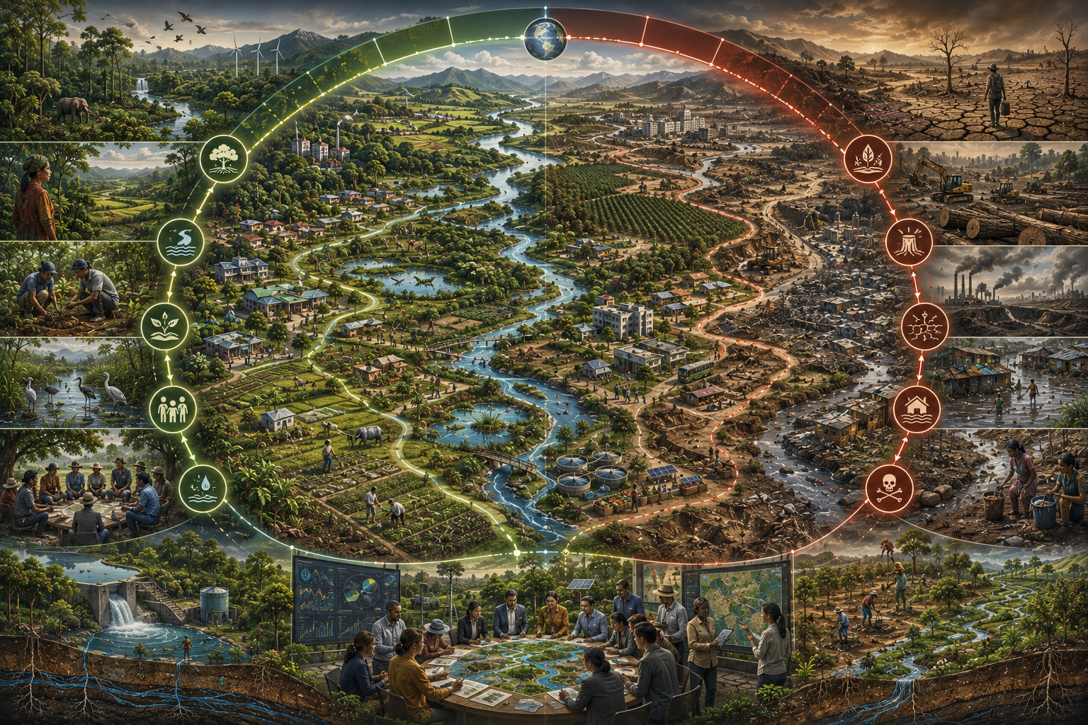
Land cover tells us what occupies the surface. Development pathways ask what a society is becoming through its land choices. This distinction is essential because land-system change is not only a descriptive condition; it is a directional process. Forest conversion, wetland loss, grassland fragmentation, road expansion, monoculture intensification, mining, sprawl, and soil degradation point toward one kind of future. Restoration, agroecology, ecological corridors, secure tenure, compact settlements, protected watersheds, regenerative land management, and resilient infrastructure point toward another.
Development pathways matter because land choices create path dependence. Once forests are cleared, wetlands drained, soils depleted, cities sprawled, roads cut through habitats, or communities displaced, the future becomes harder to repair. Restoration is possible, but it is rarely costless or immediate. Conversely, land decisions that protect ecological function and secure rights can compound benefits over time: better soils, more resilient water systems, lower disaster exposure, stronger livelihoods, and greater public trust.
This pathway logic helps explain why land-system change is a sustainability issue rather than only an environmental issue. Land decisions shape the future opportunity space. They determine whether later generations inherit a landscape capable of supporting food, water, health, biodiversity, climate regulation, settlement, and livelihoods. Development that consumes land capacity faster than it rebuilds it may raise output in the short term while reducing future resilience.
Pathways also show why simple “development versus conservation” framing is inadequate. The issue is not whether humans use land. Human societies must use land. The question is whether land use is organized in ways that maintain ecological function, social justice, and long-run habitability. Agriculture, housing, roads, energy, and industry are necessary, but they can be planned through land systems that either deepen degradation or widen resilience.
Land-system change therefore asks a more demanding question: what kinds of territory are development systems producing, and what kinds of future do those territories make possible?
Forests, Agriculture, Settlements, and Infrastructure
Forests, agriculture, settlements, and infrastructure are among the most important arenas of land-system change. Forests store carbon, regulate water, support biodiversity, sustain local and Indigenous livelihoods, influence regional climate, and protect soils. Agriculture provides food, fiber, employment, and rural income, but it can also drive land conversion, soil degradation, nutrient pollution, water stress, and habitat fragmentation. Settlements provide housing, services, schools, clinics, public space, and economic opportunity, but their form determines whether urban growth is compact, serviced, resilient, and inclusive or sprawling, exposed, and exclusionary. Infrastructure connects people and systems, but it also reorganizes territory.
The development challenge is not to choose one of these systems in isolation. It is to govern their interaction. Food security cannot be pursued by degrading soils, forests, and water systems indefinitely. Housing cannot be expanded through unsafe settlement and ecological destruction without increasing future risk. Infrastructure cannot be planned as if roads, ports, pipelines, dams, transmission lines, and industrial zones had no territorial consequences. Forest protection cannot ignore the rights and livelihoods of people who live with and steward forests.
Agriculture is especially central because it occupies large areas and connects land to food, livelihoods, water, biodiversity, climate, and trade. Agricultural expansion has been one of the most widespread forms of land-use change, while agricultural intensification can produce both higher output and deeper ecological pressure depending on how it is governed. Development pathways therefore depend on whether agricultural systems become more extractive and simplified or more diversified, soil-building, water-sensitive, and livelihood-supporting.
Settlement patterns also carry long-term consequences. Compact, serviced, and well-planned settlements can reduce land pressure, support public services, protect surrounding ecosystems, and lower infrastructure costs. Sprawl can consume agricultural land, fragment habitats, increase travel burdens, raise infrastructure costs, and expose households to flood, heat, and service gaps. Land-system change is therefore deeply connected to urbanization and housing.
Infrastructure can either repair or rupture territory. Roads, energy systems, water systems, railways, and public institutions can support inclusion and resilience when planned coherently. But infrastructure can also open frontiers of extraction, intensify land conflict, fragment ecosystems, and create unequal exposure. Development planning must therefore evaluate infrastructure not only by economic return, but by its territorial consequences.
Habitability and Territorial Resilience
Land-system change should be understood through the lens of habitability. Human development depends on whether territories remain capable of supporting life, settlement, livelihoods, food production, water regulation, health, mobility, and ecological resilience. Land choices shape whether landscapes remain habitable under stress or become increasingly exposed to flood, drought, heat, erosion, pollution, fire, food insecurity, and displacement.
Habitability is not only a climatic condition. It is territorial. Forests, wetlands, soils, rivers, grasslands, farms, and urban green systems help regulate heat, water, carbon, biodiversity, and hazards. When these systems are degraded or fragmented, human settlements become more exposed. Wetland loss can increase flood risk. Deforestation can affect rainfall, temperature, erosion, and watershed function. Soil degradation can reduce food-system resilience. Sprawling settlement can increase infrastructure burdens and hazard exposure. Land-system change therefore reshapes the conditions of inhabitable development.
Territorial resilience also depends on redundancy and connectivity. Diverse landscapes with connected habitats, functioning watersheds, healthy soils, and mixed livelihood systems can often absorb shocks better than simplified landscapes. A monoculture region may produce efficiently under stable conditions but become fragile under pests, drought, price shocks, or water stress. A compact settlement surrounded by restored ecosystems and protected watersheds may face lower long-term risk than a sprawling settlement built across floodplains and fragmented agricultural land.
This is why land-system change cannot be judged only by immediate output. A landscape can produce food, timber, housing, or minerals while losing resilience. Development analysis must therefore ask whether land systems are becoming more capable of sustaining human wellbeing under future stress, not only whether they are producing more in the present.
Habitability connects land-system change to long-run development because land is where future risk becomes spatially organized. The landscape itself can become a resilience system or a fragility system. That choice is one of the defining questions of sustainable development.
Land, Soil, Water, and Ecological Function
Land-system change matters because land is not only surface area. It is ecological function. Soils store carbon, cycle nutrients, hold water, support microorganisms, anchor vegetation, and sustain agriculture. Forests and wetlands regulate water flows, filter pollutants, support biodiversity, and buffer hazards. Grasslands and rangelands support pastoral livelihoods, biodiversity, carbon storage, and water infiltration. Riparian corridors protect rivers, reduce erosion, and connect habitats. These functions make land part of the infrastructure of life.
Soil function is especially important because soil degradation can weaken food security before dramatic ecological collapse becomes visible. Erosion, salinization, nutrient depletion, compaction, contamination, organic matter loss, and reduced microbial activity all weaken productive capacity. A field may remain cultivated while becoming less resilient, more input-dependent, and more vulnerable to drought, flood, pests, and price volatility. Soil is therefore not merely an agricultural substrate; it is a development asset.
Water regulation is equally central. Land cover affects infiltration, runoff, groundwater recharge, flood buffering, evapotranspiration, local climate, and river flows. Forests, wetlands, soils, and vegetation help regulate hydrological systems. When land is degraded, water risk often rises. Floods become more damaging, drought resilience weakens, water quality declines, and downstream communities bear higher burdens. Land and water governance cannot be separated.
Ecological function also shapes public health. Degraded land can increase dust, heat, water contamination, disease-vector shifts, nutrition stress, and disaster exposure. It can weaken livelihoods, increase migration pressure, and reduce social stability. Development systems often pay for land degradation later through public-health burdens, food insecurity, infrastructure damage, and disaster recovery costs.
To govern land well is therefore to govern soil, water, biodiversity, carbon, livelihoods, and settlement together. Land-system change is not one environmental subtopic. It is a system condition that shapes the durability of development itself.
Land-System Change as a Planetary Boundary
The planetary-boundaries framework treats land-system change as one of the Earth-system processes whose disruption can increase risk to planetary stability and resilience. This is significant because it places land beyond local planning alone. Land conversion, especially the loss and fragmentation of forests and other natural ecosystems, affects carbon cycles, water cycles, biodiversity, regional climates, soil systems, and ecological resilience. Land-system change is therefore a planetary issue as well as a local and national one.
Stockholm Resilience Centre’s planetary-boundaries materials describe land-system change as a boundary with strong regional variation and high uncertainty in global aggregation, while emphasizing that the regional distribution of land-system change is critical. This is important because land is never abstract. The consequences of conversion depend on where land change occurs, which ecosystems are affected, what rights are involved, what functions are lost, and how surrounding landscapes respond.
The planetary-boundaries lens helps clarify why land decisions cannot be evaluated only by local economic gain. A forest cleared in one place affects carbon storage, biodiversity, hydrology, local climate, and livelihoods. A wetland drained in one region affects flood buffering and water quality. Agricultural expansion can support food supply while weakening biosphere integrity and water systems. Infrastructure can connect communities while fragmenting ecosystems. These are not isolated local outcomes; they interact with Earth-system resilience.
Land-system change also interacts with other boundaries. Deforestation and degradation affect climate change and biosphere integrity. Agricultural intensification affects freshwater change and biogeochemical flows. Novel entities contaminate soils and water. Land conversion affects atmospheric aerosols, local heat, and regional rainfall. Land is therefore one of the places where planetary boundaries meet in lived territory.
This does not mean all land use should stop. It means land-use decisions must be evaluated by whether they preserve the ecological functions that support safe operating space. Sustainable development requires land systems that can feed, house, connect, and sustain people without pushing the Earth system into more dangerous ranges.
Biodiversity, Fragmentation, and Ecosystem Resilience
Land-system change is one of the major pathways through which biodiversity loss occurs. IPBES identifies land and sea-use change among the leading direct drivers of nature decline, and for terrestrial and freshwater ecosystems land-use change has had especially strong negative effects. This matters developmentally because biodiversity is not only a conservation concern. It supports pollination, pest regulation, soil formation, water quality, flood buffering, food systems, genetic resources, disease regulation, and ecological resilience.
Fragmentation is especially damaging because ecosystems depend on connectivity. Forests broken into isolated fragments may lose species, genetic exchange, microclimate stability, and ecological function. Wetlands separated from floodplains lose buffering capacity. Grasslands divided by roads and fences may lose migration pathways and species interactions. Agricultural mosaics stripped of hedgerows, riparian buffers, and habitat corridors may become more vulnerable to pests, erosion, and pollinator decline.
Fragmentation also creates edge effects. Forest edges may become hotter, drier, and more exposed to fire, invasive species, and human disturbance. Roads can open previously connected ecosystems to extraction, hunting, settlement pressure, and pollution. Infrastructure can therefore create ecological consequences far beyond its physical footprint. Land-system change must be understood spatially because patterns matter as much as totals.
Biodiversity loss reduces resilience. Diverse systems often contain multiple species and functions that can buffer disturbance. Simplified landscapes may produce efficiently under stable conditions, but they are often more fragile when conditions change. This is why development based on ecological simplification can become risky even when it appears productive in the short term.
For sustainable development, biodiversity and connectivity should be treated as conditions of resilience rather than decorative environmental values. Ecological corridors, protected areas, community stewardship, habitat mosaics, agroecology, riparian buffers, restoration, and landscape-scale planning are not luxuries. They are ways of protecting the living systems that support durable development.
Land Degradation, Restoration, and Development Capacity
Land degradation is the loss of land’s capacity to support ecological function, production, livelihoods, and human wellbeing. It can appear through soil erosion, salinization, desertification, deforestation, nutrient depletion, contamination, compaction, vegetation loss, wetland drainage, rangeland degradation, mining scars, and declining water regulation. Its development significance is profound: degraded land weakens the capacity of future development to remain productive, resilient, and habitable.
UNCCD’s Global Land Outlook 2 frames land restoration as a strategy for recovery and resilience, not merely as environmental repair. This matters because restoration can support livelihoods, food systems, climate mitigation, biodiversity, water regulation, disaster risk reduction, and local development. Restoration is therefore not only the opposite of degradation; it is a development pathway when designed around ecological function and social justice.
Restoration can take many forms: reforestation, assisted natural regeneration, wetland recovery, soil regeneration, agroforestry, riparian buffers, erosion control, rangeland recovery, mine-site rehabilitation, urban green infrastructure, and ecological corridors. But restoration must be serious. Tree planting without ecological suitability, monoculture plantations, offset schemes detached from local rights, or restoration that displaces communities can reproduce harm. Restoration must restore function, not merely create visual greenness.
Land degradation also has public-finance consequences. When land loses function, societies may pay through flood damage, food insecurity, water-treatment costs, health burdens, disaster recovery, declining livelihoods, migration pressure, and infrastructure stress. These costs often appear later and in different budgets, which makes degradation easy to underestimate. A development model that treats land degradation as an externality may simply be postponing its costs.
Restoration therefore belongs inside development planning. It helps rebuild the ecological capacity that makes future development possible. The question is not only how to use land more efficiently, but how to repair the living territorial systems on which long-run development depends.
Justice, Rights, and Uneven Land Burdens
Land-system change is inseparable from justice because land is also power, livelihood, memory, culture, home, and political recognition. Land conversion and degradation do not affect all groups equally. Smallholder farmers, pastoralists, Indigenous peoples, forest communities, informal settlers, rural workers, landless households, women, displaced people, and communities living near extraction or infrastructure frontiers often face disproportionate burdens when land systems change.
Secure tenure and rights matter because people are less able to invest in restoration, soil care, housing, irrigation, agroforestry, or long-term stewardship when they can be displaced or dispossessed. UNCCD’s land-restoration work emphasizes the connection between land tenure and restoration because secure rights help enable long-term care. Without rights security, restoration and sustainable land management can become fragile, unjust, or imposed from above.
Land-use decisions can produce development gains for some while creating losses for others. A road may support trade while exposing communities to land speculation. A dam may support energy while displacing settlements and transforming river systems. Agricultural expansion may raise exports while undermining local food systems or forest rights. Conservation may protect ecosystems while excluding communities if it ignores Indigenous and local governance. Extractive development may generate revenue while leaving degraded land, pollution, and social rupture.
Justice also requires attention to who benefits from land conversion and who bears its ecological costs. High-consuming populations and distant markets may drive land pressure through food, timber, minerals, energy, and commodity demand, while local communities bear deforestation, pollution, degraded soils, water stress, and displacement. Land-system change therefore links local territory to global political economy.
Sustainable development must treat land rights, community participation, Indigenous stewardship, gendered access, restoration benefits, and displacement risk as central rather than secondary. Land cannot be governed only as an asset class or production input. It must be governed as a living social-ecological foundation of human dignity and future possibility.
Governance, Planning, and Policy Coherence
Land-system change is a governance challenge because land connects sectors that are often planned separately. Agriculture, forestry, housing, mining, transport, water, energy, conservation, climate adaptation, disaster risk, public health, and local development all make claims on land. When these systems are governed in isolation, one policy can undermine another. Agricultural expansion may weaken watershed protection. Housing growth may consume floodplains. Infrastructure may fragment habitats. Conservation may conflict with local rights. Energy transition may increase pressure on land and minerals. Policy coherence is therefore essential.
Integrated land-use planning is not simply a technical exercise. It is a way of negotiating development priorities across territory. It must ask where food should be produced, where forests should be protected, where settlements should grow, where restoration is urgent, where infrastructure can be built with lower harm, where communities need secure tenure, and where ecological corridors or watersheds require protection. These are ecological questions, but they are also social and political questions.
Governance also requires scale awareness. Land decisions occur at household, community, municipal, national, regional, and global scales. A local land-use change may be driven by global commodity demand. A national infrastructure project may reshape local ecosystems. A global restoration target may depend on community rights. A watershed may cross administrative borders. Effective land governance must therefore connect scales without erasing local knowledge or rights.
Monitoring and data matter, but they are not enough. Satellite imagery can detect deforestation, land cover, vegetation change, and fire. Soil data can identify degradation. Biodiversity monitoring can reveal ecological decline. But land governance also requires participatory knowledge, tenure records, local histories, social safeguards, and accountability. A map can show land conversion, but communities often know the lived meaning of that conversion.
Sustainable land governance must therefore combine science, law, community participation, finance, restoration capacity, and long-term public planning. Land is too central to development to be governed only through short-term economic return or fragmented sectoral mandates.
Strengths, Critiques, and Open Questions
The strength of the land-system-change framing is that it connects ecology and development through territory. It shows that forests, soils, farms, wetlands, cities, roads, and infrastructure are not separate arenas. They interact within landscapes whose resilience determines whether development gains can endure. It also clarifies that land-system change is not only environmental loss; it is a pathway question about what kind of development is being built.
There are also important cautions. Global land metrics can obscure local context, historical dispossession, Indigenous rights, and the specific ecological meaning of land change in different biomes. Not all land conversion has the same consequences. A hectare of conversion in a biodiversity-rich forest does not carry the same implications as a change in an already degraded landscape. A land-use category can also conceal management quality: two farms may have the same cover type while differing radically in soil health, biodiversity, water use, labor conditions, and local rights.
Another challenge is that land-system change can be framed too technocratically. If land is treated only as a planning surface, governance may ignore people’s relationships to place, memory, culture, livelihood, and spirituality. Land is not merely spatial data. It is lived territory. Sustainable development must therefore combine scientific land-system analysis with rights-based, historically aware, and community-grounded governance.
Restoration also raises open questions. Who decides what counts as restoration? Who benefits from restored land? Whose land is restored, protected, or converted? Are local communities empowered or displaced? Are restoration projects ecologically meaningful or merely symbolic? These questions matter because restoration can either support justice and resilience or reproduce inequality under ecological language.
The open question is therefore not whether land matters for development. It clearly does. The harder question is how societies can meet urgent needs for food, housing, infrastructure, energy, and livelihoods while protecting and restoring the land systems that make long-run development possible.
Why This Matters for Sustainable Development
Land-system change matters for sustainable development because land is where social need, ecological function, economic activity, infrastructure, power, and future possibility meet. The way land is converted, cultivated, urbanized, restored, degraded, protected, and governed determines whether development becomes resilient or brittle. It shapes food security, water regulation, biodiversity, climate stability, soil fertility, settlement safety, rural livelihoods, infrastructure costs, and public health.
This is why land-system change is not only about land cover. It is about development pathways. One pathway treats land as a short-term input to be converted for immediate output, even if soils, forests, watersheds, habitats, rights, and future resilience are weakened. Another pathway treats land as a living territorial foundation that must support food, settlement, biodiversity, water, livelihoods, restoration, and intergenerational responsibility together.
The issue is also one of justice. Land degradation and conversion often burden those with the least power while benefiting distant markets, high-consuming systems, or politically connected interests. Sustainable development cannot be credible if land-based progress depends on dispossession, ecological simplification, insecure tenure, or the destruction of living systems that support local communities. Rights, participation, stewardship, and restoration must be part of the development equation.
To take land-system change seriously is to recognize that long-run development cannot be secured by consuming the territorial conditions that make development possible. Forests, soils, wetlands, grasslands, farms, cities, and infrastructure must be governed as parts of one social-ecological system. Development becomes durable when land systems remain capable of supporting life, livelihoods, justice, and ecological resilience across generations.
Development becomes credible when it can transform land without destroying the living territorial foundations of future human possibility.
Mathematical Lens
Land-system-related development burden can be clarified by thinking in terms of conversion pressure, ecological-function loss, social exposure, and governance capacity. Let \(D_l\) represent long-run land-development risk, \(C\) land conversion pressure, \(F\) ecological-function loss, \(E\) social and livelihood exposure, and \(G\) governance and restoration capacity:
D_l = \alpha C + \beta F + \gamma E – \delta G
\]
Interpretation: Land-development risk rises when land conversion, ecological-function loss, and social exposure intensify, and falls when governance and restoration capacity improve.
This captures the article’s core point: land-system change becomes development risk when territorial transformation weakens ecological function, social security, and future development capacity faster than institutions can restore and govern them.
We can also express territorial fragility as a weighted function of fragmentation, degradation, and rights insecurity:
R_l = w_1 H + w_2 S + w_3 T
\]
Interpretation: Territorial fragility rises when habitat fragmentation, soil degradation, and tenure insecurity reinforce one another.
Here, \(H\) is habitat fragmentation, \(S\) is soil and land degradation, and \(T\) is tenure and rights insecurity. Higher \(R_l\) means land systems are more likely to produce ecological and social vulnerability.
Finally, pathway resilience can be represented as a function of restoration, protection, and integrated governance:
P_l = \lambda R + \mu P + \nu I
\]
Interpretation: Land-pathway resilience improves when restoration, protection, and integrated governance strengthen together.
Here, \(R\) is restoration readiness, \(P\) is protection and stewardship, and \(I\) is integrated land-use governance. This helps show why similar development pressures can produce very different land-system outcomes across places.
| Term | Meaning | Interpretive role |
|---|---|---|
| \(D_l\) | Land-development risk | Represents long-run development risk created by land conversion, ecological-function loss, social exposure, and weak response capacity. |
| \(C\) | Land conversion pressure | Represents pressure from agriculture, settlement, infrastructure, extraction, and other forms of land transformation. |
| \(F\) | Ecological-function loss | Represents decline in soil fertility, water regulation, biodiversity, carbon storage, habitat connectivity, and landscape resilience. |
| \(E\) | Social and livelihood exposure | Represents people, communities, farms, settlements, and livelihoods exposed to land degradation or insecure land transitions. |
| \(G\) | Governance and restoration capacity | Represents land-use planning, rights security, restoration readiness, monitoring, policy coherence, and public capacity. |
| \(R_l\) | Territorial fragility | Represents interacting fragility from fragmentation, degradation, and tenure insecurity. |
| \(P_l\) | Land-pathway resilience | Represents the strength of restoration, protection, stewardship, and integrated governance. |
The equations are conceptual rather than predictive. Their value is to make visible the structure of the problem: land-system change depends on conversion pressure, ecological function, social exposure, rights, restoration, and governance capacity working together.
Advanced Python Workflow: Land-System Change and Development Pathway Risk Scoring
This Python workflow translates the article’s core argument into a structured land-system-risk model. Rather than treating land cover as a single variable, it scores territories across conversion pressure, deforestation, soil degradation, habitat fragmentation, water-regulation loss, biodiversity pressure, settlement sprawl, infrastructure pressure, tenure insecurity, restoration readiness, governance capacity, and policy coherence. That makes it possible to compare not only where land is changing, but where land-system change is becoming most developmentally consequential.
from __future__ import annotations

import pandas as pd
import numpy as np

INPUT_FILE = "land_system_change_panel.csv"
OUTPUT_FILE = "land_system_change_development_pathway_scores.csv"


def load_data(path: str) -> pd.DataFrame:
    """
    Load a territory-level land-system change and development pathway dataset.

    All *_index columns should be normalized to [0, 1].
    Higher values should mean more of the named property.

    Examples:
      - land_conversion_pressure_index: higher = stronger land conversion pressure
      - soil_degradation_index: higher = greater soil and land degradation
      - restoration_readiness_index: higher = stronger restoration readiness
      - governance_capacity_index: higher = stronger land governance capacity
    """
    df = pd.read_csv(path)

    required_columns = [
        "territory_name",
        "country_or_region",
        "territory_type",
        "land_conversion_pressure_index",
        "deforestation_pressure_index",
        "soil_degradation_index",
        "habitat_fragmentation_index",
        "water_regulation_loss_index",
        "biodiversity_pressure_index",
        "settlement_sprawl_index",
        "infrastructure_pressure_index",
        "tenure_insecurity_index",
        "social_livelihood_exposure_index",
        "restoration_readiness_index",
        "governance_capacity_index",
        "rights_security_index",
        "policy_coherence_index",
    ]

    missing = [col for col in required_columns if col not in df.columns]

    if missing:
        raise ValueError(f"Missing required columns: {missing}")

    return df


def validate_indices(df: pd.DataFrame) -> pd.DataFrame:
    """Validate that all *_index fields are complete and normalized to [0, 1]."""
    index_columns = [col for col in df.columns if col.endswith("_index")]

    for col in index_columns:
        if df[col].isna().any():
            raise ValueError(f"Column '{col}' contains missing values.")

        if ((df[col] < 0) | (df[col] > 1)).any():
            raise ValueError(f"Column '{col}' contains values outside [0, 1].")

    return df


def compute_scores(df: pd.DataFrame) -> pd.DataFrame:
    """
    Compute land-system stress, development exposure,
    governance readiness, and constrained land-development risk.

    Land-system stress rises with conversion pressure, deforestation,
    soil degradation, habitat fragmentation, water-regulation loss,
    biodiversity pressure, sprawl, and infrastructure pressure.

    Governance readiness rises with restoration readiness, governance capacity,
    rights security, and policy coherence.
    """
    df = df.copy()

    df["land_system_stress_score"] = (
        0.15 * df["land_conversion_pressure_index"] +
        0.14 * df["deforestation_pressure_index"] +
        0.14 * df["soil_degradation_index"] +
        0.14 * df["habitat_fragmentation_index"] +
        0.12 * df["water_regulation_loss_index"] +
        0.12 * df["biodiversity_pressure_index"] +
        0.10 * df["settlement_sprawl_index"] +
        0.09 * df["infrastructure_pressure_index"]
    ).clip(lower=0, upper=1)

    df["territorial_development_exposure_score"] = (
        0.30 * df["social_livelihood_exposure_index"] +
        0.20 * df["tenure_insecurity_index"] +
        0.16 * df["soil_degradation_index"] +
        0.14 * df["water_regulation_loss_index"] +
        0.12 * df["settlement_sprawl_index"] +
        0.08 * df["infrastructure_pressure_index"]
    ).clip(lower=0, upper=1)

    df["land_governance_readiness_score"] = (
        0.28 * df["restoration_readiness_index"] +
        0.26 * df["governance_capacity_index"] +
        0.24 * df["rights_security_index"] +
        0.22 * df["policy_coherence_index"]
    ).clip(lower=0, upper=1)

    df["constrained_land_development_score"] = (
        0.40 * df["land_system_stress_score"] +
        0.26 * df["territorial_development_exposure_score"] +
        0.14 * df["tenure_insecurity_index"] +
        0.12 * (1 - df["land_governance_readiness_score"]) +
        0.08 * (1 - df["restoration_readiness_index"])
    ).clip(lower=0, upper=1)

    df["risk_band"] = np.select(
        [
            df["constrained_land_development_score"] >= 0.80,
            df["constrained_land_development_score"] >= 0.60,
            df["constrained_land_development_score"] >= 0.40,
        ],
        [
            "Extreme land-system development risk",
            "High land-system development risk",
            "Moderate land-system development risk",
        ],
        default="Lower land-system development risk",
    )

    df["land_governance_gap"] = (
        df["land_system_stress_score"] -
        df["land_governance_readiness_score"]
    )

    df["land_warning"] = np.select(
        [
            df["land_governance_gap"] >= 0.35,
            df["land_governance_gap"] >= 0.20,
            df["land_governance_gap"] >= 0.05,
        ],
        [
            "Severe land governance gap",
            "High land governance gap",
            "Moderate land governance gap",
        ],
        default="Lower governance gap or stronger land-system readiness",
    )

    return df


def build_summary(df: pd.DataFrame) -> pd.DataFrame:
    """Return a ranked summary table for review or reporting."""
    columns = [
        "territory_name",
        "country_or_region",
        "territory_type",
        "land_system_stress_score",
        "territorial_development_exposure_score",
        "land_governance_readiness_score",
        "constrained_land_development_score",
        "risk_band",
        "land_governance_gap",
        "land_warning",
    ]

    summary = df[columns].copy()

    summary = summary.sort_values(
        by=[
            "constrained_land_development_score",
            "land_system_stress_score",
            "territorial_development_exposure_score",
        ],
        ascending=[False, False, False],
    ).reset_index(drop=True)

    return summary


def main() -> None:
    df = load_data(INPUT_FILE)
    df = validate_indices(df)
    scored = compute_scores(df)
    summary = build_summary(scored)

    summary.to_csv(OUTPUT_FILE, index=False)

    print("Land-system change and development pathway scoring complete.")
    print(summary.to_string(index=False))


if __name__ == "__main__":
    main()
This workflow is intentionally transparent. It does not claim that land-system development risk can be reduced to one objective score. Instead, it makes assumptions visible: conversion pressure, deforestation, soil degradation, habitat fragmentation, water-regulation loss, biodiversity pressure, sprawl, infrastructure pressure, tenure insecurity, livelihood exposure, restoration readiness, governance capacity, rights security, and policy coherence are treated as distinct components. The value of the model is diagnostic. It helps identify where land-system change is most likely to become a development constraint.
Advanced R Workflow: Land Degradation, Restoration Readiness, and Governance Gap Analysis
This R workflow is designed for the part of the article that emphasizes variation across territories, land systems, and exposed communities. It compares settings across land conversion, deforestation, soil degradation, habitat fragmentation, water-regulation loss, biodiversity pressure, settlement sprawl, infrastructure pressure, tenure insecurity, livelihood exposure, restoration readiness, rights security, and governance capacity, then builds grouped summaries that help show where land-system stress is strongest and where restoration and governance gaps remain developmentally costly.
library(readr)
library(dplyr)

input_file <- "land_system_change_country_panel.csv"
region_output_file <- "cross_region_land_system_summary.csv"
territory_output_file <- "cross_territory_land_system_summary.csv"

land_df <- read_csv(input_file, show_col_types = FALSE)

required_cols <- c(
  "territory_name",
  "country_or_region",
  "territory_type",
  "land_conversion_pressure_index",
  "deforestation_pressure_index",
  "soil_degradation_index",
  "habitat_fragmentation_index",
  "water_regulation_loss_index",
  "biodiversity_pressure_index",
  "settlement_sprawl_index",
  "infrastructure_pressure_index",
  "tenure_insecurity_index",
  "social_livelihood_exposure_index",
  "restoration_readiness_index",
  "governance_capacity_index",
  "rights_security_index",
  "policy_coherence_index"
)

missing_cols <- setdiff(required_cols, names(land_df))

if (length(missing_cols) > 0) {
  stop(paste("Missing required columns:", paste(missing_cols, collapse = ", ")))
}

index_cols <- names(land_df)[grepl("_index$", names(land_df))]

invalid_index_cols <- index_cols[
  vapply(
    land_df[index_cols],
    function(x) any(is.na(x) | x < 0 | x > 1),
    logical(1)
  )
]

if (length(invalid_index_cols) > 0) {
  stop(
    paste(
      "Index columns must be complete and normalized to [0, 1]:",
      paste(invalid_index_cols, collapse = ", ")
    )
  )
}

land_df <- land_df %>%
  mutate(
    land_system_stress_proxy = (
      land_conversion_pressure_index +
      deforestation_pressure_index +
      soil_degradation_index +
      habitat_fragmentation_index +
      water_regulation_loss_index +
      biodiversity_pressure_index +
      settlement_sprawl_index +
      infrastructure_pressure_index
    ) / 8,
    territorial_exposure_proxy = (
      social_livelihood_exposure_index +
      tenure_insecurity_index +
      soil_degradation_index +
      water_regulation_loss_index +
      settlement_sprawl_index +
      infrastructure_pressure_index
    ) / 6,
    governance_readiness_proxy = (
      restoration_readiness_index +
      governance_capacity_index +
      rights_security_index +
      policy_coherence_index
    ) / 4,
    land_development_risk_proxy = (
      land_system_stress_proxy +
      territorial_exposure_proxy +
      tenure_insecurity_index +
      (1 - governance_readiness_proxy) +
      (1 - restoration_readiness_index)
    ) / 5,
    land_governance_gap = land_system_stress_proxy - governance_readiness_proxy,
    risk_band = case_when(
      land_development_risk_proxy >= 0.75 ~ "Extreme land-system development risk",
      land_development_risk_proxy >= 0.55 ~ "High land-system development risk",
      land_development_risk_proxy >= 0.35 ~ "Moderate land-system development risk",
      TRUE ~ "Lower land-system development risk"
    )
  )

region_summary <- land_df %>%
  group_by(country_or_region) %>%
  summarise(
    avg_land_development_risk_proxy = mean(land_development_risk_proxy, na.rm = TRUE),
    avg_land_system_stress_proxy = mean(land_system_stress_proxy, na.rm = TRUE),
    avg_territorial_exposure_proxy = mean(territorial_exposure_proxy, na.rm = TRUE),
    avg_governance_readiness_proxy = mean(governance_readiness_proxy, na.rm = TRUE),
    avg_land_conversion_pressure = mean(land_conversion_pressure_index, na.rm = TRUE),
    avg_deforestation_pressure = mean(deforestation_pressure_index, na.rm = TRUE),
    avg_soil_degradation = mean(soil_degradation_index, na.rm = TRUE),
    avg_habitat_fragmentation = mean(habitat_fragmentation_index, na.rm = TRUE),
    avg_water_regulation_loss = mean(water_regulation_loss_index, na.rm = TRUE),
    avg_biodiversity_pressure = mean(biodiversity_pressure_index, na.rm = TRUE),
    avg_settlement_sprawl = mean(settlement_sprawl_index, na.rm = TRUE),
    avg_infrastructure_pressure = mean(infrastructure_pressure_index, na.rm = TRUE),
    avg_tenure_insecurity = mean(tenure_insecurity_index, na.rm = TRUE),
    avg_social_livelihood_exposure = mean(social_livelihood_exposure_index, na.rm = TRUE),
    avg_restoration_readiness = mean(restoration_readiness_index, na.rm = TRUE),
    avg_governance_capacity = mean(governance_capacity_index, na.rm = TRUE),
    avg_rights_security = mean(rights_security_index, na.rm = TRUE),
    avg_policy_coherence = mean(policy_coherence_index, na.rm = TRUE),
    avg_land_governance_gap = mean(land_governance_gap, na.rm = TRUE),
    observations = n(),
    .groups = "drop"
  ) %>%
  mutate(
    regional_risk_band = case_when(
      avg_land_development_risk_proxy >= 0.75 ~ "Extreme land-system development risk",
      avg_land_development_risk_proxy >= 0.55 ~ "High land-system development risk",
      avg_land_development_risk_proxy >= 0.35 ~ "Moderate land-system development risk",
      TRUE ~ "Lower land-system development risk"
    )
  ) %>%
  arrange(desc(avg_land_development_risk_proxy))

territory_summary <- land_df %>%
  group_by(territory_type) %>%
  summarise(
    avg_land_development_risk_proxy = mean(land_development_risk_proxy, na.rm = TRUE),
    avg_land_system_stress_proxy = mean(land_system_stress_proxy, na.rm = TRUE),
    avg_territorial_exposure_proxy = mean(territorial_exposure_proxy, na.rm = TRUE),
    avg_governance_readiness_proxy = mean(governance_readiness_proxy, na.rm = TRUE),
    avg_land_conversion_pressure = mean(land_conversion_pressure_index, na.rm = TRUE),
    avg_deforestation_pressure = mean(deforestation_pressure_index, na.rm = TRUE),
    avg_soil_degradation = mean(soil_degradation_index, na.rm = TRUE),
    avg_habitat_fragmentation = mean(habitat_fragmentation_index, na.rm = TRUE),
    avg_water_regulation_loss = mean(water_regulation_loss_index, na.rm = TRUE),
    avg_biodiversity_pressure = mean(biodiversity_pressure_index, na.rm = TRUE),
    avg_settlement_sprawl = mean(settlement_sprawl_index, na.rm = TRUE),
    avg_infrastructure_pressure = mean(infrastructure_pressure_index, na.rm = TRUE),
    avg_tenure_insecurity = mean(tenure_insecurity_index, na.rm = TRUE),
    avg_social_livelihood_exposure = mean(social_livelihood_exposure_index, na.rm = TRUE),
    avg_restoration_readiness = mean(restoration_readiness_index, na.rm = TRUE),
    avg_governance_capacity = mean(governance_capacity_index, na.rm = TRUE),
    avg_rights_security = mean(rights_security_index, na.rm = TRUE),
    avg_policy_coherence = mean(policy_coherence_index, na.rm = TRUE),
    avg_land_governance_gap = mean(land_governance_gap, na.rm = TRUE),
    observations = n(),
    .groups = "drop"
  ) %>%
  arrange(desc(avg_land_development_risk_proxy))

write_csv(region_summary, region_output_file)
write_csv(territory_summary, territory_output_file)

cat("Cross-region land-system summary exported to:", region_output_file, "\n")
print(region_summary)

cat("\nCross-territory land-system summary exported to:", territory_output_file, "\n")
print(territory_summary)
This workflow helps distinguish land-system stress from developmentally consequential territorial risk. A territory may face high conversion pressure but stronger restoration readiness, rights security, and governance capacity. Another may face moderate land change but severe livelihood exposure, weak tenure systems, and low policy coherence. The workflow therefore treats land-system change as a development condition, not as an isolated land-cover variable.
GitHub Repository
Complete Code Repository
The full code distribution for this article, including land-system development risk scoring workflows, land degradation diagnostics, restoration readiness analysis, SQL materials, optional monitoring support tooling, supporting documentation, and repository structure, is available on GitHub.
Related Articles
- Planetary Boundaries and Sustainable Development
- Biosphere Integrity and Human Development
- Freshwater Change and Development Risk
- Food Security, Nutrition, and Human Development
- Land-System Change and Development Pathways
- Nutrient Cycles, Agriculture, and Ecological Stress
- Safe Operating Space and the Conditions of Long-Run Development
- Growth, Limits, and the Problem of Overshoot
- Urbanization, Housing, and Basic Services
- Inequality and Inclusive Development
Further Reading
- United Nations (n.d.) Goal 15: Life on land. New York: United Nations. Available at: https://sdgs.un.org/goals/goal15
- United Nations Department of Economic and Social Affairs (n.d.) Desertification, land degradation and drought. New York: United Nations. Available at: https://sdgs.un.org/topics/desertification-land-degradation-and-drought
- Stockholm Resilience Centre (n.d.) Planetary boundaries. Stockholm: Stockholm Resilience Centre. Available at: https://www.stockholmresilience.org/research/planetary-boundaries.html
- Stockholm Resilience Centre (n.d.) Table of the nine planetary boundaries. Stockholm: Stockholm Resilience Centre. Available at: https://www.stockholmresilience.org/research/planetary-boundaries/quantitative-evolution-of-boundaries.html
- Stockholm Resilience Centre (2025) Seven of nine planetary boundaries now breached. Stockholm: Stockholm Resilience Centre. Available at: https://www.stockholmresilience.org/news–events/general-news/2025-09-24-seven-of-nine-planetary-boundaries-now-breached.html
- Intergovernmental Science-Policy Platform on Biodiversity and Ecosystem Services (2019) Summary for policymakers of the Global Assessment Report on Biodiversity and Ecosystem Services. Bonn: IPBES. Available at: https://files.ipbes.net/ipbes-web-prod-public-files/downloads/spm_unedited_advance_for_posting_htn.pdf
- Intergovernmental Science-Policy Platform on Biodiversity and Ecosystem Services (2019) Global Assessment Report on Biodiversity and Ecosystem Services. Bonn: IPBES. Available at: https://ipbes.net/global-assessment
- United Nations Convention to Combat Desertification (2022) Global Land Outlook 2nd edition: Land Restoration for Recovery and Resilience. Bonn: UNCCD. Available at: https://www.unccd.int/resources/global-land-outlook/global-land-outlook-2nd-edition
- United Nations Convention to Combat Desertification (2022) Global Land Outlook 2: Summary for Decision Makers. Bonn: UNCCD. Available at: https://www.unccd.int/resources/global-land-outlook/glo2-summary-decision-makers
- United Nations Convention to Combat Desertification (n.d.) Global Land Outlook. Bonn: UNCCD. Available at: https://www.unccd.int/resources/global-land-outlook/overview
References
- United Nations (2015) Transforming our world: the 2030 Agenda for Sustainable Development. New York: United Nations. Available at: https://sdgs.un.org/2030agenda
- United Nations (n.d.) Goal 15: Protect, restore and promote sustainable use of terrestrial ecosystems, sustainably manage forests, combat desertification, and halt and reverse land degradation and halt biodiversity loss. New York: United Nations. Available at: https://sdgs.un.org/goals/goal15
- United Nations Department of Economic and Social Affairs (n.d.) Biodiversity and ecosystems. New York: United Nations. Available at: https://sdgs.un.org/topics/biodiversity-and-ecosystems
- United Nations Department of Economic and Social Affairs (n.d.) Desertification, land degradation and drought. New York: United Nations. Available at: https://sdgs.un.org/topics/desertification-land-degradation-and-drought
- Stockholm Resilience Centre (n.d.) Planetary boundaries. Stockholm: Stockholm Resilience Centre. Available at: https://www.stockholmresilience.org/research/planetary-boundaries.html
- Stockholm Resilience Centre (n.d.) Table of the nine planetary boundaries. Stockholm: Stockholm Resilience Centre. Available at: https://www.stockholmresilience.org/research/planetary-boundaries/quantitative-evolution-of-boundaries.html
- Stockholm Resilience Centre (2025) Seven of nine planetary boundaries now breached. Stockholm: Stockholm Resilience Centre. Available at: https://www.stockholmresilience.org/news–events/general-news/2025-09-24-seven-of-nine-planetary-boundaries-now-breached.html
- Rockström, J., Steffen, W., Noone, K., Persson, Å., Chapin, F.S. III, Lambin, E.F., Lenton, T.M., Scheffer, M., Folke, C., Schellnhuber, H.J., Nykvist, B., de Wit, C.A., Hughes, T., van der Leeuw, S., Rodhe, H., Sörlin, S., Snyder, P.K., Costanza, R., Svedin, U., Falkenmark, M., Karlberg, L., Corell, R.W., Fabry, V.J., Hansen, J., Walker, B., Liverman, D., Richardson, K., Crutzen, P. and Foley, J.A. (2009) A safe operating space for humanity. Nature, 461, pp. 472–475. Available at: https://www.nature.com/articles/461472a
- Steffen, W., Richardson, K., Rockström, J., Cornell, S.E., Fetzer, I., Bennett, E.M., Biggs, R., Carpenter, S.R., de Vries, W., de Wit, C.A., Folke, C., Gerten, D., Heinke, J., Mace, G.M., Persson, L.M., Ramanathan, V., Reyers, B. and Sörlin, S. (2015) Planetary Boundaries: Guiding Human Development on a Changing Planet. Science, 347(6223). Available at: https://www.science.org/doi/10.1126/science.1259855
- Richardson, K., Steffen, W., Lucht, W., Bendtsen, J., Cornell, S.E., Donges, J.F., Drüke, M., Fetzer, I., Bala, G., von Bloh, W., Feulner, G., Fiedler, S., Gerten, D., Gleeson, T., Hofmann, M., Huiskamp, W., Kummu, M., Mohan, C., Nogués-Bravo, D., Petri, S., Porkka, M., Rahmstorf, S., Schaphoff, S., Thonicke, K., Tobian, A., Virkki, V., Wang-Erlandsson, L., Weber, L. and Rockström, J. (2023) Earth beyond six of nine planetary boundaries. Science Advances, 9(37). Available at: https://www.science.org/doi/10.1126/sciadv.adh2458
- Intergovernmental Science-Policy Platform on Biodiversity and Ecosystem Services (2019) Summary for policymakers of the Global Assessment Report on Biodiversity and Ecosystem Services. Bonn: IPBES. Available at: https://files.ipbes.net/ipbes-web-prod-public-files/downloads/spm_unedited_advance_for_posting_htn.pdf
- Intergovernmental Science-Policy Platform on Biodiversity and Ecosystem Services (2019) Global Assessment Report on Biodiversity and Ecosystem Services. Bonn: IPBES. Available at: https://ipbes.net/global-assessment
- United Nations Convention to Combat Desertification (2022) Global Land Outlook 2nd edition: Land Restoration for Recovery and Resilience. Bonn: UNCCD. Available at: https://www.unccd.int/resources/global-land-outlook/global-land-outlook-2nd-edition
- United Nations Convention to Combat Desertification (2022) Global Land Outlook 2: Summary for Decision Makers. Bonn: UNCCD. Available at: https://www.unccd.int/resources/global-land-outlook/glo2-summary-decision-makers
- United Nations Convention to Combat Desertification (n.d.) Global Land Outlook. Bonn: UNCCD. Available at: https://www.unccd.int/resources/global-land-outlook/overview