
Last Updated June 1, 2026
Cities are not collections of separate problems. Congestion, housing affordability, infrastructure capacity, public health, land use, climate exposure, economic opportunity, public finance, and social inequality are connected through feedback loops. A road expansion can change travel behavior and land development. A housing shortage can increase commute distance and transportation demand. Weak transit can deepen car dependence. Deferred infrastructure maintenance can increase public cost and reduce resilience. Rising land values can displace households from opportunity while increasing regional travel pressure.
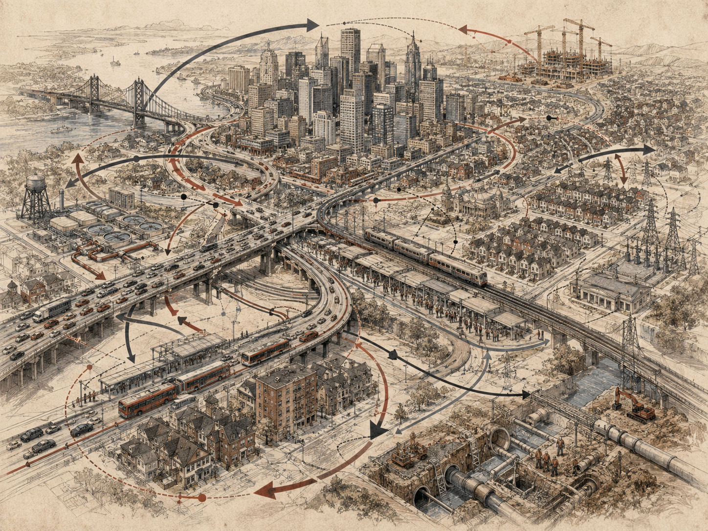
Urban Systems: Congestion, Housing, and Infrastructure examines cities as complex adaptive systems. It asks how land, transportation, housing, infrastructure, public services, environmental risk, governance, and human behavior interact over time. Urban problems often persist because interventions address visible symptoms while leaving the structure intact. Traffic is treated as a road-capacity problem. Housing is treated as a supply problem alone. Infrastructure is treated as an engineering problem alone. But cities behave as systems: decisions in one domain reshape incentives, flows, costs, vulnerability, and opportunity across the whole urban region.
This article explains urban systems through congestion, housing, and infrastructure. It examines induced demand, land-use feedback, transit capacity, housing affordability, displacement, infrastructure maintenance, public finance, climate exposure, urban heat, service access, and governance coordination. It shows why cities need systems thinking: because urban decisions create delayed consequences, reinforcing patterns, unintended trade-offs, and unequal outcomes across neighborhoods and generations.
Why Urban Systems Thinking Matters
Urban systems thinking matters because cities concentrate interdependence. Housing, transport, labor markets, schools, utilities, healthcare, public safety, parks, climate exposure, finance, land use, zoning, taxation, infrastructure, and social networks shape one another. A city is not only a physical place. It is a system of flows: people, water, energy, money, information, goods, waste, heat, risk, care, and political power.
When urban problems are treated separately, interventions can fail or create new problems. Adding road capacity may temporarily reduce congestion but can encourage more driving, longer commutes, and land-use patterns that generate new traffic. Building expensive housing in high-demand areas may increase supply but can also intensify displacement if affordability, tenant protection, public housing, and land policy are ignored. Expanding infrastructure to the urban fringe may support growth but increase long-term maintenance costs. Investing in downtown revitalization may improve tax revenue while pushing lower-income residents away from transit, jobs, and services.
Systems thinking helps urban planners, policymakers, engineers, community organizations, researchers, and residents see the structure beneath the symptom. Traffic congestion is not only too many cars. It reflects land use, job distribution, housing affordability, transit quality, road pricing, parking policy, commuting behavior, school locations, logistics, and public investment. Housing affordability is not only too few units. It reflects land markets, income, zoning, speculation, finance, construction costs, tenant protections, public housing, transit access, and political power. Infrastructure failure is not only aging assets. It reflects maintenance funding, public finance, climate stress, governance fragmentation, and deferred responsibility.
| Urban issue | Linear interpretation | Systems-thinking interpretation |
|---|---|---|
| Traffic congestion | Road capacity is insufficient. | Travel demand, land use, housing location, transit quality, parking, pricing, and induced demand interact. |
| Housing unaffordability | There are not enough housing units. | Supply, income, land value, zoning, speculation, finance, tenant protection, public housing, and transit access interact. |
| Infrastructure decay | Assets are old. | Maintenance funding, public finance, climate stress, governance, procurement, and growth patterns shape asset condition. |
| Urban heat | Weather is hotter. | Climate, tree canopy, building materials, energy access, housing quality, land use, and inequality shape heat risk. |
| Service inequality | Some neighborhoods have weaker access. | Historical investment, segregation, transit, political power, infrastructure, and institutional priorities shape access. |
| Displacement | Neighborhoods are changing. | Land value, speculation, redevelopment, wages, tenant rights, transit investment, and racialized housing history interact. |
Urban systems thinking is not a call to make cities more complicated than they already are. It is a way to prevent false simplicity. Cities are places where small design assumptions become large social consequences. A street design can shape safety, commerce, emissions, public health, and social life. A zoning rule can affect climate, affordability, segregation, and commute burden. A maintenance backlog can become a future crisis. A transit investment can either reduce inequality or accelerate displacement depending on surrounding housing policy.
Urban systems thinking asks how cities can be designed to support mobility, housing security, climate resilience, public health, ecological function, economic opportunity, and democratic life together rather than optimizing one metric while shifting costs elsewhere.
Cities as Complex Adaptive Systems
Cities are complex adaptive systems because many actors respond to one another under changing conditions. Households choose where to live based on cost, safety, schools, work, family, identity, transit, and opportunity. Developers respond to land value, zoning, financing, demand, and regulation. Employers locate based on labor access, land cost, infrastructure, taxes, and networks. Governments invest in roads, transit, utilities, schools, parks, public safety, and housing programs. Residents organize, resist, adapt, relocate, commute, cooperate, or disengage based on lived experience. The city emerges from these interacting choices and constraints.
This adaptive behavior makes urban systems difficult to manage through one-dimensional interventions. If road travel becomes easier, people may live farther from work, developers may build farther out, and congestion may return. If a neighborhood becomes more desirable, land values may rise, landlords may increase rents, and lower-income residents may be displaced. If transit service declines, people who can drive may shift to cars, reducing fare revenue and political support for transit, which can worsen service. If infrastructure maintenance is deferred, short-term budgets may improve while future repair costs rise.
Urban systems also contain multiple scales. A street corner, neighborhood, city, metropolitan region, watershed, labor market, transit network, housing market, and climate zone all matter. A decision that looks beneficial at one scale can create problems at another. A suburb may lower local housing costs by expanding outward, while the region absorbs more traffic, emissions, infrastructure cost, and farmland loss. A city may improve downtown property values while regional displacement increases commute distances.
\text{Urban Outcome} = f(\text{Land Use}, \text{Transport}, \text{Housing}, \text{Infrastructure}, \text{Markets}, \text{Governance}, \text{Behavior})
\]
Interpretation: Urban outcomes emerge from interacting land-use patterns, transport systems, housing markets, infrastructure, economic incentives, governance, and behavior.
Complexity does not mean urban systems are unknowable. It means they require feedback-aware design. Urban policy should ask how residents, markets, institutions, and infrastructure will respond over time. It should ask what delays will hide effects, what incentives will shift behavior, what burdens will be displaced, and what feedback signals should trigger revision. A good urban policy is not merely a plan. It is a learning system.
Understanding cities as complex adaptive systems also protects against moral simplification. Congestion is not caused only by selfish drivers. Housing unaffordability is not caused only by individual preference. Infrastructure failure is not caused only by old pipes or roads. These outcomes are produced by systems of incentives, constraints, governance, investment, and unequal power. Systems thinking makes accountability more precise, not less.
Congestion as System Behavior
Congestion is often treated as a traffic-engineering problem: too many vehicles, too little road capacity. Road capacity matters, but congestion is more than a capacity mismatch. It is system behavior produced by travel demand, land use, housing affordability, job location, transit quality, road pricing, parking supply, freight movement, school travel, trip timing, street design, and behavioral adaptation.
A congested road is a visible symptom of deeper urban structure. If housing near jobs is unaffordable, people commute farther. If transit is unreliable, people drive. If parking is abundant and underpriced, driving is encouraged. If jobs are concentrated in one area while housing spreads outward, peak commuting intensifies. If land use separates housing, work, shopping, school, and services, people make more trips by car. If roads are widened without changing land-use patterns, new capacity can be filled by additional trips.
Congestion also has feedback effects. Longer commutes reduce time for family, rest, civic life, and health. Congestion increases emissions, air pollution, stress, crash risk, and freight delay. It can reduce transit reliability when buses share congested roads. It can encourage calls for more road expansion, which may reinforce car-dependent development. It can also push higher-income households to move closer to jobs, increasing housing demand and displacement pressure in central areas.
\text{Congestion} = f(\text{Travel Demand}, \text{Road Capacity}, \text{Mode Share}, \text{Land Use}, \text{Trip Timing})
\]
Interpretation: Congestion depends on demand, capacity, mode choice, land-use patterns, and when trips occur, not road width alone.
| Congestion driver | System mechanism | Possible intervention |
|---|---|---|
| Long commutes | Housing and jobs are spatially separated. | Housing near jobs, transit-oriented development, regional planning. |
| Car dependence | Transit, walking, cycling, and mixed-use access are weak. | Reliable transit, safe streets, complete neighborhoods, mobility options. |
| Peak-hour concentration | Work, school, logistics, and services synchronize travel. | Flexible scheduling, demand management, school travel planning, freight coordination. |
| Underpriced road space | Drivers do not face the full congestion and pollution costs of peak trips. | Congestion pricing, parking reform, transit reinvestment, equity safeguards. |
| Freight conflict | Passenger, delivery, freight, transit, and curb uses compete. | Curb management, freight consolidation, delivery scheduling, logistics hubs. |
| Induced demand | New road capacity lowers travel cost temporarily and invites more driving. | Pair capacity management with land-use reform and multimodal investment. |
Congestion systems thinking changes the policy question. Instead of asking only how to move more cars through a corridor, it asks how to reduce the need for long car trips, improve access by multiple modes, align housing and jobs, manage peak demand, and use public space more efficiently. The goal is not mobility for its own sake. It is access: people’s ability to reach work, school, care, food, recreation, community, and public life reliably and affordably.
A city can reduce congestion by widening roads temporarily. But it can reduce urban stress more deeply by designing a system in which fewer people are forced into long, expensive, car-dependent trips.
Housing Affordability and Land-Use Feedback
Housing affordability is a systems problem involving supply, demand, income, land value, finance, zoning, infrastructure, construction costs, public housing, tenant protections, speculation, interest rates, taxes, neighborhood amenities, transit access, and regional inequality. Housing is not only a commodity. It is a foundation for health, education, employment, community, safety, and political participation.
A narrow housing analysis may ask whether a city has enough units. Supply matters, but affordability depends on what kind of units are built, where they are located, who can afford them, what protections exist, how land value is captured, how income is distributed, and whether residents are displaced by rising costs. A city can add housing while still losing affordability if new supply targets high-income demand, speculative investment accelerates, or low-cost housing is demolished faster than affordable homes are created.
Land-use feedback is central. When a neighborhood becomes more desirable because of jobs, transit, schools, parks, safety, or public investment, demand rises. Rising demand increases land value. Higher land value increases rent, redevelopment pressure, and property taxes. Existing residents may face displacement. Displacement can move households farther from jobs and transit, increasing commute costs and congestion. Public investment can therefore improve place while destabilizing residents unless housing security is built into the system.
\text{Housing Affordability} = \frac{\text{Household Income}}{\text{Housing Cost} + \text{Transport Cost} + \text{Utility Cost}}
\]
Interpretation: Housing affordability should be evaluated with transportation and utility costs, because cheaper housing far from jobs or transit may create high total household burden.
Housing and transportation are inseparable. A lower-rent home far from employment, transit, healthcare, schools, or groceries may impose high transport costs and time burden. A higher-rent home near opportunity may reduce transport costs but still be unaffordable. True affordability includes location efficiency, energy burden, infrastructure reliability, safety, and access to public services.
| Housing system variable | How it affects the city | Systems concern |
|---|---|---|
| Zoning and land-use rules | Shape where and what kind of housing can be built. | Can constrain supply, reinforce segregation, or enable mixed-use access. |
| Land value | Influences rent, redevelopment, speculation, and public revenue. | Public investment can raise value without protecting residents. |
| Transit access | Improves mobility and reduces car dependence. | Can increase displacement pressure if affordability is not protected. |
| Tenant protection | Stabilizes households and communities. | Without protection, neighborhood improvement can become displacement. |
| Public and social housing | Provides non-market affordability and long-term stability. | Can buffer households from speculative land cycles. |
| Infrastructure capacity | Determines where growth can be supported safely. | Growth without infrastructure can create service stress; infrastructure without affordability can displace. |
Housing systems thinking asks how to increase housing security, not just housing production. It asks whether new housing reduces total household burden, whether existing residents can remain, whether public investment captures value for public benefit, whether zoning supports inclusive access, and whether housing policy is coordinated with transit, climate, infrastructure, and public health.
Housing is where the urban system becomes intimate. It determines where people sleep, raise families, recover from illness, build community, and access opportunity. A city that cannot house its people affordably cannot function as a just urban system.
Infrastructure Capacity, Maintenance, and Deferred Cost
Urban infrastructure includes roads, bridges, sidewalks, transit, water systems, wastewater, stormwater, electricity, broadband, schools, parks, public buildings, waste systems, hospitals, emergency services, and digital infrastructure. Infrastructure is not only physical hardware. It is a stock of public capacity. It allows urban life to function, and it must be maintained, renewed, adapted, and governed.
Infrastructure maintenance is a stock-flow problem. Investment, repair, and renewal increase or preserve infrastructure condition. Use, age, climate stress, overload, and deferred maintenance degrade it. If degradation exceeds renewal, the infrastructure stock declines. The city may still function for a while, but future risk rises. Deferred maintenance is often politically tempting because costs can be postponed. But postponement converts ordinary maintenance into emergency repair, service failure, and higher future cost.
I_{t+1} = I_t + M_t + R_t – D_t – C_t
\]
Interpretation: Infrastructure condition \(I\) improves through maintenance \(M_t\) and renewal \(R_t\), and declines through deterioration \(D_t\) and climate or capacity stress \(C_t\).
Infrastructure systems are tightly coupled. A power outage can disrupt water treatment, traffic signals, elevators, medical devices, communications, refrigeration, transit, and emergency services. Flooded roads can prevent access to hospitals or schools. Broken water systems can close businesses and threaten public health. Transit failures can reduce labor access. Broadband gaps can limit education, employment, healthcare, and civic participation. Infrastructure failure cascades across urban systems.
Infrastructure capacity must also be evaluated against changing conditions. A drainage system designed for historical rainfall may be inadequate under climate change. A transit system designed around old commute patterns may not serve changing work and housing geographies. A water system may be stressed by drought, growth, contamination, or aging pipes. A road network may be overloaded by land-use patterns that generate long car trips. Infrastructure is not static; its adequacy depends on the system around it.
| Infrastructure stock | Urban function | Failure consequence |
|---|---|---|
| Water and wastewater | Drinking water, sanitation, public health, industry | Illness, contamination, service disruption, distrust. |
| Transit | Mobility, job access, equity, emissions reduction | Car dependence, isolation, congestion, higher household cost. |
| Roads and bridges | Movement, logistics, emergency access | Delay, safety risk, freight disruption, maintenance backlog. |
| Stormwater | Flood management, water quality, property protection | Flooding, contamination, damage, insurance stress. |
| Electric grid | Power, cooling, communication, healthcare, water systems | Cascading service failure and heat or health risk. |
| Public buildings and schools | Education, care, shelter, civic services | Unsafe facilities, disrupted learning, weak emergency response. |
Infrastructure systems thinking asks whether the city is building, maintaining, and adapting the public capacity its future will require. It connects maintenance to resilience, public finance to justice, climate adaptation to engineering, and service reliability to public trust. A city’s infrastructure is a memory of past decisions and a constraint on future possibilities.
Transportation, Housing, and Job Access
Urban opportunity depends on access. Access is not the same as speed. A person has strong access when they can reach work, school, healthcare, food, childcare, parks, community, and public services reliably, safely, affordably, and with reasonable time burden. A city can move cars quickly while still providing poor access if destinations are far apart, transit is weak, housing is unaffordable near jobs, or walking and cycling are unsafe.
Transportation and housing systems are deeply linked. When housing near job centers becomes unaffordable, workers may move farther away, increasing commute distance and transportation cost. When transit is weak, households may need cars, increasing total cost of living. When road networks dominate land use, development spreads out, making transit harder to provide. When zoning separates uses, everyday trips become longer and more car-dependent.
Job access is also spatially unequal. Low-income workers may face long commutes, unreliable transit, nonstandard schedules, multiple jobs, childcare trips, and greater risk from transit cuts. People with disabilities may face inaccessible infrastructure. Older adults may face isolation when driving becomes difficult. Young people may have limited access to school, work, or community if safe mobility options are weak.
\text{Access} = f(\text{Proximity}, \text{Mobility Options}, \text{Affordability}, \text{Reliability}, \text{Safety})
\]
Interpretation: Access depends on where opportunities are located, what mobility options exist, whether they are affordable, whether they are reliable, and whether they are safe.
Transportation policy often focuses on vehicle movement. Systems thinking shifts the focus to human access. A bus lane may move fewer vehicles than a car lane but move more people. A sidewalk may not increase vehicle speed but can increase access, safety, public health, and local commerce. Mixed-use zoning may reduce trip length. Affordable housing near transit may reduce household cost and congestion. Remote work can reduce peak travel for some, but may leave service workers with unchanged or worsened burdens if transit service declines.
Access analysis should include time poverty. A household may technically reach services, but only through long, unreliable, stressful trips. Long commutes reduce sleep, caregiving time, community participation, health, and educational support. Urban systems thinking treats time as a public resource. Cities distribute time through land use, transport, housing, and infrastructure.
Induced Demand and Policy Resistance
Induced demand is a classic urban systems pattern. When road capacity expands, driving becomes temporarily easier. Lower travel time reduces the perceived cost of driving. People may make trips they previously avoided, shift from transit or carpooling to driving, travel at peak times, choose farther destinations, or move to locations that depend on longer car trips. Over time, the added capacity can fill with new traffic. Congestion returns, but the city has reinforced a more car-dependent pattern.
Induced demand does not mean road capacity never matters. It means capacity changes behavior. A road expansion is not a neutral pipe enlargement. It changes the urban system by altering travel cost, land value, development patterns, household location, and expectations. Systems thinking asks what demand response the intervention will create.
\text{Road Capacity} \uparrow \Rightarrow \text{Travel Cost} \downarrow \Rightarrow \text{Vehicle Miles Traveled} \uparrow \Rightarrow \text{Congestion} \uparrow
\]
Interpretation: Road expansion can reduce travel cost temporarily, inducing more driving and eventually restoring congestion pressure.
Policy resistance appears when an intervention triggers system responses that offset its intended effect. Road widening can produce more driving. Parking minimums can make housing more expensive and encourage car ownership. Transit investment can raise nearby land values and displace riders if affordability is not protected. Energy-efficient buildings can reduce utility cost but increase total floor area or consumption if policy ignores rebound. Policing congestion through enforcement alone can shift burdens without reducing travel demand.
| Urban intervention | Intended effect | Possible system response | Systems redesign |
|---|---|---|---|
| Road widening | Reduce congestion. | More driving, longer commutes, car-dependent land use. | Pair demand management with transit, housing, pricing, and land-use reform. |
| Transit station investment | Improve mobility. | Land value rises and lower-income residents are displaced. | Add affordable housing, tenant protection, land value capture, community ownership. |
| Parking requirements | Prevent parking shortage. | Higher housing cost, more driving, lower density. | Price curb space, unbundle parking, improve non-car access. |
| Downtown revitalization | Increase investment and activity. | Displacement, rising commercial rent, cultural loss. | Protect residents and small businesses; capture value for public benefit. |
| Infrastructure expansion | Support growth. | Higher long-term maintenance liabilities. | Account for lifecycle cost, compact growth, maintenance funding, climate adaptation. |
Policy resistance is not proof that urban improvement is impossible. It is evidence that urban systems adapt. Better policy anticipates adaptation. It asks how households, developers, employers, landlords, commuters, agencies, and investors will respond. It designs the feedback environment so public goals are reinforced rather than undermined.
The urban systems question is not “What should we build?” alone. It is “What behavior and land-use pattern will this investment create over time?”
Urban Sprawl, Density, and Public Services
Urban form shapes infrastructure cost, travel behavior, climate impact, public service delivery, and social life. Sprawl generally refers to low-density, separated land uses that expand outward across a region. Density refers to concentration of people, housing, jobs, or activity within a smaller area. Neither term is enough by itself. The systems question is whether urban form supports access, affordability, ecological function, public services, and resilience.
Sprawl can create hidden costs. Low-density development often requires more roads, pipes, wires, schools, emergency coverage, and vehicle travel per household. It can increase municipal maintenance liabilities, convert farmland or habitat, increase car dependence, and make transit less efficient. Households may find cheaper housing at the edge but pay more in transport time, fuel, vehicle ownership, and public-service costs.
Density can support transit, walking, local services, lower per-capita infrastructure cost, and reduced land consumption. But density without affordability, public space, schools, green infrastructure, heat protection, and tenant rights can intensify overcrowding or displacement. Density is not automatically just. It must be designed with infrastructure, services, public health, and social protection.
\text{Urban Cost} = \text{Housing Cost} + \text{Transport Cost} + \text{Infrastructure Cost} + \text{Environmental Cost}
\]
Interpretation: Urban affordability and sustainability should include housing, transportation, infrastructure, and environmental costs together.
Public services are affected by urban form. Fire and emergency response, school access, transit frequency, utility maintenance, waste collection, parks, libraries, healthcare, and social services all depend on spatial organization. A dispersed city may struggle to provide frequent transit or maintain infrastructure cost-effectively. A dense city may provide strong access but face pressure on schools, parks, housing, and utilities if investment does not keep pace.
Systems thinking avoids simplistic “sprawl bad, density good” arguments. It asks what kind of density, where, for whom, with what infrastructure, at what affordability, and with what ecological design. It also asks what kinds of low-density areas should be preserved for agriculture, habitat, watershed function, or cultural reasons rather than converted by speculative growth.
Urban form is a long-lived structure. Once roads, subdivisions, zoning, utilities, and property patterns are built, they shape behavior for decades. This makes land-use decisions among the most powerful leverage points in urban systems.
Climate Risk, Heat, Water, and Urban Resilience
Cities are deeply exposed to climate risk. Heat waves, flooding, drought, wildfire smoke, storms, sea-level rise, power outages, and water stress affect urban systems through infrastructure, housing, public health, transportation, energy, insurance, public finance, and emergency response. Climate risk is not evenly distributed. It is shaped by land use, housing quality, tree canopy, drainage, income, age, disability, health, labor conditions, and political power.
Urban heat illustrates the systems nature of climate risk. Heat exposure depends on regional climate, but also on pavement, rooftops, building materials, tree canopy, air conditioning access, electricity reliability, housing quality, work conditions, and social isolation. A heat wave becomes deadly when vulnerable people are exposed without cooling, support, healthcare access, or reliable power. Heat is a weather hazard and an urban design problem at the same time.
Flooding is also systemic. Impervious surfaces increase runoff. Inadequate drainage increases flood risk. Aging sewer systems can overflow. Development in floodplains increases exposure. Loss of wetlands reduces natural buffering. Insurance and disaster recovery can reinforce inequality if wealthier households recover faster. Flooding is not only water in the wrong place. It is land use, infrastructure, climate, finance, and governance interacting.
\text{Urban Climate Risk} = \text{Hazard} \times \text{Exposure} \times \text{Vulnerability} \div \text{Adaptive Capacity}
\]
Interpretation: Urban climate risk depends on climate hazards, exposed people and assets, social vulnerability, and the capacity to adapt and recover.
Urban resilience requires more than emergency response. It includes tree canopy, cool roofs, shade, public cooling, floodplain management, green infrastructure, stormwater investment, housing retrofits, distributed energy, accessible transit, emergency communication, public health capacity, community networks, and climate-informed infrastructure standards. It also requires preventing displacement through resilience investments that increase land value.
Climate adaptation can produce injustice if it protects property without protecting people. A flood barrier may protect expensive real estate while leaving renters exposed elsewhere. Green infrastructure may improve neighborhoods but raise rents. Disaster recovery may reward property ownership while excluding informal, disabled, undocumented, or low-income residents. Systems thinking asks who benefits from resilience and who is moved, priced out, or left behind.
Urban resilience should preserve life, dignity, housing security, ecological function, and public capacity. It should not become a branding exercise for cities while vulnerable communities absorb preventable risk.
Equity, Displacement, and Spatial Injustice
Urban systems distribute opportunity and harm through space. Some neighborhoods receive parks, transit, schools, safe streets, clean air, and investment. Others receive highways, pollution, disinvestment, flooding, heat exposure, poor transit, and undermaintained infrastructure. These patterns are not accidental. They reflect histories of segregation, redlining, zoning, highway construction, urban renewal, exclusionary housing policy, environmental racism, public finance, and political power.
Displacement is one of the most important systems effects in urban change. When land values rise faster than household income and protections, residents may be forced to move. Displacement can break social networks, increase commute burden, disrupt schooling, reduce access to care, and erase cultural memory. It can also transfer the benefits of public investment away from existing communities toward investors and higher-income newcomers.
Spatial injustice means that the burdens and benefits of urban systems are distributed unequally across geography. A highway may give suburban commuters faster access while exposing urban neighborhoods to pollution, noise, and division. A transit investment may improve mobility while increasing land speculation. A new park may improve environmental quality while accelerating gentrification. A flood-control project may protect one area while redirecting risk elsewhere.
\text{Urban Equity} = \text{Access} + \text{Affordability} + \text{Protection} + \text{Participation} + \text{Repair}
\]
Interpretation: Urban equity requires access to opportunity, affordability, protection from harm and displacement, meaningful participation, and repair for historical injustice.
Equity must be designed into urban systems, not evaluated afterward. This includes affordable housing, tenant protections, anti-displacement policy, accessible transit, disability access, environmental remediation, participatory planning, community land trusts, public housing, local hiring, small-business protection, and public value capture. It also includes measuring who benefits from infrastructure investment and who bears construction, disruption, policing, cost, or displacement burden.
Systems thinking asks difficult questions: Who has the right to remain? Who benefits from rising land values? Who pays for deferred maintenance? Whose commute is treated as acceptable? Whose neighborhood absorbs infrastructure? Whose data is missing? Whose voice changes the plan? Whose losses are called revitalization?
A just city is not only efficient or vibrant. It is a city whose systems protect the people and places that made urban life possible.
Urban Governance and Institutional Coordination
Urban systems are governed by many institutions: city departments, regional agencies, transit authorities, school districts, housing authorities, water utilities, state governments, federal agencies, private developers, landlords, employers, community organizations, financial institutions, and residents. These institutions often operate with different boundaries, budgets, incentives, data systems, and political pressures. Yet urban problems cross those boundaries.
Congestion is regional, but land-use decisions may be local. Housing markets cross municipal borders, but zoning is often fragmented. Watersheds cross jurisdictions, but stormwater investments may be local. Transit networks require regional coordination, but funding may depend on state or local politics. Climate adaptation involves infrastructure, housing, emergency management, public health, insurance, and land use. Governance fragmentation is therefore a structural cause of urban policy failure.
Institutional coordination requires more than meetings. It requires shared goals, common data, aligned incentives, public accountability, decision authority, funding mechanisms, and memory. A city cannot solve regional housing affordability alone if surrounding jurisdictions restrict housing supply. A transit agency cannot solve ridership decline alone if land use, safety, housing, and funding are misaligned. A water utility cannot solve flood risk alone if land development increases runoff.
| Urban governance problem | System effect | Coordination response |
|---|---|---|
| Fragmented land-use authority | Local exclusion creates regional housing and commute burdens. | Regional housing targets, fair-share rules, transit-aligned zoning. |
| Siloed infrastructure budgets | Road, transit, water, housing, and climate projects conflict. | Integrated capital planning and lifecycle cost accounting. |
| Weak public feedback loops | Plans miss lived barriers and lose legitimacy. | Participatory planning with authority, resources, and accountability. |
| Short political time horizons | Maintenance and prevention are deferred. | Asset management, resilience funds, long-term public reporting. |
| Data fragmentation | Agencies cannot see cross-sector consequences. | Shared indicators for access, affordability, risk, emissions, and equity. |
Urban governance must also manage conflict. Cities involve real trade-offs: who gets housing, where roads go, what land is protected, what gets built, who pays, who benefits, and who is displaced. Systems thinking does not erase politics. It clarifies the system consequences of choices and makes hidden burdens visible.
A learning urban institution preserves memory. It remembers past displacement, failed infrastructure, ignored community warnings, maintenance backlogs, climate near misses, and policy promises. Without institutional memory, cities repeat harms under new project names.
Redesigning Urban Systems
Redesigning urban systems means changing the structures that generate congestion, unaffordability, infrastructure fragility, climate exposure, and inequality. It is not enough to pressure existing systems to perform better. Cities must redesign land use, mobility, housing, infrastructure, public finance, governance, and public participation so the system produces better outcomes over time.
Urban redesign often requires shifting from mobility to access, from housing production to housing security, from infrastructure expansion to lifecycle stewardship, from emergency response to resilience, from participation as consultation to participation as power, and from economic growth to public value. These shifts change what the city optimizes.
Important urban leverage points include zoning reform, affordable housing preservation, public and social housing, transit priority, parking reform, congestion pricing with equity safeguards, complete streets, infrastructure maintenance funding, stormwater redesign, green infrastructure, land value capture, community land ownership, regional governance, public-health integration, and climate adaptation.
| Urban goal | Shallow intervention | Systems redesign |
|---|---|---|
| Reduce congestion | Add road capacity. | Reduce car dependence through housing near jobs, transit priority, pricing, parking reform, and mixed-use access. |
| Improve affordability | Build market-rate units alone. | Combine supply, public housing, tenant protection, land value capture, community ownership, and income support. |
| Strengthen infrastructure | Repair after failure. | Fund maintenance, monitor condition, plan lifecycle cost, and adapt assets for climate risk. |
| Improve resilience | Create emergency plans. | Reduce exposure, retrofit housing, restore ecosystems, protect vulnerable residents, and build community capacity. |
| Increase equity | Add equity language to plans. | Change allocation, ownership, protection, participation, and accountability structures. |
Systems redesign should be evaluated over time. Did commute burden fall? Did total household cost decline? Did affordable housing remain available near opportunity? Did transit reliability improve? Did infrastructure condition improve? Did heat risk decline in vulnerable neighborhoods? Did displacement slow? Did public trust improve? Did climate risk fall? Did the same problem stop recurring?
Urban redesign must also avoid technocratic overconfidence. Models, dashboards, sensors, and optimization tools can help, but they do not decide what a city should value. Urban systems are lived systems. Residents hold knowledge about danger, access, belonging, exclusion, and repair that technical systems often miss. Redesign should combine data, engineering, planning, political accountability, and community knowledge.
A better city is not simply more efficient. It is more livable, just, resilient, accessible, healthy, and capable of learning.
Ethics: Place, Mobility, Housing, and Public Responsibility
Urban systems are ethical systems because they organize access to the conditions of life: shelter, mobility, water, sanitation, safety, health, education, work, community, and public space. Urban decisions decide who can remain, who must move, who breathes polluted air, who waits for transit, who crosses dangerous streets, who lives near parks, who faces flooding, who pays rising rent, and who receives public investment.
Housing is ethical because displacement is not merely market movement. It can mean loss of community, culture, school continuity, care networks, political voice, and belonging. Mobility is ethical because time, safety, and access are distributed unequally. Infrastructure is ethical because maintenance, water quality, flood protection, transit reliability, and emergency response determine whether public systems honor their obligations.
Urban ethics requires asking:
- Who benefits from public investment?
- Who is displaced by rising land value?
- Who carries commute burden?
- Who is exposed to heat, flood, pollution, traffic danger, or infrastructure failure?
- Who has access to transit, schools, parks, healthcare, food, and public space?
- Who pays for deferred maintenance?
- Who has decision power in planning?
- Whose neighborhood is treated as expendable?
- Whose history is erased by redevelopment?
- What repair is owed for past urban harms?
Public responsibility is central because cities are collective creations. Markets shape cities, but public rules structure markets. Zoning, roads, transit, utilities, schools, policing, taxation, subsidies, finance, environmental regulation, and public investment all shape urban outcomes. When cities produce inequality, it is not enough to blame individual choice. Public systems helped create the structure.
Ethical urban systems thinking does not reject growth, technology, or development. It asks development for whom, at what cost, under whose authority, and with what protections. It asks whether the city is becoming more accessible or merely more expensive, more resilient or merely more branded, more efficient or more unequal.
A city is not just infrastructure. It is a shared moral landscape built in concrete, law, money, memory, and movement.
Examples Across Urban Systems
Urban systems thinking applies across many planning and policy domains. The examples below show how congestion, housing, infrastructure, climate risk, and equity interact.
Highway expansion
A highway expansion may reduce congestion temporarily, but it can also induce more driving, encourage sprawl, divide neighborhoods, increase emissions, and raise long-term maintenance liabilities. The systems question is whether the investment improves access and equity over time or reinforces car-dependent land use.
Transit-oriented development
Transit-oriented development can reduce car dependence and improve access, but it can also increase land values and displacement pressure. The systems solution is not to avoid transit investment, but to pair it with affordable housing, tenant protection, community land strategies, and public value capture.
Parking reform
Parking requirements can increase housing cost, reduce density, encourage driving, and consume valuable land. Reforming parking can support affordability and access, but it must be paired with transit, street management, disability access, loading zones, and neighborhood-specific design.
Stormwater and green infrastructure
Green infrastructure can reduce flooding, improve water quality, cool neighborhoods, support biodiversity, and improve public space. But it can also raise nearby land values. Climate adaptation should include anti-displacement policy and community governance.
Housing near jobs
Building housing near job centers can reduce commute burden and congestion. But if the housing is unaffordable, access benefits concentrate among higher-income households. Systems thinking connects land use, income, transit, housing tenure, and affordability.
Urban heat mitigation
Tree canopy, cool roofs, shade, public cooling, and housing retrofits can reduce heat risk. But heat mitigation must prioritize vulnerable neighborhoods, renters, outdoor workers, older adults, disabled people, and households facing energy insecurity.
Infrastructure maintenance backlog
Deferred maintenance can keep taxes lower temporarily but increases future risk and cost. When failures occur, lower-income communities may experience slower repair, worse service, and greater health consequences. Maintenance is a public equity issue.
Regional housing imbalance
When high-opportunity suburbs restrict housing, regional affordability worsens and workers commute farther. The problem appears as city congestion or urban displacement, but the cause is regional land-use governance. Systems thinking requires regional accountability.
Across these examples, urban systems thinking asks how visible interventions reshape hidden relationships. Good urban policy improves the structure, not only the symptom.
Mathematics, Computation, and Modeling
Urban systems can be modeled through stock-flow models, accessibility metrics, travel-demand models, housing affordability indices, infrastructure asset-management models, land-use simulations, network analysis, climate-risk indices, and scenario analysis. Models are useful when they clarify assumptions, reveal feedback, and support public learning. They become harmful when they hide value judgments, ignore displacement, or optimize narrow metrics without community accountability.
A simple congestion relationship can be represented as:
C_t = \frac{D_t}{K_t}
\]
Interpretation: Congestion \(C_t\) rises when travel demand \(D_t\) grows relative to effective capacity \(K_t\). Effective capacity includes roads, transit, timing, mode choice, and system management.
Induced demand can be represented conceptually as:
D_{t+1} = D_t + \alpha (K_t – C_t)
\]
Interpretation: When added capacity lowers travel cost, demand may increase over time, partially or fully absorbing the new capacity.
Housing affordability can be represented as:
A_h = \frac{Y_h}{H_h + T_h + U_h}
\]
Interpretation: Household affordability \(A_h\) depends on income \(Y_h\) relative to housing cost \(H_h\), transport cost \(T_h\), and utility cost \(U_h\).
Infrastructure condition can be represented as:
I_{t+1} = I_t + M_t – D_t – X_t
\]
Interpretation: Infrastructure condition \(I\) improves through maintenance \(M_t\), and declines through deterioration \(D_t\) and climate or overload stress \(X_t\).
Urban access can be represented as:
Access_i = \sum_j \frac{O_j}{Time_{ij} \times Cost_{ij} \times Barrier_{ij}}
\]
Interpretation: Access for person or place \(i\) depends on opportunities \(O_j\), travel time, travel cost, and barriers such as disability access, safety, language, or service reliability.
| Modeling task | Urban systems question | Example output |
|---|---|---|
| Congestion scenario modeling | Does added capacity reduce travel burden or induce more demand? | Travel demand, mode share, delay, and congestion trajectories. |
| Housing affordability modeling | Who can afford to live near jobs, transit, and services? | Housing plus transport cost burden by household or neighborhood. |
| Infrastructure asset modeling | Is maintenance keeping pace with deterioration and climate stress? | Condition index, maintenance backlog, failure risk, lifecycle cost. |
| Accessibility analysis | Who can reach jobs, care, schools, food, and public space? | Access scores by mode, income, neighborhood, disability, or time period. |
| Displacement risk modeling | Where might public investment increase housing insecurity? | Rent pressure, tenant vulnerability, land value change, and protection gaps. |
| Climate resilience modeling | Which neighborhoods face heat, flood, outage, or infrastructure risk? | Hazard-exposure-vulnerability indices and adaptation-priority maps. |
Urban modeling should be transparent about boundaries. A congestion model that excludes induced demand is incomplete. A housing model that excludes transport cost is incomplete. A climate-risk model that excludes renters, informal residents, disabled people, or infrastructure quality is incomplete. A public model should support democratic reasoning about trade-offs, not merely technical optimization.
Python Workflow: Congestion, Housing, Infrastructure, and Urban Resilience Scenarios
The Python workflow below turns urban systems analysis into a small reproducible stock-flow and scenario model. It compares four scenarios: road expansion and induced demand, deferred maintenance and affordability stress, transit and housing coordination, and integrated resilient urbanism. It also includes one-at-a-time sensitivity analysis for the integrated resilient urbanism scenario. The script uses only the Python standard library, writes CSV outputs relative to the article folder, and is designed as a clear starting point for companion repository work.
# urban_systems_congestion_housing_infrastructure_workflow.py
# Dependency-light workflow for urban systems diagnostics:
# congestion, induced demand, transit capacity, housing affordability, displacement risk,
# infrastructure condition, maintenance backlog, climate exposure, access, and resilience.
# Writes outputs relative to the article root.

from __future__ import annotations

from dataclasses import dataclass, replace
from pathlib import Path
import csv
from statistics import mean

ARTICLE_ROOT = Path(__file__).resolve().parents[1]
TABLES = ARTICLE_ROOT / "outputs" / "tables"


@dataclass
class UrbanScenario:
    name: str
    travel_demand_growth: float
    road_capacity_expansion: float
    induced_demand_strength: float
    transit_investment: float
    housing_supply_growth: float
    affordable_housing_commitment: float
    land_value_pressure: float
    tenant_protection_strength: float
    infrastructure_maintenance: float
    climate_stress: float
    green_infrastructure_investment: float
    regional_coordination: float
    equity_capacity: float
    public_trust_repair: float
    parking_pricing_reform: float
    policy_delay: float


def clamp(value: float, low: float = 0.0, high: float = 140.0) -> float:
    return max(low, min(high, value))


def run_scenario(scenario: UrbanScenario, years: int = 40) -> list[dict[str, object]]:
    travel_demand = 74.0 + scenario.travel_demand_growth * 12.0
    road_capacity = 64.0 + scenario.road_capacity_expansion * 12.0
    transit_capacity = 34.0 + scenario.transit_investment * 18.0
    housing_supply = 40.0 + scenario.housing_supply_growth * 16.0
    affordable_housing_stock = 28.0 + scenario.affordable_housing_commitment * 18.0
    housing_cost_stock = 58.0 + scenario.land_value_pressure * 14.0
    infrastructure_condition = 62.0
    maintenance_backlog = 38.0 + (1.0 - scenario.infrastructure_maintenance) * 16.0
    climate_risk_stock = 36.0 + scenario.climate_stress * 18.0
    displacement_pressure_stock = 38.0 + scenario.land_value_pressure * 16.0
    public_trust_stock = 38.0 + scenario.public_trust_repair * 14.0
    governance_learning_stock = 34.0 + scenario.regional_coordination * 16.0
    rows: list[dict[str, object]] = []

    delay_years = int(round(scenario.policy_delay * 12.0))

    for year in range(years + 1):
        policy_active = year >= delay_years

        transit_effort = scenario.transit_investment if policy_active else scenario.transit_investment * 0.25
        housing_effort = scenario.housing_supply_growth if policy_active else scenario.housing_supply_growth * 0.30
        affordability_effort = scenario.affordable_housing_commitment if policy_active else scenario.affordable_housing_commitment * 0.25
        tenant_protection = scenario.tenant_protection_strength if policy_active else scenario.tenant_protection_strength * 0.30
        maintenance_effort = scenario.infrastructure_maintenance if policy_active else scenario.infrastructure_maintenance * 0.25
        climate_effort = scenario.green_infrastructure_investment if policy_active else scenario.green_infrastructure_investment * 0.25
        coordination_effort = scenario.regional_coordination if policy_active else scenario.regional_coordination * 0.30
        equity_effort = scenario.equity_capacity if policy_active else scenario.equity_capacity * 0.35
        pricing_effort = scenario.parking_pricing_reform if policy_active else scenario.parking_pricing_reform * 0.20

        added_road_capacity = scenario.road_capacity_expansion * (1.8 if policy_active else 0.7)
        road_capacity = clamp(road_capacity + added_road_capacity - scenario.climate_stress * 0.18, 1.0, 120.0)

        induced_demand_flow = clamp(
            added_road_capacity * scenario.induced_demand_strength * 2.8
            + max(0.0, road_capacity - travel_demand) * scenario.induced_demand_strength * 0.04
            + scenario.land_value_pressure * 0.7
            - transit_effort * 0.7
            - pricing_effort * 1.0,
            0.0,
            20.0,
        )

        transit_capacity = clamp(
            transit_capacity
            + transit_effort * 1.3
            + coordination_effort * 0.6
            - maintenance_backlog * 0.025
            - scenario.climate_stress * 0.45,
            0.0,
            120.0,
        )

        transit_mode_share = clamp(
            10.0
            + transit_capacity * 0.34
            + housing_supply * 0.05
            + affordable_housing_stock * 0.05
            + pricing_effort * 4.0
            - housing_cost_stock * 0.035
            - displacement_pressure_stock * 0.030,
            0.0,
            75.0,
        )

        travel_demand = clamp(
            travel_demand
            + scenario.travel_demand_growth * 1.2
            + induced_demand_flow
            + max(0.0, housing_cost_stock - affordable_housing_stock) * 0.035
            - transit_mode_share * 0.035
            - coordination_effort * 0.45,
            0.0,
            150.0,
        )

        vehicle_demand = clamp(travel_demand * (1.0 - transit_mode_share / 100.0), 0.0, 150.0)
        congestion_index = clamp((vehicle_demand / max(1.0, road_capacity)) * 58.0, 0.0, 120.0)

        housing_supply = clamp(
            housing_supply
            + housing_effort * 1.2
            + coordination_effort * 0.45
            - climate_risk_stock * 0.015,
            0.0,
            120.0,
        )

        affordable_housing_stock = clamp(
            affordable_housing_stock
            + affordability_effort * 1.4
            + equity_effort * 0.8
            + coordination_effort * 0.5
            - land_loss_from_displacement(displacement_pressure_stock) * 0.05,
            0.0,
            120.0,
        )

        housing_cost_stock = clamp(
            housing_cost_stock
            + scenario.land_value_pressure * 1.2
            + transit_effort * 0.20
            + max(0.0, housing_supply - affordable_housing_stock) * 0.025
            + congestion_index * 0.018
            - affordable_housing_stock * 0.035
            - tenant_protection * 1.1
            - coordination_effort * 0.45,
            0.0,
            120.0,
        )

        transportation_cost_index = clamp(
            20.0
            + congestion_index * 0.28
            + scenario.travel_demand_growth * 5.0
            - transit_mode_share * 0.16
            - pricing_effort * 0.8,
            0.0,
            100.0,
        )

        utility_and_heat_burden = clamp(
            18.0
            + scenario.climate_stress * 16.0
            + max(0.0, 55.0 - infrastructure_condition) * 0.10
            - climate_effort * 3.0
            - equity_effort * 2.0,
            0.0,
            100.0,
        )

        total_household_burden = clamp(
            housing_cost_stock * 0.48
            + transportation_cost_index * 0.32
            + utility_and_heat_burden * 0.20
            - affordable_housing_stock * 0.07
            - equity_effort * 3.0,
            0.0,
            120.0,
        )

        infrastructure_condition = clamp(
            infrastructure_condition
            + maintenance_effort * 1.5
            + coordination_effort * 0.4
            - maintenance_backlog * 0.05
            - scenario.climate_stress * 0.85
            - congestion_index * 0.018,
            0.0,
            120.0,
        )

        maintenance_backlog = clamp(
            maintenance_backlog
            + max(0.0, 65.0 - infrastructure_condition) * 0.08
            + scenario.climate_stress * 1.0
            + road_capacity * 0.015
            - maintenance_effort * 1.4
            - coordination_effort * 0.6,
            0.0,
            120.0,
        )

        climate_risk_stock = clamp(
            climate_risk_stock
            + scenario.climate_stress * 1.2
            + max(0.0, 55.0 - infrastructure_condition) * 0.06
            + congestion_index * 0.025
            - climate_effort * 1.4
            - equity_effort * 0.7,
            0.0,
            120.0,
        )

        displacement_pressure_stock = clamp(
            displacement_pressure_stock
            + housing_cost_stock * 0.045
            + transit_effort * 0.08
            + scenario.land_value_pressure * 0.8
            - affordable_housing_stock * 0.055
            - tenant_protection * 1.3
            - equity_effort * 0.8,
            0.0,
            120.0,
        )

        access_index = clamp(
            78.0
            + transit_mode_share * 0.18
            + affordable_housing_stock * 0.12
            + infrastructure_condition * 0.10
            + coordination_effort * 5.0
            - congestion_index * 0.17
            - total_household_burden * 0.16
            - displacement_pressure_stock * 0.10
            - climate_risk_stock * 0.06,
            0.0,
            100.0,
        )

        public_trust_stock = clamp(
            public_trust_stock
            + scenario.public_trust_repair * 0.9
            + equity_effort * 0.7
            + access_index * 0.025
            + governance_learning_stock * 0.020
            - displacement_pressure_stock * 0.035
            - maintenance_backlog * 0.025
            - total_household_burden * 0.020,
            0.0,
            100.0,
        )

        governance_learning_stock = clamp(
            governance_learning_stock
            + coordination_effort * 1.1
            + public_trust_stock * 0.025
            + equity_effort * 0.7
            - scenario.policy_delay * 0.4
            - displacement_pressure_stock * 0.015,
            0.0,
            120.0,
        )

        urban_fragility_index = clamp(
            congestion_index * 0.16
            + total_household_burden * 0.18
            + maintenance_backlog * 0.14
            + displacement_pressure_stock * 0.15
            + climate_risk_stock * 0.14
            + max(0.0, 55.0 - public_trust_stock) * 0.12
            + max(0.0, 55.0 - governance_learning_stock) * 0.08
            - equity_effort * 3.0,
            0.0,
            100.0,
        )

        urban_resilience_index = clamp(
            access_index * 0.18
            + affordable_housing_stock * 0.15
            + infrastructure_condition * 0.15
            + transit_capacity * 0.11
            + governance_learning_stock * 0.12
            + public_trust_stock * 0.10
            + equity_effort * 8.0
            + climate_effort * 5.0
            - urban_fragility_index * 0.18
            - total_household_burden * 0.10
            - displacement_pressure_stock * 0.08,
            0.0,
            100.0,
        )

        rows.append({
            "year": year,
            "scenario": scenario.name,
            "policy_active": policy_active,
            "travel_demand": round(travel_demand, 3),
            "vehicle_demand": round(vehicle_demand, 3),
            "road_capacity": round(road_capacity, 3),
            "induced_demand_flow": round(induced_demand_flow, 3),
            "transit_capacity": round(transit_capacity, 3),
            "transit_mode_share": round(transit_mode_share, 3),
            "congestion_index": round(congestion_index, 3),
            "housing_supply": round(housing_supply, 3),
            "affordable_housing_stock": round(affordable_housing_stock, 3),
            "housing_cost_stock": round(housing_cost_stock, 3),
            "transportation_cost_index": round(transportation_cost_index, 3),
            "utility_and_heat_burden": round(utility_and_heat_burden, 3),
            "total_household_burden": round(total_household_burden, 3),
            "infrastructure_condition": round(infrastructure_condition, 3),
            "maintenance_backlog": round(maintenance_backlog, 3),
            "climate_risk_stock": round(climate_risk_stock, 3),
            "displacement_pressure_stock": round(displacement_pressure_stock, 3),
            "access_index": round(access_index, 3),
            "public_trust_stock": round(public_trust_stock, 3),
            "governance_learning_stock": round(governance_learning_stock, 3),
            "urban_fragility_index": round(urban_fragility_index, 3),
            "urban_resilience_index": round(urban_resilience_index, 3),
        })

    return rows


def land_loss_from_displacement(displacement_pressure: float) -> float:
    return clamp(displacement_pressure * 0.45, 0.0, 60.0)


def summarize(rows: list[dict[str, object]]) -> list[dict[str, object]]:
    output: list[dict[str, object]] = []
    for scenario_name in sorted({row["scenario"] for row in rows}):
        subset = [row for row in rows if row["scenario"] == scenario_name]
        final = subset[-1]
        avg_congestion = mean(float(row["congestion_index"]) for row in subset)
        avg_burden = mean(float(row["total_household_burden"]) for row in subset)
        min_infrastructure = min(float(row["infrastructure_condition"]) for row in subset)
        avg_displacement = mean(float(row["displacement_pressure_stock"]) for row in subset)
        avg_resilience = mean(float(row["urban_resilience_index"]) for row in subset)

        if avg_resilience >= 65 and avg_congestion <= 45 and avg_burden <= 50:
            diagnostic = "integrated urban redesign is improving access, affordability, and resilience"
        elif avg_congestion >= 60:
            diagnostic = "congestion pressure remains high and may be reinforced by induced demand"
        elif avg_burden >= 60:
            diagnostic = "total household burden remains too high for urban equity"
        elif min_infrastructure <= 35:
            diagnostic = "infrastructure condition is too weak for long-term resilience"
        elif avg_displacement >= 60:
            diagnostic = "displacement pressure is undermining access and public value"
        elif avg_resilience >= 55:
            diagnostic = "partial improvement with remaining congestion, housing, or infrastructure risks"
        else:
            diagnostic = "weak evidence of durable urban systems redesign"

        output.append({
            "scenario": scenario_name,
            "final_congestion_index": final["congestion_index"],
            "final_total_household_burden": final["total_household_burden"],
            "final_infrastructure_condition": final["infrastructure_condition"],
            "final_displacement_pressure_stock": final["displacement_pressure_stock"],
            "final_access_index": final["access_index"],
            "final_public_trust_stock": final["public_trust_stock"],
            "final_urban_resilience_index": final["urban_resilience_index"],
            "average_congestion_index": round(avg_congestion, 3),
            "average_total_household_burden": round(avg_burden, 3),
            "minimum_infrastructure_condition": round(min_infrastructure, 3),
            "average_displacement_pressure_stock": round(avg_displacement, 3),
            "average_urban_resilience_index": round(avg_resilience, 3),
            "diagnostic": diagnostic,
        })

    return output


def one_at_a_time(base: UrbanScenario, delta: float = 0.10) -> list[dict[str, object]]:
    base_score = float(run_scenario(base)[-1]["urban_resilience_index"])
    parameters = [
        "travel_demand_growth",
        "road_capacity_expansion",
        "induced_demand_strength",
        "transit_investment",
        "housing_supply_growth",
        "affordable_housing_commitment",
        "land_value_pressure",
        "tenant_protection_strength",
        "infrastructure_maintenance",
        "climate_stress",
        "green_infrastructure_investment",
        "regional_coordination",
        "equity_capacity",
        "public_trust_repair",
        "parking_pricing_reform",
        "policy_delay",
    ]

    rows: list[dict[str, object]] = []
    for parameter in parameters:
        for direction in (-1, 1):
            current = getattr(base, parameter)
            revised_value = max(0.0, min(1.0, current + direction * delta))
            revised = replace(base, name=f"{base.name} {parameter} {direction * delta:+.2f}", **{parameter: revised_value})
            revised_score = float(run_scenario(revised)[-1]["urban_resilience_index"])
            rows.append({
                "parameter": parameter,
                "delta": direction * delta,
                "base_value": current,
                "revised_value": revised_value,
                "base_final_urban_resilience_index": round(base_score, 3),
                "revised_final_urban_resilience_index": round(revised_score, 3),
                "score_change": round(revised_score - base_score, 3),
                "absolute_score_change": round(abs(revised_score - base_score), 3),
            })

    return sorted(rows, key=lambda row: float(row["absolute_score_change"]), reverse=True)


def validate(rows: list[dict[str, object]]) -> list[str]:
    errors: list[str] = []
    bounded_fields = [
        "transit_mode_share",
        "congestion_index",
        "total_household_burden",
        "infrastructure_condition",
        "maintenance_backlog",
        "climate_risk_stock",
        "displacement_pressure_stock",
        "access_index",
        "public_trust_stock",
        "urban_fragility_index",
        "urban_resilience_index",
    ]

    for row in rows:
        for field in bounded_fields:
            value = float(row[field])
            if value < -0.001 or value > 120.001:
                errors.append(f"{field} outside expected range in {row['scenario']} year {row['year']}.")
        if float(row["road_capacity"]) <= 0:
            errors.append(f"Road capacity dropped to zero in {row['scenario']} year {row['year']}.")

    return errors


def write_csv(path: Path, rows: list[dict[str, object]]) -> None:
    path.parent.mkdir(parents=True, exist_ok=True)
    if not rows:
        raise ValueError(f"No rows to write: {path}")
    with path.open("w", newline="", encoding="utf-8") as handle:
        writer = csv.DictWriter(handle, fieldnames=list(rows[0].keys()))
        writer.writeheader()
        writer.writerows(rows)


def main() -> None:
    scenarios = [
        UrbanScenario("Road expansion and induced demand", 0.72, 0.82, 0.86, 0.24, 0.24, 0.22, 0.66, 0.18, 0.26, 0.38, 0.22, 0.24, 0.22, 0.22, 0.18, 0.58),
        UrbanScenario("Deferred maintenance and affordability stress", 0.58, 0.30, 0.48, 0.28, 0.30, 0.24, 0.70, 0.22, 0.18, 0.46, 0.26, 0.28, 0.26, 0.28, 0.22, 0.68),
        UrbanScenario("Transit and housing coordination", 0.42, 0.22, 0.30, 0.74, 0.68, 0.70, 0.44, 0.62, 0.60, 0.30, 0.54, 0.66, 0.68, 0.62, 0.58, 0.28),
        UrbanScenario("Integrated resilient urbanism", 0.28, 0.16, 0.18, 0.84, 0.82, 0.86, 0.28, 0.82, 0.84, 0.22, 0.82, 0.84, 0.86, 0.84, 0.78, 0.16),
    ]

    rows: list[dict[str, object]] = []
    for scenario in scenarios:
        rows.extend(run_scenario(scenario))

    validation_errors = validate(rows)
    if validation_errors:
        raise ValueError("Validation failed:
" + "
".join(validation_errors))

    write_csv(TABLES / "urban_systems_timeseries.csv", rows)
    write_csv(TABLES / "urban_systems_summary.csv", summarize(rows))
    write_csv(TABLES / "urban_systems_sensitivity_analysis.csv", one_at_a_time(scenarios[-1]))

    validation_path = TABLES / "validation_report.txt"
    validation_path.parent.mkdir(parents=True, exist_ok=True)
    validation_path.write_text(
        "Validation passed.
Urban bounded indicators, road-capacity checks, and scenario outputs completed.
",
        encoding="utf-8",
    )

    print("Urban systems workflow complete.")
    print(TABLES / "urban_systems_timeseries.csv")


if __name__ == "__main__":
    main()
The workflow is intentionally simple enough to inspect. It shows how travel demand, road capacity, induced demand, transit capacity, housing supply, affordable housing, land-value pressure, tenant protection, infrastructure maintenance, climate stress, green infrastructure, regional coordination, equity, public trust, parking reform, and policy delay interact over time. It also shows why urban systems cannot be evaluated through one sector alone: road capacity can induce new demand, transit investment can raise displacement pressure, housing costs interact with transportation costs, and deferred maintenance can become climate and equity risk. The model is synthetic and illustrative; it supports disciplined inquiry rather than replacing planning expertise, engineering judgment, community knowledge, or democratic decision-making.
R Workflow: Urban Indicators, Scenario Diagnostics, and Trajectory Visualization
The R workflow reads the Python-generated time-series and sensitivity outputs, creates urban-system summaries, and exports base R plots for congestion, transit mode share, total household burden, infrastructure condition, displacement pressure, access, and urban resilience. It uses only base R so it remains portable across simple local environments.
# urban_systems_congestion_housing_infrastructure_diagnostics.R
# Base R workflow for urban systems summaries and trajectory visualization.

args <- commandArgs(trailingOnly = FALSE)
file_arg <- grep("^--file=", args, value = TRUE)

if (length(file_arg) > 0) {
  script_path <- normalizePath(sub("^--file=", "", file_arg[1]), mustWork = TRUE)
  article_root <- normalizePath(file.path(dirname(script_path), ".."), mustWork = TRUE)
} else {
  article_root <- getwd()
}

setwd(article_root)

tables_dir <- file.path(article_root, "outputs", "tables")
figures_dir <- file.path(article_root, "outputs", "figures")

if (!dir.exists(tables_dir)) {
  dir.create(tables_dir, recursive = TRUE)
}

if (!dir.exists(figures_dir)) {
  dir.create(figures_dir, recursive = TRUE)
}

timeseries_path <- file.path(tables_dir, "urban_systems_timeseries.csv")
sensitivity_path <- file.path(tables_dir, "urban_systems_sensitivity_analysis.csv")

if (!file.exists(timeseries_path)) {
  stop(paste("Missing", timeseries_path, "Run the Python workflow first."))
}

data <- read.csv(timeseries_path, stringsAsFactors = FALSE)

last_by_scenario <- do.call(
  rbind,
  lapply(split(data, data$scenario), function(df) df[nrow(df), ])
)

avg_congestion <- aggregate(congestion_index ~ scenario, data = data, FUN = mean)
avg_burden <- aggregate(total_household_burden ~ scenario, data = data, FUN = mean)
min_infra <- aggregate(infrastructure_condition ~ scenario, data = data, FUN = min)
avg_displacement <- aggregate(displacement_pressure_stock ~ scenario, data = data, FUN = mean)
avg_resilience <- aggregate(urban_resilience_index ~ scenario, data = data, FUN = mean)

names(avg_congestion)[2] <- "average_congestion_index"
names(avg_burden)[2] <- "average_total_household_burden"
names(min_infra)[2] <- "minimum_infrastructure_condition"
names(avg_displacement)[2] <- "average_displacement_pressure_stock"
names(avg_resilience)[2] <- "average_urban_resilience_index"

final_fields <- last_by_scenario[, c(
  "scenario",
  "congestion_index",
  "total_household_burden",
  "infrastructure_condition",
  "displacement_pressure_stock",
  "access_index",
  "public_trust_stock",
  "urban_resilience_index"
)]

names(final_fields) <- c(
  "scenario",
  "final_congestion_index",
  "final_total_household_burden",
  "final_infrastructure_condition",
  "final_displacement_pressure_stock",
  "final_access_index",
  "final_public_trust_stock",
  "final_urban_resilience_index"
)

summary_table <- Reduce(
  function(x, y) merge(x, y, by = "scenario"),
  list(avg_congestion, avg_burden, min_infra, avg_displacement, avg_resilience, final_fields)
)

summary_table$diagnostic <- ifelse(
  summary_table$average_urban_resilience_index >= 65 &
    summary_table$average_congestion_index <= 45 &
    summary_table$average_total_household_burden <= 50,
  "integrated urban redesign is improving access, affordability, and resilience",
  ifelse(
    summary_table$average_congestion_index >= 60,
    "congestion pressure remains high and may be reinforced by induced demand",
    ifelse(
      summary_table$average_total_household_burden >= 60,
      "total household burden remains too high for urban equity",
      ifelse(
        summary_table$minimum_infrastructure_condition <= 35,
        "infrastructure condition is too weak for long-term resilience",
        ifelse(
          summary_table$average_displacement_pressure_stock >= 60,
          "displacement pressure is undermining access and public value",
          ifelse(
            summary_table$average_urban_resilience_index >= 55,
            "partial improvement with remaining congestion, housing, or infrastructure risks",
            "weak evidence of durable urban systems redesign"
          )
        )
      )
    )
  )
)

summary_table <- summary_table[order(summary_table$final_urban_resilience_index, decreasing = TRUE), ]

write.csv(
  summary_table,
  file.path(tables_dir, "urban_systems_r_summary.csv"),
  row.names = FALSE
)

if (file.exists(sensitivity_path)) {
  sensitivity <- read.csv(sensitivity_path, stringsAsFactors = FALSE)
  sensitivity_ranked <- sensitivity[order(sensitivity$absolute_score_change, decreasing = TRUE), ]
  write.csv(
    sensitivity_ranked,
    file.path(tables_dir, "urban_systems_sensitivity_ranked_r.csv"),
    row.names = FALSE
  )
}

plot_metric <- function(metric, label, file_name) {
  png(file.path(figures_dir, file_name), width = 1200, height = 700)
  scenarios <- unique(data$scenario)
  plot(
    NA,
    xlim = range(data$year),
    ylim = range(data[[metric]], na.rm = TRUE),
    xlab = "Year",
    ylab = label,
    main = paste(label, "by Urban Scenario")
  )
  for (scenario_name in scenarios) {
    subset_data <- data[data$scenario == scenario_name, ]
    lines(subset_data$year, subset_data[[metric]], lwd = 2)
  }
  legend("topright", legend = scenarios, lwd = 2, cex = 0.75, bty = "n")
  grid()
  dev.off()
}

plot_metric("congestion_index", "Congestion index", "congestion_trajectories.png")
plot_metric("transit_mode_share", "Transit mode share", "transit_mode_share_trajectories.png")
plot_metric("total_household_burden", "Total household burden", "household_burden_trajectories.png")
plot_metric("infrastructure_condition", "Infrastructure condition", "infrastructure_condition_trajectories.png")
plot_metric("displacement_pressure_stock", "Displacement pressure", "displacement_pressure_trajectories.png")
plot_metric("access_index", "Access index", "access_trajectories.png")
plot_metric("urban_resilience_index", "Urban resilience index", "urban_resilience_trajectories.png")

png(file.path(figures_dir, "final_urban_resilience_scores.png"), width = 1200, height = 700)
barplot(
  summary_table$final_urban_resilience_index,
  names.arg = summary_table$scenario,
  las = 2,
  ylab = "Final urban resilience index",
  main = "Final Urban Resilience by Scenario"
)
grid()
dev.off()

print(summary_table)
This workflow supports the article’s central methodological claim: cities should be evaluated through access, household burden, maintenance, displacement risk, climate exposure, infrastructure condition, public trust, and resilience, not through isolated traffic, housing, or asset metrics. The R outputs help readers compare road expansion, delayed maintenance, coordinated transit-housing policy, and integrated resilient urbanism.
GitHub Repository
The companion repository for this article should help readers model urban systems as interacting dynamics of congestion, housing affordability, infrastructure condition, transit capacity, induced demand, displacement pressure, climate risk, access, and resilience using synthetic datasets and reproducible workflows.
Complete Code Repository
Companion repository for the article, including urban systems simulations, congestion and induced-demand models, housing-transport affordability diagnostics, infrastructure maintenance scenarios, displacement-risk indicators, climate-resilience measures, access and public-trust workflows, Python and R workflow scripts, synthetic datasets, documentation assets, and multi-language scaffolds for systems analysis.
articles/urban-systems-congestion-housing-and-infrastructure/
├── python/
│   ├── urban_systems_congestion_housing_infrastructure_workflow.py
│   ├── congestion_induced_demand_scenarios.py
│   ├── housing_transport_affordability.py
│   ├── infrastructure_maintenance_model.py
│   ├── displacement_risk_diagnostics.py
│   ├── urban_access_index.py
│   ├── climate_heat_flood_resilience.py
│   ├── public_trust_and_governance_learning.py
│   ├── validation_checks.py
│   └── run_all_urban_workflows.py
├── r/
│   ├── urban_systems_congestion_housing_infrastructure_diagnostics.R
│   ├── urban_systems_diagnostics.R
│   ├── congestion_visualization.R
│   ├── affordability_tradeoff_tables.R
│   ├── infrastructure_condition_plots.R
│   ├── displacement_access_summary.R
│   ├── urban_resilience_outputs.R
│   └── run_all_urban_workflows.R
├── julia/
│   ├── nonlinear_urban_feedback_dynamics.jl
│   ├── congestion_capacity_sensitivity.jl
│   └── infrastructure_resilience_model.jl
├── sql/
│   ├── schema_transport_indicators.sql
│   ├── schema_housing_affordability.sql
│   ├── schema_infrastructure_condition.sql
│   ├── schema_land_use_indicators.sql
│   ├── schema_climate_risk.sql
│   ├── schema_displacement_risk.sql
│   ├── schema_accessibility_indicators.sql
│   ├── schema_governance_feedback.sql
│   ├── schema_model_runs.sql
│   └── schema_outputs.sql
├── rust/
│   └── urban_scenario_validator.rs
├── go/
│   └── urban_scenario_runner.go
├── cpp/
│   ├── efficient_congestion_scan.cpp
│   └── infrastructure_threshold_solver.cpp
├── fortran/
│   └── recurrence_urban_system_model.f90
├── c/
│   └── low_level_urban_feedback_kernel.c
├── docs/
│   ├── modeling_principles.md
│   ├── article_notes.md
│   ├── urban_systems_framework.md
│   ├── congestion_and_induced_demand_notes.md
│   ├── housing_transport_affordability_guide.md
│   ├── infrastructure_maintenance_and_lifecycle_cost.md
│   ├── climate_resilience_and_spatial_justice.md
│   ├── python_workflow.md
│   ├── r_workflow.md
│   ├── diagnostic_questions.md
│   ├── ethics_and_spatial_justice.md
│   ├── assumptions_and_limitations.md
│   └── responsible_use.md
├── data/
│   ├── synthetic_transport_indicators.csv
│   ├── synthetic_housing_affordability.csv
│   ├── synthetic_infrastructure_condition.csv
│   ├── synthetic_land_use_indicators.csv
│   ├── synthetic_climate_risk.csv
│   ├── synthetic_displacement_risk.csv
│   ├── synthetic_accessibility_indicators.csv
│   ├── synthetic_governance_feedback.csv
│   ├── synthetic_model_runs.csv
│   └── synthetic_outputs.csv
├── outputs/
│   ├── README.md
│   ├── figures/
│   └── tables/
└── notebooks/
    ├── python_urban_systems_walkthrough.ipynb
    └── r_urban_indicator_visualization_placeholder.ipynb
This repository structure supports the article’s central argument: urban systems must be analyzed dynamically, with attention to congestion, induced demand, housing affordability, infrastructure condition, displacement, climate stress, access, equity, and governance learning. The python/ folder supports dependency-light simulation and diagnostics. The r/ folder supports visualization and interpretive summaries. The julia folder supports nonlinear urban feedback dynamics. The sql folder defines schemas for urban systems data. The lower-level language folders provide scaffolds for congestion scanning, infrastructure threshold solving, recurrence modeling, and low-level feedback simulation.
A Practical Method for Urban Systems Diagnosis
Urban systems diagnosis requires moving from visible symptoms to causal structure. The method below can support planning, infrastructure policy, housing strategy, transportation reform, climate adaptation, public-health planning, and equitable development.
1. Define the urban outcome and scale
Clarify whether the issue concerns a street, neighborhood, corridor, city, metropolitan region, watershed, housing market, infrastructure network, or climate-risk zone.
2. Map the system boundary
Include land use, housing, transport, infrastructure, public services, climate exposure, public finance, institutions, residents, employers, and markets where relevant.
3. Identify stocks and flows
Map infrastructure condition, housing stock, public trust, transit capacity, road capacity, travel demand, land value, maintenance backlog, and displacement risk.
4. Trace feedback loops
Identify loops involving induced demand, land value, displacement, car dependence, transit ridership, infrastructure decay, public trust, and climate vulnerability.
5. Analyze access rather than movement alone
Ask who can reach jobs, schools, care, food, parks, and public life reliably, safely, affordably, and with reasonable time burden.
6. Evaluate total household burden
Measure housing cost together with transportation, utilities, time, exposure, and service access rather than rent or mortgage cost alone.
7. Assess infrastructure lifecycle risk
Examine maintenance, deterioration, climate stress, funding, replacement cost, and cascading failure risk across infrastructure systems.
8. Identify equity and displacement risk
Ask who benefits from investment, who is exposed to harm, who can remain, and whose neighborhood is vulnerable to rising land value or service neglect.
9. Compare scenarios
Model road expansion, transit investment, housing reform, maintenance investment, climate adaptation, anti-displacement policy, and integrated urban redesign.
10. Build feedback and learning into governance
Create indicators, public reporting, participatory review, institutional memory, and authority to revise plans when outcomes diverge from expectations.
This method treats the city as a living system of access, infrastructure, land value, climate risk, governance, and social power. It asks whether urban interventions change the structure that keeps reproducing congestion, displacement, deferred maintenance, and unequal exposure.
Common Pitfalls
Urban systems thinking can fail when cities treat visible symptoms as isolated problems. Several patterns are especially common.
- Road capacity as the only congestion solution: added capacity can induce more driving unless paired with land-use reform, pricing, transit, and access planning.
- Housing supply without affordability strategy: supply matters, but affordability also depends on income, land value, tenure, public housing, speculation, tenant protection, transport cost, and displacement risk.
- Transportation separated from housing: lower-cost housing far from jobs can increase commute time, household transportation costs, emissions, and congestion.
- Maintenance treated as secondary: new projects often receive attention while maintenance is deferred, turning ordinary stewardship into future crisis and inequity.
- Revitalization confused with justice: investment can improve places while displacing existing residents unless the right to remain and benefit is protected.
- Average access metrics: average travel times can hide deep differences by income, disability, race, age, neighborhood, shift work, and travel mode.
- Climate risk as an afterthought: infrastructure, housing, heat, stormwater, energy, and public health must be designed for future conditions, not historical averages alone.
- Participation as a checkbox: public meetings without power, resources, feedback, or accountability do not create democratic urban planning.
The central pitfall is treating the city as a set of separate sectors rather than a dynamic system of land, mobility, housing, infrastructure, climate, public finance, and social power.
Why Urban Systems Require Systems Thinking
Urban systems require systems thinking because cities are built from interdependence. Housing affects transportation. Transportation affects land value. Land value affects displacement. Displacement affects commute burden. Infrastructure affects climate resilience. Climate risk affects public health and finance. Public investment affects trust. Governance shapes all of these relationships.
Congestion, housing unaffordability, and infrastructure decay are not isolated failures. They are patterns produced by land-use choices, public investment, market incentives, historical injustice, maintenance decisions, and institutional coordination. A city can widen roads and still worsen travel burden. It can add housing and still displace residents. It can build infrastructure and still deepen long-term liabilities. It can adapt to climate change and still leave vulnerable communities behind.
Systems thinking changes the urban question. It asks not only what to build, but what behavior, cost, access, risk, and land-use pattern the intervention will create over time. It asks who benefits, who pays, who moves, who waits, who breathes polluted air, who faces heat, who loses community, and who has the power to shape the city.
A better urban system is not simply denser, faster, bigger, or more technologically advanced. It is more accessible, affordable, resilient, healthy, inclusive, maintainable, and accountable. It reduces forced car dependence, protects housing security, maintains infrastructure before failure, adapts to climate risk, and distributes opportunity more fairly. Cities are among humanity’s most powerful systems. They should be designed not merely to grow, but to support dignified life across neighborhoods, generations, and ecological limits.
Related Articles
- Public Health as a System
- Food-Water-Energy Systems Thinking
- Climate Systems and Feedback Dynamics
- Systems Thinking and Sustainability
- Systems Thinking in Public Policy
- Systems Thinking in Governance and Public Institutions
- Resilience, Thresholds, and Regime Shifts
- Emergence, Adaptation, and Complexity
Further Reading
- Jacobs, Jane. The Death and Life of Great American Cities. Random House.
- Alexander, Christopher. A Pattern Language: Towns, Buildings, Construction. Oxford University Press.
- Glaeser, Edward. Triumph of the City. Penguin Press.
- Duany, Andres, Plater-Zyberk, Elizabeth and Speck, Jeff. Suburban Nation: The Rise of Sprawl and the Decline of the American Dream. North Point Press.
- Newman, Peter and Kenworthy, Jeffrey. Sustainability and Cities: Overcoming Automobile Dependence. Island Press.
- UN-Habitat. World Cities Report. United Nations Human Settlements Programme.
- World Bank. Urban Development Overview. World Bank.
- Litman, Todd. Evaluating Transportation Equity. Victoria Transport Policy Institute.
- Meadows, Donella H. Thinking in Systems: A Primer. Chelsea Green Publishing.
- Sterman, John D. Business Dynamics: Systems Thinking and Modeling for a Complex World. Irwin/McGraw-Hill.
References
- Alexander, C., Ishikawa, S. and Silverstein, M. (1977) A Pattern Language: Towns, Buildings, Construction. New York: Oxford University Press.
- Duany, A., Plater-Zyberk, E. and Speck, J. (2000) Suburban Nation: The Rise of Sprawl and the Decline of the American Dream. New York: North Point Press.
- Glaeser, E. (2011) Triumph of the City: How Our Greatest Invention Makes Us Richer, Smarter, Greener, Healthier, and Happier. New York: Penguin Press.
- Jacobs, J. (1961) The Death and Life of Great American Cities. New York: Random House.
- Litman, T. (2022) Evaluating Transportation Equity: Guidance for Incorporating Distributional Impacts in Transportation Planning. Victoria Transport Policy Institute. Available at: https://www.vtpi.org/equity.pdf
- Meadows, D.H. (2008) Thinking in Systems: A Primer. White River Junction, VT: Chelsea Green Publishing. Available at: https://www.chelseagreen.com/product/thinking-in-systems/
- Newman, P. and Kenworthy, J. (1999) Sustainability and Cities: Overcoming Automobile Dependence. Washington, DC: Island Press.
- Sterman, J.D. (2000) Business Dynamics: Systems Thinking and Modeling for a Complex World. Boston: Irwin/McGraw-Hill.
- UN-Habitat (2022) World Cities Report 2022: Envisaging the Future of Cities. Nairobi: United Nations Human Settlements Programme. Available at: https://unhabitat.org/wcr/
- World Bank (2023) Urban Development Overview. Washington, DC: World Bank. Available at: https://www.worldbank.org/en/topic/urbandevelopment/overview