
Last Updated May 12, 2026
Environmental sensor networks examine how distributed sensing devices collect, transmit, validate, interpret, and sustain measurements of physical, chemical, and ecological conditions across landscapes, infrastructures, watersheds, farms, cities, and ecosystems. In embedded and edge systems, these networks transform local sensor readings into coordinated environmental intelligence, but only when siting, calibration, timing, communications, energy, maintenance, uncertainty, and data quality are treated as architectural concerns rather than afterthoughts.
Environmental sensing has become one of the most important application domains for embedded and edge devices because many environmental processes are spatially distributed, temporally variable, and operationally consequential. Water quality changes over time and along waterways. Air pollution varies block by block and hour by hour. Soil moisture differs across fields, slopes, irrigation zones, and root depths. Weather, heat, particulate concentrations, sound, vibration, radiation, nutrient loading, and ecological indicators all require measurement architectures that can function beyond the laboratory.
An environmental sensor network is therefore not simply a group of instruments placed outdoors. It is a distributed measurement system that must decide what to measure, where to measure it, how often to sample, how to conserve energy, how to move data, how to validate measurements, how to preserve calibration evidence, how to handle missing or degraded data, and how to interpret field records under changing environmental conditions. Poorly placed, poorly calibrated, poorly maintained, or poorly documented sensors can generate data that appear precise but are environmentally misleading.
Environmental sensor networks belong to systems architecture as much as to environmental science. They bring together sensing hardware, low-power embedded design, communications, timing, edge processing, calibration, maintenance, uncertainty management, field operations, and domain-specific measurement logic. Only when those elements are aligned does distributed measurement become dependable environmental observation.
Main Library
Publications
Article Map
Embedded & Edge Systems
Related Topic
Environmental Monitoring
Related Topic
Data Systems & Analytics
Related Topic
Intelligent Infrastructure
The engineering question is therefore not merely whether environmental sensors can be deployed in the field. It is whether the network can produce measurements that remain meaningful across time, space, weather, fouling, drift, communication gaps, energy constraints, maintenance cycles, and changing environmental context. A strong network does not only collect data. It preserves the conditions under which those data can be trusted.
Engineering Problem
The engineering problem is how to design a distributed embedded measurement system that can observe environmental conditions over time and space without losing scientific meaning, operational reliability, or data-quality evidence. Environmental networks are exposed to field conditions that laboratory systems often avoid: weather, moisture, biofouling, dust, corrosion, animals, vandalism, intermittent connectivity, solar variability, battery degradation, clock drift, shifting site conditions, and irregular maintenance access.
A single environmental reading is already complex. It depends on the measurand, sensor placement, calibration state, measurement method, local microenvironment, sampling time, sensor condition, and data handling. A network multiplies that complexity across devices, sites, communication links, gateways, firmware versions, calibration histories, and analysis pipelines. The result can be powerful, but it can also produce false spatial precision if the architecture does not preserve uncertainty, provenance, and context.
A rigorous environmental sensor network must therefore answer several questions. What environmental process is being observed? What spatial and temporal resolution is needed? Which parameters are directly measured, and which are derived or inferred? How are sensors sited? How are calibration and maintenance recorded? How are measurement gaps, fouling, drift, outliers, and communication failures detected? Which data are suitable for operational alerts, which are suitable for exploratory analysis, and which are suitable for high-assurance reporting?
The central challenge is not deployment alone. It is disciplined environmental observation under real-world constraints. In engineering terms, the network must maintain traceability between the field condition, the sensing device, the measurement record, and the decision context.
Reference Architecture
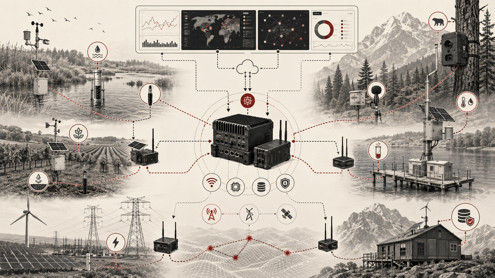
A practical environmental sensor network can be understood as a layered distributed measurement architecture. The exact implementation may use microcontroller-based field nodes, RTOS firmware, solar power systems, cellular telemetry, LoRaWAN, Wi-Fi, mesh networking, MQTT, local gateways, edge processing, cloud storage, dashboards, and environmental data platforms. The architectural responsibilities are consistent even when the technology stack changes.
| Layer | Engineering Role | Environmental Concern | Evidence Artifact |
|---|---|---|---|
| Measurement objective | Defines what environmental process the network is meant to observe | Scientific purpose, operational use, decision threshold, required spatial and temporal resolution | Monitoring objective, study design, decision-use statement |
| Siting and field context | Defines where nodes are placed and why | Representativeness, local disturbance, airflow, hydrology, shade, access, installation constraints | Siting record, location metadata, field notes, photos, installation log |
| Sensor-node layer | Acquires local environmental measurements | Sensor range, calibration, enclosure, ingress protection, fouling, drift, local conditions | Node manifest, sensor manifest, calibration record, maintenance record |
| Embedded acquisition layer | Converts physical signals into digital records | ADC quality, digital bus integrity, timestamping, sampling cadence, buffering, validation | Acquisition configuration, quality flags, timestamp source, measurement schema |
| Power layer | Sustains unattended field operation | Battery life, solar variability, duty cycle, sleep scheduling, brownout recovery | Energy budget, battery log, solar exposure record, power-health telemetry |
| Communications layer | Moves data from field nodes to gateways or remote systems | Coverage, packet loss, latency, retry cost, network partition, gateway dependency | Link-quality metrics, delivery logs, retry counters, network topology map |
| Edge-processing layer | Filters, aggregates, validates, fuses, or classifies data near the measurement site | Local interpretability, event detection, selective reporting, evidence retention | Edge policy, transform version, event log, local decision trace |
| Data-quality layer | Detects whether measurements remain fit for use | Calibration drift, fouling, outliers, stale data, missing records, sensor disagreement | Quality flags, validation report, drift summary, collocation result |
| Storage and analytics layer | Stores, analyzes, and visualizes environmental measurements | Schema consistency, provenance, uncertainty, aggregation, reproducibility | Database schema, lineage metadata, dashboard, analytical workflow |
| Governance and interpretation layer | Defines how data are used, communicated, and acted upon | Decision suitability, uncertainty communication, public trust, accountability, maintenance responsibility | Use policy, data-quality statement, reporting protocol, review log |
This architecture separates environmental observation from raw device output. A sensor value becomes useful only when the system can explain where it came from, why that location matters, when it was sampled, how the sensor was calibrated, what quality checks passed, how it traveled through the network, and what decision context it supports.
Implementation Pattern
A rigorous environmental sensor network begins with monitoring design before hardware selection. The network should define the environmental question, spatial coverage, temporal cadence, parameters, uncertainty tolerance, site constraints, communications options, power budget, maintenance plan, and interpretation requirements.
| Artifact | Purpose | Typical Format |
|---|---|---|
| Monitoring objective | Defines the environmental process, decision use, target parameter, and required resolution | Markdown, study plan, engineering requirement |
| Site manifest | Documents location, environmental context, installation constraints, access, and representativeness | YAML, CSV, GIS record, field survey |
| Node manifest | Defines sensors, microcontroller, radio, storage, enclosure, firmware, and power subsystem | YAML, JSON, asset inventory |
| Sensor calibration record | Preserves calibration date, method, coefficients, reference instrument, and maintenance status | CSV, JSON, calibration certificate, maintenance log |
| Sampling policy | Defines baseline cadence, event-triggered sampling, burst behavior, and timestamp requirements | YAML, firmware configuration, scheduling table |
| Communications policy | Defines radio, gateway, retry, buffering, uplink cadence, and offline behavior | YAML, network map, telemetry contract |
| Power budget | Defines expected consumption, duty cycle, battery reserve, solar assumptions, and degraded modes | Spreadsheet, YAML, Python simulation, test report |
| Data-quality schema | Defines range checks, plausibility checks, drift checks, stale-data checks, uncertainty flags, and sensor-health states | SQL, JSON Schema, validation workflow |
| Environmental event model | Defines how readings become alerts, events, or local decisions | Python/R workflow, ruleset, edge policy |
| Network runbook | Defines maintenance, calibration, replacement, firmware update, incident response, and data-release procedures | Markdown, operations manual, field checklist |
The implementation goal is to make environmental measurement inspectable. Engineers, researchers, maintainers, and decision-makers should be able to reconstruct what the network measured, why those locations were selected, how sensors were maintained, whether the readings were valid, and what uncertainty should travel with the data.
Research-Grade Framing: Environmental Networks as Distributed Measurement Infrastructure
Environmental sensor networks should be framed as distributed measurement infrastructure. They are not neutral data machines. They embody decisions about where environmental conditions are visible, which communities or ecosystems are measured, which signals are prioritized, which uncertainties are disclosed, and which forms of environmental evidence become actionable.
This matters because environmental data often influence public communication, infrastructure operations, irrigation decisions, pollution awareness, watershed management, climate adaptation, regulatory interpretation, and community trust. A network that is technically functional but poorly sited or poorly calibrated can mislead. A network that is scientifically careful but operationally fragile may produce gaps precisely when environmental events matter most. A network that reports results without uncertainty can create false confidence.
| Evidence Dimension | Question | Required Network Evidence |
|---|---|---|
| Representativeness | Does the node location meaningfully represent the environmental process being studied? | Siting rationale, field notes, coordinates, photos, local context, known limitations |
| Measurement integrity | Are the readings technically valid for the parameter and use case? | Calibration record, quality flags, maintenance log, sensor-health indicators |
| Temporal coherence | Can measurements be compared across time and across nodes? | Timestamp source, clock drift estimate, sampling policy, missing-data record |
| Spatial coherence | Can readings be interpreted as a network rather than isolated points? | Topology map, spatial metadata, node density, site categories, environmental gradients |
| Operational continuity | Does the network remain useful during outages, storms, low power, or communication gaps? | Energy budget, buffer policy, offline behavior, recovery log, uptime record |
| Interpretability | Can downstream users understand what was measured directly and what was inferred? | Raw/derived field distinction, transform version, edge policy, data lineage |
| Governance | Are data limitations visible when results are communicated or acted upon? | Quality statement, data-use policy, uncertainty summary, review workflow |
In this framing, an environmental sensor network is not only an engineering system. It is an environmental evidence system. Its design determines what can be seen, trusted, compared, maintained, and responsibly used.
Formal Model: Distributed Environmental Measurement
A useful formal model separates the environmental field, node placement, local sensing, communication, and interpreted network record. Let \(E(x,y,t)\) represent an environmental condition over space and time, \(p_i=(x_i,y_i)\) the location of node \(i\), \(s_i(t)\) the local sensor measurement, \(q_i(t)\) the quality state of the node, and \(r_i(t)\) the reported network record.
s_i(t) = E(x_i,y_i,t) + b_i(t) + \epsilon_i(t)
\]
Interpretation: The measurement \(s_i(t)\) reflects the environmental condition at node location \((x_i,y_i)\), plus sensor bias \(b_i(t)\) and random or contextual error \(\epsilon_i(t)\). Siting and calibration shape whether the reading is environmentally meaningful.
q_i(t) = Q(c_i(t), m_i(t), p_i(t), \ell_i(t))
\]
Interpretation: The node quality state \(q_i(t)\) depends on calibration condition \(c_i(t)\), maintenance state \(m_i(t)\), power state \(p_i(t)\), and link condition \(\ell_i(t)\). Measurement quality is operational as well as sensor-specific.
r_i(t) = \{s_i(t), q_i(t), p_i, \tau_i, \gamma_i, v_i, u_i\}
\]
Interpretation: A useful environmental record includes value, quality state, location, timestamp \(\tau_i\), calibration version \(\gamma_i\), firmware or transform version \(v_i\), and uncertainty indicator \(u_i\). The record must carry enough metadata to remain interpretable after transmission.
D(t) = \frac{1}{N}\sum_{i=1}^{N} I(q_i(t) \geq q_{\min})
\]
Interpretation: Network data availability \(D(t)\) is the share of nodes whose quality state meets the minimum threshold for use. A network can be online while still producing too little high-quality evidence for some decisions.
This model makes two points explicit. First, environmental meaning depends on location and context, not just sensor output. Second, network quality is dynamic. Calibration, maintenance, power, communications, and field conditions all change the evidentiary value of the data over time.
What Are Environmental Sensor Networks?
Environmental sensor networks are distributed systems of sensing devices designed to observe environmental conditions across time and space. Each node typically includes one or more sensors, embedded processing, local timing and storage, communications capability, and energy management. Taken together, the network can support continuous or periodic observation of water, air, soil, weather, infrastructure conditions, or ecological signals.
What distinguishes a network from a standalone sensor is coordination. The network creates a measurement field rather than an isolated reading. That field may be sparse or dense, local or regional, event-driven or periodic, but it introduces architectural questions that a single sensor does not. Measurements must be comparable across nodes, time must be synchronized enough for interpretation, failures must be detectable, energy use must be balanced against reporting needs, and transmission strategy must suit the environment in which the nodes operate.
Environmental sensor networks can range from a few water-quality stations to large air-sensor deployments, watershed observatories, weather-station arrays, habitat-monitoring systems, or precision-agriculture deployments using distributed soil-moisture and environmental probes. Their value lies not only in more sensing, but in more coherent environmental evidence.
Sensor Nodes as Embedded Environmental Devices
An environmental sensor node is an embedded device and a measurement instrument at the same time. It must excite sensors, acquire signals, apply timing and filtering, store local state, communicate results, manage energy, recover from faults, and survive long unattended deployments with limited maintenance.
This makes node design inseparable from embedded systems architecture. The node needs processors or microcontrollers sized to the workload, interfaces suited to sensors and radios, memory sufficient for buffering and logging, and firmware capable of recovery from imperfect field conditions. The network’s usefulness depends not only on sensing accuracy, but on whether nodes remain observable, updatable, diagnosable, and recoverable over time.
A field node should also preserve measurement identity. A temperature reading, turbidity estimate, particulate concentration, soil-moisture value, or dissolved-oxygen measurement should carry information about sensor identity, calibration version, timestamp source, battery state, communication state, and quality flags. Otherwise, downstream systems receive values without enough evidence to judge whether those values should be trusted.
Environmental nodes are often expected to operate under conditions that degrade electronics and sensors: condensation, dust, insects, algae, sediment, snow, heat, vibration, corrosion, and physical interference. Node design should therefore include enclosure strategy, cable strain relief, connector choice, ingress protection, watchdog behavior, local logging, field diagnostics, and maintenance access as part of the measurement system itself.
Site Selection, Placement, and Environmental Context
Environmental sensing is unusually sensitive to placement. A technically correct sensor in the wrong location can produce environmentally misleading data. A water sensor placed in a stagnant pocket may not represent the flow being studied. An air sensor placed too close to a wall, vent, heat source, or obstruction may reflect a local artifact. A soil sensor installed at the wrong depth may miss the root-zone dynamics that matter for irrigation or ecological interpretation.
Siting is therefore not a logistical detail. It is part of the epistemic validity of the whole network. Strong architectures treat site selection as a formal input to system design. Sensor housings, ingress protection, maintenance access, cable routing, solar exposure, shading, local radio conditions, flood risk, wildlife exposure, vegetation growth, and environmental shielding all influence whether a node remains both operational and interpretable.
Siting also has ethical and governance implications. A network can make some places visible while leaving others unmeasured. Air-quality, heat, flood, and water-quality monitoring can shape public understanding and resource allocation. If sensor placement ignores vulnerable communities, informal settlements, rural areas, downstream users, or ecological hotspots, the network can reproduce environmental blind spots even while appearing data-rich.
A strong siting process should therefore document both technical and contextual rationale. It should identify what each node represents, what it does not represent, and what limitations should travel with the data.
Environmental Parameters and Measurement Logic
Environmental sensor networks are shaped by what they measure. Different parameters impose different timing, calibration, maintenance, and hardware requirements. Water temperature, specific conductance, dissolved oxygen, pH, turbidity, nitrate, chlorophyll, particulate matter, ozone, carbon dioxide, soil moisture, soil temperature, rainfall, wind, solar radiation, sound, and vibration each demand different measurement logic.
Some parameters are relatively stable and support lower sampling rates. Others change rapidly during rainfall events, pollutant episodes, irrigation cycles, equipment failures, traffic peaks, or extreme weather. Some require frequent calibration or cleaning. Some are indirect proxies rather than direct measurements. Some become meaningful only when interpreted together, such as temperature and dissolved oxygen, rainfall and turbidity, soil moisture and irrigation, or particulate concentration and local meteorology.
Measurement logic is therefore architectural. The network must decide whether measurements are continuous, threshold-based, burst-sampled, averaged, event-triggered, or fusion-derived. It must decide which raw signals are worth transmitting and which can be summarized locally. It must also decide how to preserve the difference between measured values, corrected values, derived indicators, and alerts.
A network that treats all environmental parameters as equivalent data fields will usually be weak. A strong network treats each parameter as a measurement practice with its own physics, chemistry, maintenance burden, uncertainty profile, and interpretation constraints.
Calibration, Collocation, and Data Quality
Environmental data are only as useful as the network’s ability to preserve measurement quality over time. Calibration is therefore central. Sensors drift, foul, age, and respond differently under field conditions than in controlled settings. Low-cost sensors may be especially valuable for spatial density and local awareness, but they require careful attention to performance, bias, environmental sensitivity, and comparison against reference or higher-assurance measurements where appropriate.
Collocation is one way to understand sensor behavior. Placing a sensor near a reference instrument or trusted measurement station can help estimate bias, drift, noise, response behavior, and environmental sensitivity. Collocation does not make a sensor perfect, but it can make uncertainty more visible. It can also reveal whether a device is useful for trend detection, relative comparison, operational screening, or higher-assurance reporting.
Data quality should not be handled only after data arrive in a database. Quality logic should be present at multiple layers: firmware checks, field-maintenance procedures, calibration schedules, validation workflows, plausibility rules, dashboard flags, and data-release policies. A record should indicate whether it is raw, corrected, provisional, validated, degraded, or excluded.
A strong environmental sensor network therefore includes calibration schedules, maintenance records, self-checks, plausibility bounds, fouling indicators where possible, fault flags, collocation evidence, and enough metadata to distinguish trustworthy readings from degraded ones. Without this, a network risks producing confident but low-integrity environmental narratives.
Sampling Strategy, Timing, and Event Sensitivity
Sampling strategy is one of the main determinants of network usefulness. Too little sampling and the system misses meaningful variation. Too much sampling and it wastes energy, saturates storage, increases communications cost, or generates noisy data with little added value. Sampling must therefore be matched to the temporal character of the environmental process.
Some parameters change slowly and support sparse intervals. Others shift rapidly during rainfall events, pollution episodes, irrigation cycles, fires, heat waves, combined sewer overflows, or infrastructure failures. Environmental networks often need hybrid timing models: low baseline sampling with higher-frequency bursts during events or anomalies.
Timing is also interpretive. If nodes measure at inconsistent intervals or unsynchronized times, comparisons become weaker. A particulate-matter sensor, weather station, and traffic-adjacent node may all be functioning properly, but their readings may not support event reconstruction if timestamps are weak or sampling windows do not align. The same is true for water-quality networks where upstream and downstream measurements must be interpreted in relation to flow and travel time.
Embedded timing architecture matters in environmental monitoring. Clocks, RTCs, scheduled wake-ups, timestamp fidelity, data-ready interrupts, and gateway time correction all influence whether distributed data can later be interpreted as a coherent environmental record.
Communications, Gateways, and Network Topology
An environmental sensor network must move data from the field to places where it can be interpreted and used. That may involve direct cellular uplinks, low-power wide-area radios, short-range mesh protocols, wired monitoring infrastructure, satellite links, or intermediary gateways that aggregate local node traffic. The right topology depends on geography, density, energy budget, data urgency, maintenance access, and failure tolerance.
Communications architecture is rarely neutral. More frequent transmission may improve timeliness but dominate the power budget. Less frequent transmission conserves energy but delays visibility and can increase data-loss risk if local storage is limited. Gateway-based designs can reduce per-node complexity but introduce concentration points whose failure affects many nodes. Mesh designs may increase resilience in some settings but also introduce routing overhead, timing variability, and additional energy cost.
Environmental sensor networks therefore have to treat communications as part of measurement design rather than as a back-end convenience. The network is not only collecting environmental data. It is choosing when those data become visible, how resilient the reporting chain is, what evidence is preserved during outages, and what level of field autonomy exists when connectivity is poor.
Offline behavior should be explicit. Nodes should define how long they can buffer, which data receive priority, how duplicate records are handled after reconnection, how gaps are marked, and how gateway or cloud systems reconstruct delayed environmental events.
Energy Constraints and Long-Lived Operation
Many environmental networks are fundamentally energy-constrained. Nodes may run on batteries, solar support, energy harvesting, or other limited sources for long periods. That makes low-power architecture essential. Duty cycling, sleep states, low-power sensing, burst transmission, local thresholding, adaptive sampling, and selective wake paths are often what make long-lived deployment practical.
Energy constraints reshape measurement strategy. A node that samples continuously may provide richer data but fail early. A node that sleeps too aggressively may miss short-lived events. A radio that transmits frequently may drain the battery faster than the sensor itself. A solar-powered node may perform well in summer and degrade during winter, storms, dust accumulation, or shading from vegetation growth.
Power design should therefore include an energy budget, not merely a battery selection. The budget should estimate sensor current, microcontroller active time, sleep current, radio transmit cost, local processing cost, storage cost, solar input, temperature effects, and reserve capacity. It should also define degraded modes: reduced sampling, delayed transmission, local-only logging, or emergency heartbeat.
A node that theoretically measures well but requires frequent servicing may not be operationally viable at scale. Environmental networks are classic examples of why low-power embedded design is not just about component efficiency. It is about matching observation strategy to what field deployment can actually sustain.
Edge Processing, Sensor Fusion, and Local Intelligence
Environmental sensor networks increasingly benefit from edge processing. Rather than transmitting every raw reading, nodes or gateways can filter noise, detect anomalies, compute local summaries, fuse related measurements, trigger event-based sampling, or issue local alerts. This reduces transmission cost and can improve responsiveness during environmentally significant events.
Edge processing can be especially useful when connectivity is intermittent, bandwidth is expensive, or environmental events require rapid local response. A water-quality node might increase sampling during a turbidity spike. A soil-moisture network might adjust reporting during irrigation. An air-quality gateway might detect local particulate episodes and preserve higher-resolution data windows. A weather-linked system might change sampling behavior during storms or heat events.
But edge intelligence introduces responsibility. Local processing must not make the network more opaque. Environmental systems often need raw data, derived data, and clear provenance so users can understand what was measured directly and what was inferred locally. A locally generated anomaly flag is not the same as the underlying sensor record. A compressed summary is not the same as the full time series.
Edge processing is strongest when it reduces waste and improves responsiveness without degrading interpretability. It should preserve transform versions, thresholds, quality flags, and enough raw or intermediate evidence to support review.
Uncertainty, Maintenance, and Network Drift
One of the most common weaknesses in environmental sensor networks is treating uncertainty as a reporting problem rather than an operating problem. In reality, uncertainty grows through deployment: calibration drifts, sensors foul, housings age, batteries weaken, solar panels accumulate dust, siting conditions change, firmware versions diverge, and communication gaps create uneven records.
A network that is excellent at installation can become epistemically weak over time if it lacks disciplined maintenance and uncertainty tracking. This is especially true for long-lived environmental monitoring. Biofouling can change water-quality readings. Dust and humidity can affect air sensors. Soil movement can alter probe contact. Vegetation can change solar exposure or airflow. Seasonal change can modify both the environment and the sensor’s operating conditions.
Network drift is therefore both technical and organizational. Nodes drift physically, but monitoring programs can drift institutionally as maintenance discipline, metadata quality, and interpretation standards weaken. A sensor may remain online while its calibration evidence becomes stale. A gateway may transmit successfully while the field installation no longer represents the intended environmental process.
Strong networks resist both forms of drift by keeping calibration, uncertainty, data quality, and maintenance practices attached to the technical system itself. The network should make uncertainty visible, not bury it in later interpretation.
Interpretation, Governance, and Environmental Decision Support
Environmental sensor networks do not end with measurement. Their data feed interpretation, alerts, planning, compliance discussions, irrigation decisions, public communication, scientific analysis, infrastructure operations, and community advocacy. This creates governance questions that should shape the network from the beginning.
Who trusts the data, under what quality conditions, and for what decisions? How are degraded sensors flagged? What metadata accompany measurements? What happens when low-cost or participatory sensing conflicts with reference-grade systems? How are uncertainty and calibration status communicated? Who maintains the network? Who can access the data? Which communities benefit from the visibility created by the sensors, and which remain unmeasured?
Those are not downstream policy questions alone. They affect what kind of network should be built in the first place. A network intended for exploratory awareness may have different calibration, quality, and reporting requirements than a network intended for operational alerts or high-assurance decision support. Confusing those use cases can harm trust.
Good environmental sensor networks therefore include governance as part of architecture. They preserve provenance, expose limitations, support quality assessment, and distinguish exploratory sensing from higher-assurance measurement. Without those distinctions, distributed environmental intelligence may become more visually compelling than decision-useful.
Environmental Data Model and Measurement Provenance
Environmental sensor networks need data models that preserve measurement meaning. A table of timestamps and values is rarely enough. The record should include device identity, site identity, sensor identity, parameter, units, acquisition time, processing time, location, calibration version, firmware version, quality flag, uncertainty indicator, maintenance status, and whether the value is raw, corrected, derived, or inferred.
This is especially important because environmental data often outlive the hardware that produced them. A dataset may be reused months or years later for trend analysis, infrastructure planning, environmental justice work, hydrologic review, agricultural management, or public communication. Without provenance, later users cannot know whether a reading represents direct measurement, local averaging, calibration-corrected data, sensor-fusion output, or an event classification.
A strong data model also separates measurement events from node-health events. Battery voltage, link quality, enclosure intrusion, sensor-cleaning status, firmware updates, and calibration records are not environmental parameters, but they determine whether environmental parameters remain credible. These operational records should be stored alongside measurement data, not in disconnected maintenance notes.
The goal is to make the environmental record reproducible, reviewable, and fit for its intended use.
Mathematical Lens: Coverage, Sampling, Drift, Power, and Data Quality
A mathematical lens helps connect environmental-network design choices to measurement consequences. Let \(N\) be the number of deployed nodes, \(A\) the monitoring area, \(d_i\) the distance from a point of interest to the nearest node, \(f_i\) the sampling frequency of node \(i\), \(P_i\) the average node power consumption, \(B_i\) the available battery energy, and \(q_i(t)\) the quality state of node \(i\).
\rho = \frac{N}{A}
\]
Interpretation: Node density \(\rho\) gives a simple first-order measure of spatial coverage. It does not guarantee representativeness, but it helps make coverage assumptions explicit.
T_i \approx \frac{B_i}{P_i}
\]
Interpretation: Expected node lifetime \(T_i\) depends on available energy \(B_i\) and average power consumption \(P_i\). Duty cycling, radio use, sensor warm-up, local storage, and edge processing all affect \(P_i\).
f_i(t) =
\begin{cases}
f_{\mathrm{base}}, & \text{normal conditions} \\
f_{\mathrm{event}}, & \text{event or anomaly detected}
\end{cases}
\]
Interpretation: Adaptive sampling allows a network to conserve energy during normal conditions while increasing resolution during rainfall events, pollution episodes, equipment faults, or other environmentally significant changes.
b_i(t) = b_i(0) + \delta_i t
\]
Interpretation: A simple drift model treats sensor bias \(b_i(t)\) as increasing over time at drift rate \(\delta_i\). Real drift can be nonlinear, but even this simple model shows why calibration and maintenance records matter.
C_i = \frac{M_i^{\mathrm{valid}}}{M_i^{\mathrm{expected}}}
\]
Interpretation: Data completeness \(C_i\) compares valid measurements from node \(i\) with the measurements expected under its sampling policy. Completeness should exclude records that fail quality gates, not merely count received packets.
Q_{\mathrm{network}}(t) = \frac{\sum_{i=1}^{N} w_i q_i(t)}{\sum_{i=1}^{N} w_i}
\]
Interpretation: Network quality can be summarized as a weighted average of node quality states. Weights \(w_i\) may reflect site importance, representativeness, parameter sensitivity, or decision relevance.
These equations are not a substitute for environmental expertise. Their purpose is to make design trade-offs visible: coverage, energy, sampling, drift, completeness, and quality are coupled. A network that maximizes one dimension without tracking the others may produce more data without producing better evidence.
Python Workflow: Environmental Network Coverage, Sampling, and Quality Simulation
The companion Python workflow models an environmental sensor network as a distributed measurement system. It creates sample site metadata, node positions, environmental time series, simulated sensor drift, communication gaps, battery behavior, and quality flags. It then writes outputs that help engineers examine coverage, event detection, data completeness, and measurement reliability.
The workflow is designed to answer practical questions. Does the node layout cover the environmental gradient of interest? How much data are lost during communication gaps? How does adaptive sampling affect battery life? How does calibration drift affect measurement quality over time? Which nodes contribute most to network-level evidence? Where does the network create blind spots?
Useful outputs include a node inventory, simulated measurement events, site-level data completeness, quality-flag summaries, battery-risk rankings, and plots of environmental signals under baseline and event-driven sampling. In a production setting, this workflow could be adapted into a planning tool for network design or a validation harness for field deployments.
The purpose is not to replace field expertise. It is to connect field assumptions with quantitative evidence before, during, and after deployment.
R Workflow: Environmental Sensor Network Reporting and Data-Quality Review
The companion R workflow treats the network as an operational monitoring and data-quality system. It summarizes measurement completeness, quality flags, calibration age, maintenance status, battery condition, link quality, event coverage, and site-level reporting performance.
This matters because environmental networks often degrade unevenly. One site may experience frequent communication failures. Another may suffer from sensor fouling. Another may have strong link quality but stale calibration. Another may operate normally except during storms, when the most important measurements are needed. Fleet-level reporting helps distinguish isolated node faults from structural weaknesses in the network design.
The R workflow should produce CSV and PNG outputs suitable for engineering and environmental review. Useful reports include quality by site, calibration age by parameter, uptime by node, battery risk by field station, missing-data heatmaps, and event-capture summaries. These reports support maintenance planning, calibration scheduling, field visits, data release decisions, and network redesign.
A strong environmental network is not merely deployed. It is continuously reviewed.
Systems Code: Sensor Nodes, Gateways, Telemetry, Validation, PYNQ, HDL, and Bash
The companion systems stack demonstrates how environmental-network concerns appear across embedded and edge implementation layers.
The C example focuses on firmware-adjacent sensor-node logic: sampling schedules, node-health flags, battery thresholds, quality classification, and event-triggered sampling. The C++ example models a network-node state machine with normal, event, degraded, offline, and recovery modes. The Rust example validates node manifests and ensures that required site, sensor, calibration, power, timing, and communication fields are present before deployment. The Go example sketches a gateway or telemetry utility that aggregates node reports and summarizes network health.
MicroPython provides a prototype for field-node behavior: periodic sensing, sleep scheduling, local quality flags, and telemetry payload preparation. TinyML can support local event detection or anomaly screening where useful, but it should not replace explicit measurement-quality logic. PYNQ support can demonstrate hardware-assisted preprocessing, timestamping, or stream buffering for higher-rate environmental signals. HDL examples can model pulse counting, timestamp counters, stream framing, trigger logic, or low-level acquisition buffers.
The Bash scripts tie the workflow together by validating manifests, running Python and R workflows, generating outputs, and checking repository structure. The goal is not to make every environmental network production-ready from this scaffold. The goal is to provide a concrete engineering structure that mirrors the real problems of field sensing: measurement quality, timing, energy, communication, and long-term stewardship.
Technical Verification Gates
Environmental sensor networks should pass explicit verification gates before field deployment, after installation, and during operation. These gates prevent the network from being judged only by whether packets arrive or dashboards update.
| Gate | Verification Question | Evidence Required |
|---|---|---|
| Measurement gate | Does each sensor measure the intended environmental parameter within the required range and uncertainty? | Sensor specification, calibration record, bench test, uncertainty statement |
| Siting gate | Does the node location represent the environmental process or decision context? | Siting rationale, photos, coordinates, field notes, exclusion limits |
| Timing gate | Are sampling cadence, timestamp source, and clock drift suitable for interpretation? | Sampling policy, clock test, timestamp audit, missing-data report |
| Power gate | Can the node sustain expected duty cycles under realistic field conditions? | Energy budget, solar/battery test, degraded-mode behavior, reserve margin |
| Communication gate | Can data move reliably enough, and are offline/replay behaviors defined? | Link-quality test, packet-loss summary, buffer duration, replay/idempotency design |
| Quality gate | Can the network detect degraded measurements, drift, fouling, stale data, and invalid records? | Quality flags, validation workflow, collocation result, fault-injection test |
| Governance gate | Are use limits, uncertainty, data status, and maintenance responsibility visible to downstream users? | Data-quality statement, metadata schema, publication rule, review workflow |
These gates make the network reviewable. They also prevent a common failure: treating deployment success as measurement success. An environmental network is not ready because it is online. It is ready when it can demonstrate that its measurements are fit for the uses assigned to them.
Testing and Validation
Testing environmental sensor networks requires laboratory testing, field validation, and ongoing operational review. Bench tests can verify sensor response, firmware behavior, ADC or bus handling, power consumption, watchdog recovery, local storage, and telemetry formatting. Field tests validate siting, enclosure performance, solar behavior, radio coverage, environmental exposure, and maintenance procedures.
A useful validation strategy includes at least six layers. First, configuration validation checks node manifests, site metadata, sensor parameters, sampling policies, and communications settings. Second, firmware validation checks sampling, buffering, sleep behavior, watchdog recovery, and local quality flags. Third, calibration validation checks sensor performance against reference methods or known standards where practical. Fourth, field validation checks siting, installation, weather exposure, and real communications behavior. Fifth, data-quality validation checks plausibility, drift, missing data, and measurement gaps. Sixth, governance validation checks whether data limitations are visible to downstream users.
Negative testing is important. Nodes should be tested under low battery, communication loss, sensor failure, stale readings, enclosure intrusion, clock drift, storage pressure, fouling-like behavior, and event-triggered sampling. Gateways should be tested for duplicate uploads, delayed records, network partitions, idempotent replay, and recovery after outage.
A network that works only under ordinary conditions is not an engineering-grade environmental sensor network. The most important environmental events often occur under stress.
Operational Signals and Network Observability
Network observability is the ability to understand whether the environmental measurement system remains healthy after deployment. This requires telemetry beyond the environmental value itself.
Useful operational signals include battery voltage, charge state, solar input, enclosure temperature, humidity intrusion indicators, watchdog resets, firmware version, calibration age, maintenance date, link quality, packet loss, retry counts, gateway status, local buffer occupancy, missing-sample counts, timestamp drift, sensor self-test results, data-quality flags, and event-trigger activation.
These signals help engineers distinguish environmental change from network failure. A sudden drop in reported turbidity may reflect real water conditions, sensor fouling, power degradation, or a failed cleaning cycle. A particulate spike may reflect pollution, sensor humidity sensitivity, local construction, or placement artifact. A missing event may reflect true absence, communications failure, battery exhaustion, or overly sparse sampling.
Environmental network observability should be proportional to the importance of the use case. Exploratory networks need enough metadata to prevent overinterpretation. Operational or public-interest networks need stronger diagnostics, maintenance evidence, and quality communication. High-assurance networks need formal validation, calibration records, and review procedures.
A network that cannot observe itself cannot reliably observe the environment.
Common Failure Modes
Environmental sensor-network failures often appear as plausible data. That is what makes them difficult. A node may remain online while its measurements drift. A dashboard may update normally while the site context has changed. A sensor may report stable values because it is fouled, not because the environment is stable.
Common node-level failure modes include sensor drift, fouling, blocked inlets, water ingress, connector corrosion, enclosure overheating, insect intrusion, battery degradation, solar charging failure, clock drift, firmware lockup, and memory exhaustion. Common network-level failures include communication gaps, gateway outages, duplicate records, delayed uploads, packet loss, inconsistent firmware versions, broken calibration metadata, and missing maintenance records.
Common interpretation failures include treating low-cost sensor data as reference-grade, comparing nodes with different siting contexts, ignoring microclimate effects, interpolating sparse networks too aggressively, hiding uncertainty, and presenting derived or corrected values without preserving raw-data lineage.
A particularly important failure mode is environmental false confidence. The system may produce smooth charts, maps, and alerts while the underlying measurement evidence is weak. Strong network design resists this by making uncertainty, data gaps, calibration status, and node health visible.
Trade-Offs in Environmental Sensor Network Design
Environmental sensor-network design is shaped by trade-offs that cannot all be optimized at once. More nodes may improve spatial coverage but increase maintenance burden. Higher sampling rates may capture events but reduce battery life. More frequent transmission may improve timeliness but increase energy use and communications cost. Edge processing may reduce bandwidth but can obscure raw evidence if poorly documented. Low-cost sensors may increase coverage but require stronger calibration and uncertainty practices.
The right design depends on the environmental question. A watershed-monitoring network, an urban heat network, an air-quality awareness network, a soil-moisture irrigation system, and a remote ecological observatory do not need the same architecture. Their spatial density, sampling cadence, calibration requirements, communications strategy, and governance burden differ.
Good environmental network architecture is proportional. It matches sensing, power, communication, validation, and reporting to the decision context. It does not confuse more data with better evidence. It asks what the network must prove, what uncertainty can be tolerated, and what maintenance can be sustained.
Applications in Embedded and Edge Systems
Environmental sensor networks appear across water monitoring, air-quality sensing, precision agriculture, weather observation, habitat monitoring, infrastructure resilience, industrial environmental compliance, wildfire detection, urban heat mapping, stormwater monitoring, flood risk assessment, and ecological restoration.
These applications differ in scale and assurance level, but they share a common architectural challenge: turning fragile local measurements into coherent environmental information that remains meaningful over time and under field conditions. In water systems, networks may support continuous observation of temperature, turbidity, conductivity, dissolved oxygen, pH, nutrients, or biological indicators. In air systems, distributed sensors may support neighborhood-scale awareness of particulate matter, gases, smoke, or local pollution episodes. In agriculture, soil and microclimate networks may support irrigation, plant stress monitoring, and resource efficiency.
The value of these networks depends on whether they preserve context. A field measurement is not just a number from a place. It is a number from a place, at a time, under a sensor state, maintenance state, calibration state, power state, and environmental context.
Engineer Checklist
| Question | Why It Matters |
|---|---|
| Is the monitoring objective explicit? | Prevents the network from collecting data without a clear environmental or operational purpose. |
| Is each site’s representativeness documented? | Protects against technically valid readings being interpreted as broader environmental truth. |
| Are calibration, maintenance, and cleaning records attached to data quality? | Helps distinguish valid environmental change from sensor drift or fouling. |
| Does the sampling policy match the process dynamics? | Ensures the network captures slow trends and important events without wasting energy. |
| Is offline behavior defined? | Prevents communication gaps from becoming silent data loss or misleading timelines. |
| Are battery, solar, and duty-cycle assumptions validated in the field? | Ensures long-lived operation under real environmental conditions. |
| Are raw, corrected, derived, and inferred values clearly distinguished? | Preserves interpretability and prevents edge processing from hiding measurement lineage. |
| Can the network report its own health? | Allows engineers to diagnose whether changes reflect the environment or the sensing system. |
GitHub Repository
This article is supported by a companion workflow that treats environmental sensor networks as distributed measurement infrastructure: site design, node manifests, sampling policies, power budgets, telemetry, quality flags, calibration records, network-health monitoring, Python simulation, R reporting, SQL evidence schemas, embedded systems examples, and field-operations documentation.
The companion repository includes Python, R, SQL, C, C++, Rust, Go, MicroPython, TinyML, PYNQ, HDL, Bash, YAML/JSON configuration, notebooks, tests, docs, data, outputs, and article-specific engineering workflows.
Where This Fits in the Series
This article extends the foundation established in Embedded Systems Architecture, Microcontrollers and System-on-Chip Design, Data Acquisition and Embedded Sensor Interfaces, Real-Time Operating Systems in Embedded Computing, Firmware, Hardware Abstraction, and Device Control, Low-Power Embedded System Design, and Reliability and Fault Tolerance in Embedded Devices by focusing on how distributed embedded devices observe real environments over time and space.
It also connects the Embedded and Edge Systems series to broader work on environmental monitoring, infrastructure intelligence, sustainable development, data systems, and public-interest measurement.
Related articles
- Embedded Systems Architecture
- Data Acquisition and Embedded Sensor Interfaces
- Low-Power Embedded System Design
- Reliability and Fault Tolerance in Embedded Devices
- Edge Computing Architectures
- Cyber-Physical Systems and Hardware Integration
Further reading
- EPA (2026) Air Sensor Toolbox. Available at: https://www.epa.gov/air-sensor-toolbox.
- EPA (2025) How to Use Air Sensors: Air Sensor Guidebook. Available at: https://www.epa.gov/air-sensor-toolbox/how-use-air-sensors-air-sensor-guidebook.
- USGS (2000) Guidelines and standard procedures for continuous water-quality monitors: Site selection, field operation, calibration, record computation, and reporting. Available at: https://www.usgs.gov/publications/guidelines-and-standard-procedures-continuous-water-quality-monitors-site-selection.
- USGS (n.d.) Water Quality Monitoring. Available at: https://www.usgs.gov/centers/california-water-science-center/science/science-topics/water-quality-monitoring.
- Zephyr Project (n.d.) Sensing Subsystem. Available at: https://docs.zephyrproject.org/latest/services/sensing/index.html.
- FAO (n.d.) Digital agriculture and water management resources. Available at: https://www.fao.org/.
References
- EPA (2026) Air Sensor Toolbox. Available at: https://www.epa.gov/air-sensor-toolbox.
- EPA (2025) How to Use Air Sensors: Air Sensor Guidebook. Available at: https://www.epa.gov/air-sensor-toolbox/how-use-air-sensors-air-sensor-guidebook.
- USGS (2000) Guidelines and standard procedures for continuous water-quality monitors: Site selection, field operation, calibration, record computation, and reporting. Available at: https://www.usgs.gov/publications/guidelines-and-standard-procedures-continuous-water-quality-monitors-site-selection.
- USGS (n.d.) Water Quality Monitoring. Available at: https://www.usgs.gov/centers/california-water-science-center/science/science-topics/water-quality-monitoring.
- Zephyr Project (n.d.) Sensing Subsystem. Available at: https://docs.zephyrproject.org/latest/services/sensing/index.html.